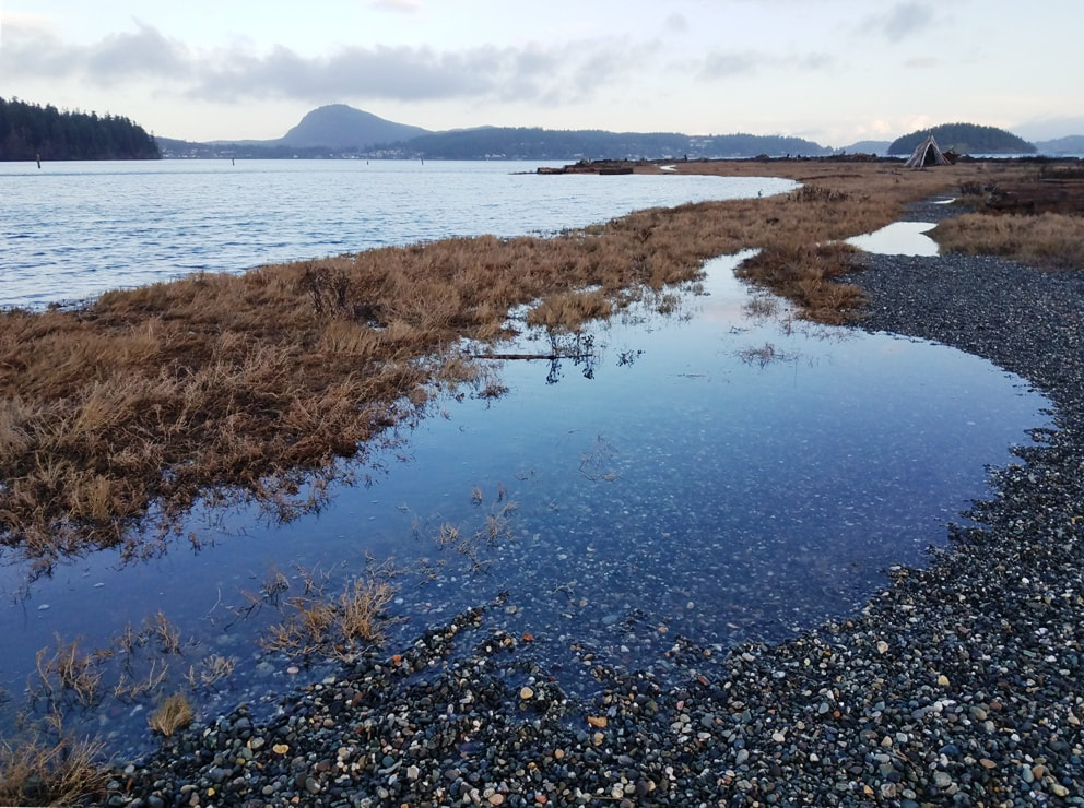
 Fashion comes and goes. Storms come and go, currents come and go. Changes are a constant. Ala Spit is different every time I visit, and certainly gave out a few surprises and delights on New Year’s Day this year too. The sign at the parking lot cautions hikers to beware that high tides can cover the trails. I was about to test what it said. But first a little history: the spit is alive. And that wasn’t always the case. A century ago it was growing to the northwest. To anchor the spit and keep storm waves from cutting through, engineers built a rock wall at its neck. This solidified the neck but caused problems further down the spit, leading to erosion and the potential loss of the spit, and the salmon habitat behind. A few years ago the rock wall was removed and the spit came to life again. Sediment from the bluffs to the south is once again growing the spit, and large woody debris has anchored the base of the spit in a way that rocks never would. The salmon habitat is alive and well, harboring forage fish and giving young salmon a chance to rest up before hitting the Pass on their way out to the open sea. New Year’s Day was a restless day of sunshine playing peekaboo and strong winds building a high tide in the morning, much higher than predicted for a ‘normal’ day. Ala Spit was protected from the westerly winds, but the king tide still did its best to flood the spit inch by inch. As I hiked out I could see the waters of the bay climbing higher, inundating first the lower trails on the west side, then rising more to take away much of the log-free beach along the eastern shore as well. Salt weeds thrive in this kind of environment; gumweed not so much, now brown in its winter clothing. Birds of many different feathers sang and swam and serenaded the new year, with geese and scoters and song sparrows and gulls joining the chorus and dancing along the logs and waterways. A fisherman tried his luck but gave up with so much debris now floating on the tide. A family passed me going the other way, stretching the legs of their new puppy. After meandering the living beach, I finally arrived at the far northwest corner, and enjoyed the view stretching from Mt. Erie to Skagit, Kiket, and Hope Islands and down south to Goat Island and beyond. The return hike was a balancing act of stepping on, over, and around the large woody debris on the little bit of beach left on the spit. I never had to go wading, but it was a little work to get back across the driftwood that now keeps the spit alive. It was an amazing make-over of a beautiful hike surrounded by the sea on nearly every side. What will tomorrow bring? As the song says, Drench yourself in words unspoken Live your life with arms wide open Today is where your book begins The rest is still unwritten Directions:
From Highway 20, 6.5 miles north of Oak Harbor, take Troxell Road east four miles (it winds around a little bit) to Geck Road near the water's edge, which drops you down to the parking lot.
0 Comments
|
Authors
Maribeth Crandell has been a hiking guide in the Pacific NW for over 20 years. She's lived on Whidbey and Fidalgo Island for decades. As a frequent bus rider she easily makes connections between trails and transit. Archives by date
April 2024
Categories
All
|
 RSS Feed
