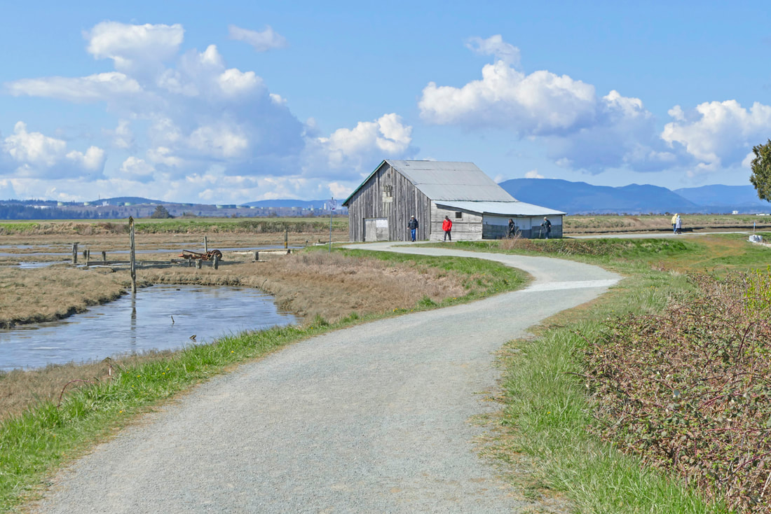
 With the sun breaking out into a chorus yesterday, it invited us all to get outside and explore a local trail. My friend Eric Shen joined me for the hike. We chose to hike the Padilla Bay Shore Trail because it is wide, and the views are wide too. On a midweek day in March, it won't be crowded, I thought. I thought wrong. The parking lot at the south end was more than full, so we went to the parking at the north end, where the parking lot is far larger and less known. Take a right on 2nd street in Bay View and it's just a hundred feet up the hill. On the trail, we found a wide variety of hikers, joggers, bicyclists, strollers, dog walkers, and elderly lovers just happy to be outside and together or alone, connecting with the beauty of the hike and the freedom of the outdoors. The tide was low, revealing the expansive mudflats of this critical estuary for keeping our planet healthier. Cinnamon teal, herons, and even a teenage eagle were in their own version of a grocery store. As we walked, I observed most of the trail users being very conscious of the need to keep a respectful distance from us and from each other, while still sharing a friendly greeting as we passed. One large group that may have been an extended family congregated quite closely as they walked. But mostly it seemed everyone was taking these health concerns seriously, while still being able to get outdoors and enjoy the trail. A brisk breeze pushed us southward and brought a steady tear to my eye as we turned northward again. I had to smile to see a young father running the entire distance of the trail, four miles round trip, following alongside his two children riding bikes who were not easing up at all for him. Two Skagit County Parks employees were on the trail graveling in low places that had become a little muddy with the recent rain. Give our trail maintainers a hearty thank you for the care they give our special places! Eric and I carried on a steady conversation as we walked the route at a comfortable pace, me interrupting the walk frequently to take photos of this most amazing day and enjoyable trail. Hike the trails and enjoy their good tidings. Fill your days with life, love, and beauty. Just be smart; stay safe and stay sane in these memorable times. But do get out! jack Directions:
Located between Anacortes and Mt. Vernon, take Highway 20 to the Bay View - Edison Road intersection, at the Farmhouse. Turn north and drive about 1 mile to the southern trailhead on your left. Or go a couple miles farther to 2nd Street in Bay View, go up the hill a hundred feet, and park in the large gravel lot. It's a short walk down to the trailhead from here.
0 Comments
 With the Coronavirus Covid-19 pandemic on everyone's minds I'm taking steps to be safe, sanitized and remain healthy. I wipe down my counters, knobs and handles with a bleach solution. I wash my hands frequently. And I'm taking more walks outside for the fresh air, exercise and UV rays that kill viruses. Still all the terrible news is oppressive. So when Janet, Nicole, Kelly and Tootsie invited me to join them for a walk at Admiralty Inlet Preserve, I gladly accepted. It was a gorgeous spring day. Being outside with friends on such an afternoon does great things for body, mind and spirit. We practiced social distancing, but not self isolation since none of us were sick. We stayed at least 6 feet apart (except for Tootsie). This 86 acre preserve, like most of our local trails, isn't crowded. We saw only a few other people. There's a loop trail about a mile and a half long and maps and signs along the way. The property is jointly owned by the Department of Natural Resources and the Whidbey Camano Land Trust who manage it to protect this rare remnant of native prairie and old growth forest on a high bluff waterfront. A rustic split rail fence keeps wandering feet from trampling the rare plants including the Golden Paintbrush, found in only 12 sites around the world. They bloom in May along with many other wildflowers here. Artistic, full color interpretive panels show the plants and animals that live here. This early season walk had a few muddy spots, but it was like a scavenger hunt looking for signs of spring. We found flowering Indian Plum, Salmonberry blossoms, Oregon Grape flowers and free range daffodils at the bluff overlook. We passed two bald eagles sitting together at the top of a tree. We found several birds nests and saw woodpecker holes in snags. As we walked I began to notice things that are known healers. Nettles are popping up everywhere and make a good spring tonic tea. I recommend taking long scissors to carefully cut the small stems and leaves into a large bag before steaming them. Nicole commented on a wonderful nettle lasagna a friend had made last week. Harvest them in early spring as later they become too strong. We passed a Pacific Yew tree with thin branches in the shape of a fan. The Yew produces Taxol which is used to inhibit certain types of cancer. It took years before scientists were able to replicate it in the lab and make this life-saving drug commonly available. Janet leaned against a rail fence and chugged some water reminding me to stay hydrated. We marveled at some huge 200 year old fir trees. They'd been whipped by the wind with broken branches near the top, but still stood strong, a reminder that our elders have withstood many trials and are still resilient. Stay strong! Wash your hands! Go for a walk! For more information about this preserve visit: www.wclt.org/projects/admiralty-inlet-natural-area-preserve/ unDirections:
From Highway 20 near Coupeville, follow the signs toward the Coupeville Ferry. Admiralty Inlet Preserve is 1.5 miles west of the ferry terminal on Engle Road. Look for the blue and brown houses at the top of the hill. A small unmarked parking area is near the brown house. The trails are across the street. This trail is accessible by the Route 1 Island Transit bus on Saturdays or Route 6 on weekdays with a short walk from Camp Casey Inn. Follow the split rail fence along Engle Road. 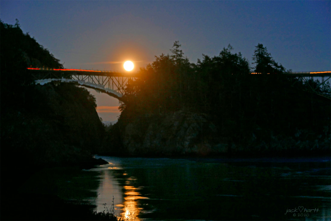 He first visited Bowman Bay in the summer of 1958 as a 4 year old boy, falling asleep in the canvas tent to the fading hiss of a Coleman lantern segueing into the sound of singing frogs and the soft lapping of waves nearby. In the morning he and his family walked the rip-rapped beach of the bay. In 1972 the high school senior hiked the length of Whidbey Island on spring break in March, sleeping in empty pastures in Freeland and along the bluffs near Fort Casey, listening to Roberta Flack on car radios as they drove past him, before arriving at the bridge and hiking down to Bowman then out to Lighthouse Point. He camped illegally somewhere in the woods on the point, then from the meadows on the south end he watched the early dawn become a flood of sunshine. He lay in the green grass and absorbed the overwhelming sensations of warmth, wildlife and living water surrounding him. A few years later his college senior thesis suggested replacing the rip-rap at Bowman Bay with a naturally sloped, vegetated beach that would bring back the native shoreline habitat. He moved here in 2003 to manage the park and got a chance to help restore that beach in 2015. Then in March of 2020, 48 years after high school, he again lay in the green grass of the meadows near Lighthouse Point, watching the evening darken and the flood of moonlight rising above Pass Island, absorbing the overwhelming sensations of wildness, wildlife, and living water surrounding him. The Lighthouse Point trail is one of my favorites for a lot of reasons. The navigation lightbulb at the point is somewhat of a disappointment for those expecting an actual lighthouse. But for those looking for a separate peace, a hike into the wild, surrounded by wildlife and the waters of the Pass, it never disappoints. The route climbs steeply from the Bowman Bay parking area, unless the tide is low in which case you can hike the beach out to Reservation Head. An isthmus or tombolo connects the Head to Fidalgo Island with the purest sand that I have found at the water’s edge anywhere on Fidalgo Island. Then the trail sidles up the side to the south and my favorite meadows and secluded bays, curls around to Lighthouse Point, penetrates through dense salal into deep fjords cut into the west side of the point, reminiscent of Tatoosh on the coast, and cuts back across the middle of the head to bring you back to the isthmus/tombolo/spit/sandy beach. It was here this week, long after sundown, that I sat on the trail, listening to waves lapping and to Pacific Tree Frogs serenading their loved ones in a song in the key of life, powerful, overwhelming, filling my heart and bringing me full circle. jack Listen to the frogs for yourself at https://youtu.be/Loc9jpw5ShY Directions:
From Whidbey, cross the Deception Pass bridge, turn left at Rosario Road, and take an immediate left again onto Bowman Bay Road. Coming from Fidalgo Island, drive south on Highway 20 and turn right at the west end of Pass Lake onto Rosario Road. Take an immediate left onto Bowman Bay Road. 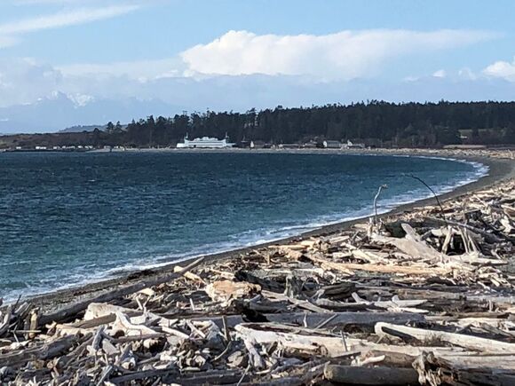 Last Saturday I caught the Route 1 bus to the Coupeville Ferry and went for a walk at Keystone Spit. I walked past a few houses, and on to the old road that runs just off the beach the length of the Spit. It’s pitted and gravelly and difficult to drive, but flat and easy to walk. Interpretive signs tell how the Spit was plotted for development in the 1890s. Those plans fell through. Again, in the 1970s a couple of model homes were built with a plan to build 200 more. But the community fought long and hard for this stretch of beach, and in the end, prevailed. Now Keystone Spit is open to the public as part of Fort Casey State Park. I worked for the State Park in the late 1980s when the model homes were torched by the Fire Department for practice. We watched the blaze take hold and put an end to those plans to develop the Spit. But every ending is a new beginning. Now Keystone Spit, on the Pacific Flyway, offers nesting sites and a rest stop to over 230 species of birds. It's an official Important Bird Area monitored almost daily by Whidbey Audubon. In recent years the Whidbey Camano Land Trust secured 423 acres on the north and east side of Crockett Lake as a preserve. Now most of the lake shore is closed to hunting. Stop here even briefly and you could see shorebirds, waterfowl, raptors, and songbirds. In summer you could even see White Pelicans. On my walk I watched Cormorants, Buffleheads, Scoters, Mallards, Eagles, Red Tail Hawks and Great Blue Herons. If I’d brought binoculars, or a spotting scope, I might have seen much more. The observation deck is often occupied by serious bird watchers. As I walked the 1.7 miles from one end to the other, what struck me was the human creativity on display. People don’t come here just to walk. There’s an amazing mass of materials and driftwood huts had been constructed all down the beach. Stick animals guarded the bird houses on Crockett Lake. Picnic sites were set up with log benches and tables. With a south facing beach, even in the cool months there’s warmth from the sun, though there is often a brisk wind, too. At the east end of the spit I saw a few divers entering the water rocking with the waves. Clearly, the key to Keystone is much more than walking. As I headed back, I came upon a couple collecting plastics from the driftwood. I looked down around my feet and noticed the assorted shapes and colors, like so much detritus. Stinger Anderson, the WSU Extension Community Beach Litter Volunteer Coordinator, leads regular clean-up efforts here. You can join him at the east end of Keystone Spit on March 25, 1:30-3:30, or on the west end of Keystone Spit on March 26, 1:30-3:30. He’ll bring the bags and gloves. You just need to dress for the weather. If you can make it, let him know. Email: [email protected] or call his Office: (360) 639-6060 or Cell: (360) 941-3171. Or get more information here: extension.wsu.edu/island/nrs/beachlitter/ Maribeth Directions:
Take the Route 1 bus on Saturday or the Route 6 bus on weekdays to the Coupeville Ferry and walk east along the beach to Keystone Spit. Or drive from South Whidbey on Highway 525 north, or from North Whidbey south, and follow the signs toward the Coupeville Ferry. Keystone Spit is just east of the ferry landing. Bring a Discover Pass to park on the old road in the middle of the Spit, or park at the east end at Driftwood Park where the road makes a 90 degree turn. |
Authors
Maribeth Crandell has been a hiking guide in the Pacific NW for over 20 years. She's lived on Whidbey and Fidalgo Island for decades. As a frequent bus rider she easily makes connections between trails and transit. Archives by date
July 2024
Categories
All
|
 RSS Feed
