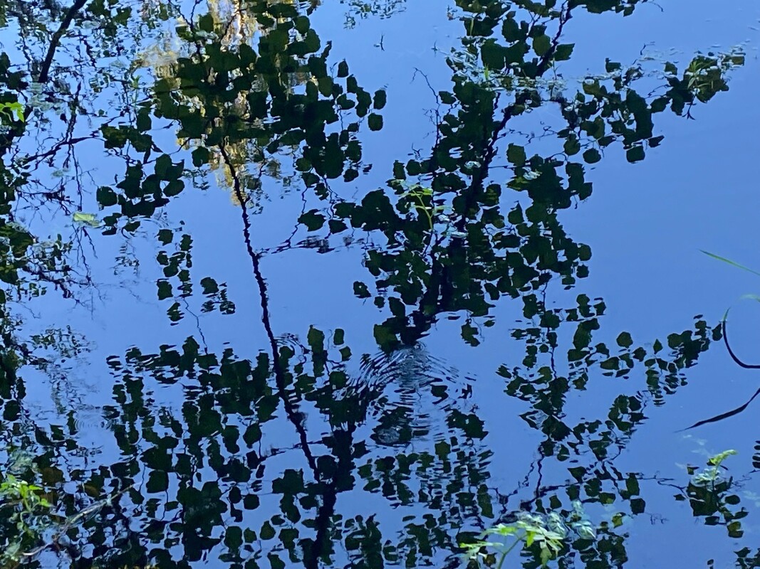
 It was a bright sun-shiney day. I had done my share of yard work and run some errands in town. The sun was low by the time I was done, but before going home, I decided to stop by the Freeland Wetland Preserve. The last time I’d been there it was snowing. What a difference the seasons make. The old barn and neighboring cabins seemed to glow in the afternoon sun as I started for the trailhead. It’s spring, at last, and there were flowers blooming at every turn. Buttercups smiled up amidst the small cedars that had been planted and fenced near the trailhead. A clump of purple columbine stood out among them. As I ventured further into the woods, lily of the valley spread out at my feet. The carpet of heart-shaped leaves boldly spring out of the damp soil as if they’d never left. Around the corner the delicate fronds of lady fern reached out over the trail. And the dainty white flowers of the native blackberries climbed over downed logs. Thimbleberry blossoms promised more to come. My attention went from the forest floor to the wide expanse of wetland as I stood at the edge, looking and listening. Yellow water lilies on the surface of the water beamed with light from the setting sun. Red-winged blackbirds sang, “Mukilteeeee-o, Mukilteeee-o.” I could see swallows swooping and gliding over the cattails in the distance. A great blue heron launched and rowed low across the water settling among the alder branches on the far shore. There were robins and song sparrows calling constantly and high in the treetops many small voices chirping and chatting together, but without my binoculars, I couldn’t see who they were. I decided to come back early the next morning. This time I was prepared. I wore a green jacket to blend in and go under cover. I brought my camera, binoculars, and the new phone app I’m just learning to use, called Merlin. It’s like having an expert birder in your pocket. Merlin listens to the bird calls and then lists the birds that are singing and even shows a little picture of the songsters. I didn’t want the birds to know they were under surveillance. So, I stopped and sat still in different spots on a bench, or a log, here and there. Merlin caught the calls of the usual characters, the robins, song sparrows, chickadees, towhees, a downy woodpecker, red-winged blackbirds and a heron. There was a chipping sparrow, house finch, pacific slope flycatcher, an olive sided flycatcher and wood pewee. I was thrilled, but it got better! It listed an orange crowned warbler and yellow warbler, birds I only see in the spring. Then I moved upslope into the cedar grove, it told me the bird calling consistently on my left was a black-headed grosbeak, the one on my right was a Western Tanager! I don’t know all of these bird’s calls, but I know what most of them look like, so I looked. I looked hard. I scanned with binoculars. I stood for several minutes in one spot trying to catch a glimpse, but no. These birds were under cover. The spring flush of foliage had provided the cover they need to feel safe, find food and build nests. It makes them very hard to see. So just go and listen. If you get really lucky, you may actually see some. And if you’re very, quiet and clever, you may even get a photo. Good luck with that. Maribeth Whidbey Watershed Stewards owns and maintains the Freeland Wetland Preserve. Click this link to learn about their educational programs and their Spring Matching Challenge. A generous, anonymous donor will match any donations contributed before June 1st up to $5,000. Donate online or mail to: Whidbey Watershed Stewards, PO Box 617, Langley, WA 98260. Directions: From Highway 525 in Freeland at the light, turn north onto Main Street and follow it east to Newman Road. Turn left and look for the sign on the right.
Bus and Bike: The Route 1 fare-free Island Transit bus comes through Freeland six days a week and stops nearby (800 feet away) at the corner of Main Street and Newman Road. A bus bike rack can hold 2-3 bikes. Newman Road is a mostly level and lightly traveled road. Please wear bright clothes while riding a bike. Mobility: This trail is short and mostly gentle. However, there are some obstacles including a tree that has fallen, and a few significant roots across the trail that may be challenging for those with mobility issues.
0 Comments
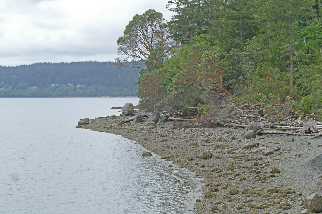 The rain was letting up. Clouds were lifting a little; sunshine threatened to break out later in the day. The air was not cold, though a constant breeze off the water told us to keep our coats on for now. We parked near the small parking area for Kukutali Preserve, shouldered our packs, and headed down the gravel roadway, the trail leading onto Kiket Island. Birds sang gloriously in the freshly clothed alders and willows to the side. Hear the song sparrow, the nuthatch, the thrush and the flycatcher joining disparate voices. The creek beside us gurgled quietly. I still remember the first time I visited here. The owner, Wally Opdyke, invited four Parks staff to walk the island with him to see if Parks might be interested in buying it. We walked down this road, talked about the island as we looked at maps draped across my car, then headed down to the causeway leading to the island itself. This will be amazing, I am sure, I told myself back then. Walking onto an island park. I feel the same way every time I visit. As we walked down the approach, the island loomed ahead, inviting exploration in this place separate from the mainland, separate from daily life, separate from the noise and busyness and cares of our civilized lives. Those cares become a distant memory as we walked out onto the isthmus, the wind freshening across the bay and open beach, an eagle cruising above. Back then, this was a causeway, built up with rocks and gravel to be a road connecting Kiket Island with Fidalgo Island. A few years ago, we were able to remove the causeway, allowing the shoreline processes to literally re-create Kiket Island as an island, at least at high tide. Today the tide was receding. Driftwood and wrack lay in the gap between Fidalgo and Kiket. A heron watched the lagoon’s waters for breakfast with the patience of a Zen master. Seagulls took the more relaxed approach, lingering at the lowering tideline to see what they might find left behind. We climbed out onto the small meadow on the southeast corner, then wandered up the island’s center road a ways. An orange-crowned warbler flittered from tree to bush to tree, singing a trilling melody. Thrushes sang their own tunes. We followed the north trail through the old growth forest, hearing a pileated pounding on a hollowed-out snag. The forest is otherwise quite quiet here. We walked with hushed footsteps, admiring the new growth on ferns, salal, Doug firs, evergreen huckleberries – indeed, every plant seemed to be lush in an explosion of bright green in this belated spring. Of course we paused at the bench that overlooks the water, with Deception Pass in the distance. Then dropping down to the meadow area, the memories of my first visit visited me like a friendly ghost. Back then, there was a large house here, and a swimming pool and tennis court. It had been a home for various people for almost sixty years. Wally walked us through the hallways and out the back door, past the hot tub, to the view of the Pass. The view was astounding, astonishing, a world apart. Today, we walked past the meadow and down the short path to the west end of the island. Bees hummed among magenta salmonberry flowers. Sunlight bounced off wavelets to the south; the north bay was calm and quiet. Clams squirted every couple of seconds as the tide continued to lower. We sat on the beach, mesmerized by the place. Again I felt that amazement I had first felt, that feeling of being in a world apart, a private enclave, a rich man’s paradise -- now a natural paradise, belonging to all, for everyone to experience. We lingered far longer than we had intended. It will always linger in our memories. Directions: From Highway 20 at the March Point Park and Ride, go east on 20 to Reservation Road. Go south on Reservation Road about a mile and a half; turn right onto SneeOosh Road and go just over a mile to the parking area on your right.
By Bus: Transit services does not go down Reservation Road or SneeOosh Road. By Bike: From Anacortes, the Tommy Thompson Trail goes to the March Point Park and Ride. From here, ride across Highway 20 and turn left on Summit Park Road. Continue east on Stevenson Road, then right on Reservation as described above. These hilly roads have limited shoulders but relatively limited traffic also. Mobility: the main trail across the island is firmly graveled but fairly steep. Getting to the island is a challenge however, as the beach is covered with loose gravel, driftwood, and other obstacles. 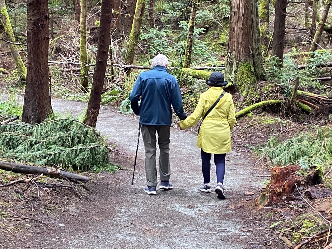 There are certain people that live on long after their body falls away, like Carl Westling. From 1970 until 1997 he was a science teacher and coach at South Whidbey High School. He was named “Coach of the Year” in 1992 for his work with the girls’ cross-country track team. Since he started coaching the team in 1975, they had earned seven league championships and four state awards. Some of his team members went on to become All-American athletes in college. Westling suffered a series of strokes. Still, from his wheelchair, he continued to work with the Falcon track team as an assistant. He designed and, with lots of volunteer help, built the first trails in the woods just behind the High School at South Whidbey Community Park. These trails are now considered one of the best cross-country courses in the state. They circle ball fields, a skateboard park, playgrounds and picnic shelters. I didn’t know Carl, or run track, though for twenty years, I ran a few miles a day. A back injury slowed me down. Then I discovered that I could see and hear more at a walking pace. Sunday, I went walking with a friend and her dog. As we started out, we heard a mob of robins barking at something. We peered through the trees and saw a barred owl perched in a tree, surrounded by raucous robins. It looked up and down and all around, as only owls can do. We watched for a while before moving on. Though the first week of May was a wet one and the day before had been especially soggy here, these trails were mostly dry and smooth for easy walking... or running. I had come here last spring with a friend in a wheelchair. We’d taken an Island Transit bus to the park entrance on Maxwelton Road and gone right through the park on trails to meet the bus again on Langley Road. There was just one place that might have given her wheelchair trouble. Alongside the upper soccer field, the trail slants and the edges are soft. All the other trails could easily support someone on wheels, or someone using a cane, like the fellow we met on our walk. The Falcon Trail at the south end of the park is steep in places but the rest have a gentle grade. These trails were well designed and constructed, well-marked and well maintained for anyone whether they walk, run or roll. Almost everyone we passed had a dog. Dogs are ambassadors that reach out to meet and greet their canine counterparts. Holding the end of the leash we are pulled together to say hello and ask about each other’s animals. One looked like Toto. There was a sweet white one and a charming gold one. There were hounds with beautiful brown eyes and huskies with brilliant blue. Each looked for a little sniff, a pet, a smile and a word. There were pet poop bag dispensers strategically placed and we didn’t see anything left behind for the track team, or anyone else, to step in. Carl Westling and his wife, Pat, had traveled widely including going to 3 Olympics in Atlanta, Barcelona, and Los Angeles. Before he died, Carl told his wife he wanted to continue to travel the world, so when he was cremated, his ashes were dispersed into small, green bottles. His friends and former students have carried them on their global adventures. His remains were taken on a safari in Africa, run a marathon in Athens, scattered on the Nile, climbed Mount Saint Helens, trudged the snows of Alaska, and cast upon the waters of Tierra del Fuego. And when you’re taking a walk on the trails at the South Whidbey Community Park and the High School track team runs by, you can bet he is there, too. Maribeth For a map of these trails click here. Directions: From Highway 525, 3 miles north of Clinton, turn north at the light onto Maxwelton Road. Pass the High School and take the next right into the park.
Bus and Bike: Island Transit Route 60 goes to the park entrances on Maxwelton Road and Langley Road and can carry 2 wheelchairs and 2-3 bikes. Maxwelton Road is fairly flat, has wide shoulders and slow speeds through the school zone, so it's a good place for a bike ride. Wear bright colors for safety. Mobility: This park is a good place for people of every ability level. Wheelchairs do well on all but the trail alongside the upper soccer field. There are steep sections on the Falcon Trail at the south end of the park. 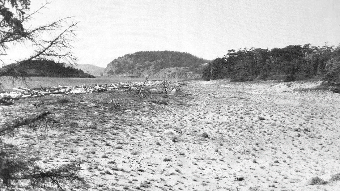 Celebrate a birthday! Deception Pass State Park is 100 years old this year! Set aside as a park in 1922, it has unfortunately suffered in the ensuing years from some uninformed development that destroyed key habitats. Consider West Beach as it once looked a hundred years ago. Sand dunes covered the backshore between Cranberry Lake and the Straits, from West Point all the way down to the present Navy base. In the Thirties, National Park planners designed park roads and structures to allow visitors to explore the park while still protecting critical and sensitive resources. The plans guided the work of the Civilian Conservation Corps, who added a swim beach at the east end of Cranberry, with a promenade in the lake and a bathhouse and store in the grassy uplands. No development other than a lakeshore trail went west of here, leaving the dunes and West Beach entirely natural. Fast forward to the early Fifties, when Parks decided to turn the lakeshore trail into a road. The unique and fragile dunes became a parking lot, first covered with gravel, then paved over, right into the beach driftwood. Later a long bathroom and concession dominated the narrow spit between the lake and seashore. Houses filled the dunes south of the park boundary all the way to the now-noisy Navy base. A remnant of the dunes was left untouched south of the concession stand, with a loop trail through the foredune and backwoods. Park staff later paved this trail, then added interpretive signs to illustrate the life of the dunes that remained.  We hiked the Dunes Trail last weekend. The parking lot was filling up at noon on this warmish day. We went south, passing kids swimming in the still-cool waters of the lake, families barbecuing at picnic tables, folks flying kites, and a scattered stream of beachcombers walking the gravelly shoreline on an outgoing tide. The Dunes Trail, though, was empty as we walked down the eastern edge and through the shaded woods, sheltered from the breezes off the water. At the lakeshore overlook we paused to listen to a chorus of birds in the ecotone of forest and wetland. Love songs of spring filled the air. A bright-yellow Wilson’s flitted past, a ray of sunshine through the dark green branches. Walking farther south, we commented how we had neither seen nor heard anyone for some time now. That’s when three young kids barreled toward us on bikes, their parents sheepishly following behind, apologizing to us. “No apology necessary,” we said, as the kids passed us slowly and safely, heading to the beach. We followed them along a spur trail to the beach and sat down on a log to soak up the sun and salt air. Groups of friends and families strolled by in both directions, smiles on their faces. Dogs led their owners over to us to greet our dog Murphy, who relished meeting new faces and smells. We eventually headed back to finish the loop. The openness of the sunny skies above filled our hearts with joy after months of gray. The half-mile trail was still mostly devoid of people, yet full of interest and beauty. Flowers burst in vibrant colors above the sand. We stood in awe to marvel at the 800-year-old fir near the end of the trail, its magnificent branches intricately interwoven. An elderly woman shuffled past us, clinging to the elbow of her friend for support. A lone woman walked past, lost in thought. A young couple sauntered the other way, arm in arm. An eagle watched over it all from its perch above. We wandered back to the hubbub and busyness of the parking lot, the dunes a distant memory underneath. Oh what changes time brings, what changes we have wrought upon the land. And what remnant havens we still have today and for the next hundred years. Directions: From Highway 20 at the Deception Pass Bridge, go south one mile to the Cornet Bay Road intersection and stoplight. Turn right, west, into Deception Pass State Park. (A proper park pass is required to park in the park.) Follow the signs to West Beach, and park in the large parking lot. (Or park at the entrance and follow the lakeshore trail as the original planners intended.) Go south from the parking lot to the remnant of the dunes. The trail is a loop.
By bus: From March's Point or Oak Harbor, take Island Transit 411W to Seabolts or the nearby Cornet Bay transit stops at Deception Pass. Enter the park on the west side of the highway. By bike: Highway 20 is narrow and hilly in this area, for several miles in each direction, particularly from the north. Mobility: From the West Beach parking lot, the paved trail follows the lake shore to become the Dunes Trail. Be aware: the park is extremely busy on warm days, especially in the summer, and may be full. Parking is plentiful at the park entrance. And jets fly low and loud at times, but less often on weekends. |
Authors
Maribeth Crandell has been a hiking guide in the Pacific NW for over 20 years. She's lived on Whidbey and Fidalgo Island for decades. As a frequent bus rider she easily makes connections between trails and transit. Archives by date
July 2024
Categories
All
|
 RSS Feed
