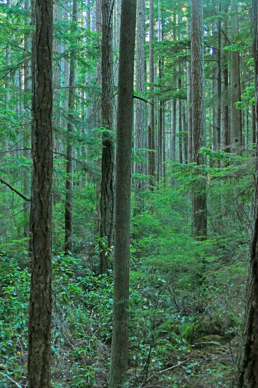
 A tree that is beginning to grow sends roots down into the earth even as it reaches and opens to the sky above, seeking light. In the same way, we can envision ourselves as treelike beings, imagining that we have roots reaching down into the earth, strands that keep us connected. At the same time, our heads and hearts lift and open to receive light from above. Recent studies have shown that underground, where roots are growing, trees intermingle their web of roots to communicate with each other, to share resources, and to warn of danger. As our roots with others intermingle, our web of connections gives us strength, and help in time of need, and deeper insights into the world around us. We also share creative ways of growing, regardless of the challenges we come up against in our environments. Trees will grow through rock, shattering it in their effort to reach the soil and air and light they need to survive. We are similarly resilient, with a built-in propensity for growth and the conditions that promote it. We find creative ways around the obstacles we confront as we move along our paths, getting fed and in turn giving back to our world. I wanted to be a tree this morning. I wanted to feel the soil under my feet, the bark against my skin, and the sun and wind on my head. I knew Hoypus Hill would give me a huge community of trees to join up with. I hiked into the forest before sunrise on a toasty warm morning. I started at the Ducken Road trailhead, a quiet access point in a busy park. Almost immediately I heard robins chirping an alarm, so I looked around and found the source of their irritation: a barred owl sitting on a branch not far from the trail. I followed the Logging Road trail to the Big Swamp trail, then headed deeper into the woods along that rougher route. In 1984, before it was a park, Hoypus Hill was logged and replanted. Some old growth can be found, but many of the trees date from the Eighties, almost forty years ago now. I found an inviting tree and I hugged it for a minute or two, feeling its rough bark, sensing the life underneath. Then I slipped off my shoes and walked the trail barefoot for a while, recognizing the earth’s sustaining energy below me and the occasional sharp stick. Then I sat on a log and sat. And sat. And listened and smelled and breathed and became a tree. A bee buzzed the huckleberry next to me. A squirrel chattered nearby. A Pacific wren walked the log across from me. A raven called to a partner, who answered back. A rooster crowed in the distance. A rooster? An unseen bird flapped its wings high above the treetops. And the trees just stood there, as they have for decades, growing slowly and deliberately. Not trying to impress, but impressive anyway. Steadfast, rooted, grounded, strong, dependable. I became them. Sunlight dappled through the high crowns. Here on the ground the air smelled rich, almost tasty with oxygen. A chickaree walked across the log in front of me, up the next tree, and called to a mate, who chittered a reply. A nuthatch whined loudly, a flycatcher called for beer, and it was time for me to move on. I followed Big Swamp to Hemlock Hideaway, which features groves of hemlocks of course. That dropped into Fern Gulley, which slips through an amazing field of swordferns. That connected to the North Fork Trail and back to Ducken. Now I could hear distant sounds from the highway and our human way of life. I got back in my truck and became a part of that noise, separate from the world of the forest that had bathed and cleansed me so well this morning. Getting there:
From Highway 20 follow Ducken Road to its easternmost end. The parking area is round to allow horse trailers to turn around. The Logging Road trail heads north past the gate and kiosk at this parking area. Take a photo of the map on the bulletin board if you didn't bring a map with you, as there are no obvious landmarks other than trail signs in the woodlands. Be sure to have your Discover Pass displayed in your vehicle.
0 Comments
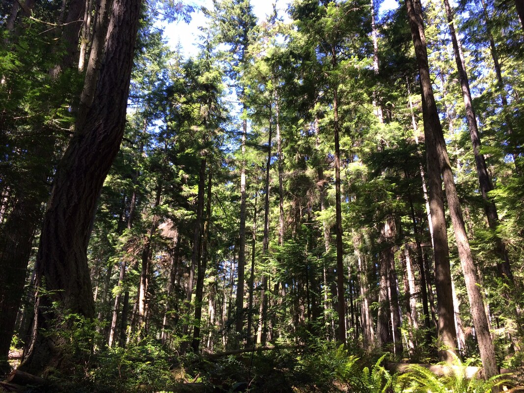 Our Northwest summer has finally arrived. It’s the best time for outdoor activity and the best place for it. I grew up in the hot, humid South and suffered through my childhood summers. My parents didn’t believe in air conditioning so I sometimes stood directly in front of the fan for relief. When I came to Washington for a summer job forty years ago, I loved the natural beauty, the climate and the people. I’ve lived here ever since. Even in 2006 when I hiked the Appalachian Trail from Georgia heading north in March, I stopped hiking in hot, humid, bug ridden New York State in June to return to Washington and work as a hiking guide for the summer. I returned to the Appalachian Trail in September in Maine and hiked south through New England in the fall until I completed my thru-hike. Timing is everything. Even in the mild Northwest summer there are days that are downright hot. Then I choose my hikes carefully and pack appropriately. This week I wanted to explore Putney Woods. It’s shady. I brought lemonade which adds electrolytes to my water bottle. On the AT I discovered when you’re sweating on a long hike and drinking only water, the minerals in your body can get depleted. Any kind of fruit juice, sport drinks or salty snacks can help restore the minerals you need. I hadn’t hiked in Putney Woods very much. With over 600 acres and 15 miles of trails I thought I might need a guide so I stopped to ask my friend, Lee, who lives nearby. Without hesitation, she said yes. Her dog, Piper, was happy to come along. She packed water and treats for herself and Piper. This area near Langley has poor cell phone reception, so she also brought a paper map which we referred to often as we made our way through the web of trails. Putney Woods connects to Saratoga Woods and the Metcalf Trust Land trails so you could walk from Saratoga Road all the way to Goss Lake on this trail system. These connections are important for people and wildlife. Instead of entering the woods at the expansive Lone Lake Road parking lot, she directed me to Keller Road, across from Goss Lake Road. There are three trail heads here. We started on the middle trail where I could park in the shade. We didn’t see any other cars at these entrances though it’s walking distance to some houses and accessed by locals on foot. It’s fun to choose a route with all the imaginative trail names here. We could have taken the Jane Eyre, Wuthering Heights, Oliver Twist and Trail of Two Kitties loop. Instead we chose the Ross Road to Wile E. Coyote, and Moss Valley to Pteromys (Latin for flying squirrel). We passed Strix Varia (Latin for Barred Owl), crossed the Spiders Web and finished our hike on Edgewood. It's a maze of trails but all are well marked. Mid hike we sat on a log for a drink and a snack. With Pipers fur coat she was a hot dog. In one hour we’d hiked through the heart of the woods on a summer Saturday and met only 10 others, jogging, dog walking, mountain-biking and hiking. Near the end of our hike we passed LuLu’s Lane. Gary Putney’s passion was building and maintaining these trails riding his white mule LuLu. From 1980 to his death in 2006 he worked with the Backcountry Horsemen and other volunteers to develop this trail system. The south end trails where we started were nearly flat, but the north end has some ups and downs, like on the Roller Coaster trail. If you’re looking for a cool hike on a hot day, this one is made in the shade. Click here for a map: www.islandcountywa.gov/PublicWorks/Parks/Pages/putney-woods.aspx Directions:
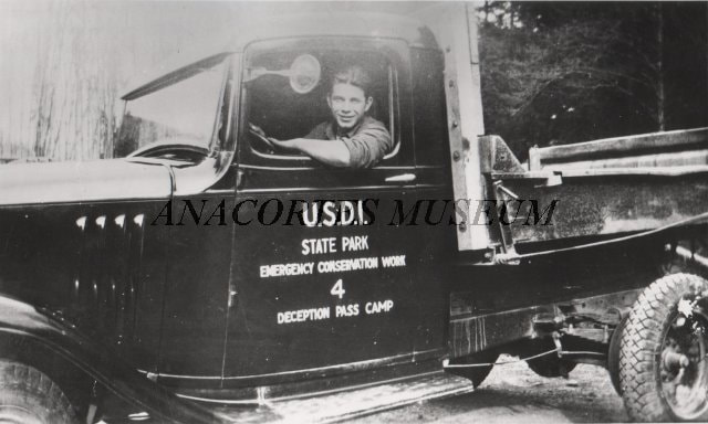
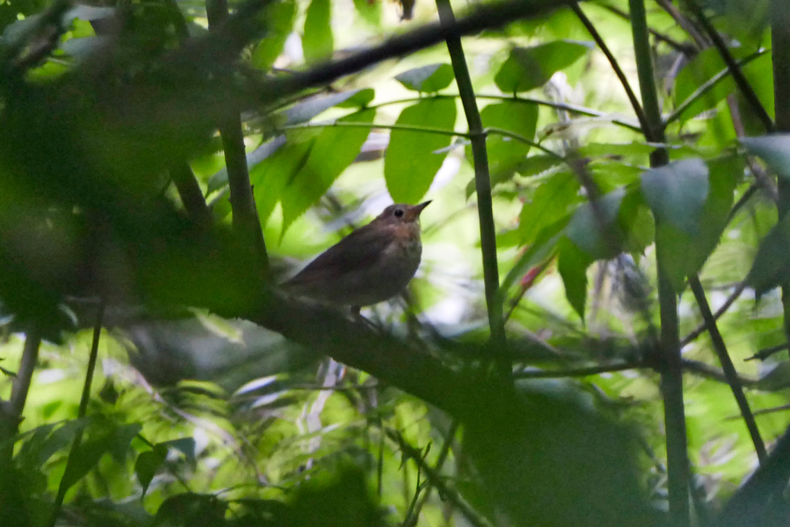
On Whidbey take highway 525 to Bayview Road and turn north toward Langley. Drive 2.2 miles and turn left onto Andreason Road. In a half a mile turn right onto Lone Lake Road. In another half mile turn right onto Keller Road across from Goss Lake Road, where there are three trail heads on the left. Or continue north on Lone Lake Road another half mile to the large gravel parking lot on the right. This parking lot is big enough for horse trailers and has a kiosk with a map and a picnic table.  As a ten-year-old he was raised on the streets of Brooklyn by his older brother. When the Depression hit a couple years later, he stole food to survive. After being arrested yet again at the age of 16, a judge gave him a choice between jail or the newly formed Civilian Conservation Corps, created by President Roosevelt six weeks into his first term. He chose the CCC. He was shipped by rail to a little town in Washington called Anacortes, and then by truck and boat to a camp at Cornet Bay on the shores of Deception Pass. There he served two six-month terms, building roads, using dynamite, learning how to fashion metal, create concrete and rock structures, and get along with others. He was fed three meals a day and paid $25 a month, most of which went to his brother and he never saw it. The camp changed the teenager, John Tursi, into a responsible adult, who served in the army and then became a successful engineer with the refineries in Anacortes. He and his beloved wife Doris donated generously to the community, including to the Anacortes Community Forest Lands and to the place where his new life had started, Deception Pass State Park. Living until his mid-nineties, John humbly created a legacy of caring for our community and our environment. His legacy and memory are honored and commemorated by having a trail named after him, a trail that connects Deception Pass with the Anacortes Community Forest Lands. He helped dedicate the trail a few months before he passed away, squeezing my hand lightly as the John Tursi Trail sign was revealed. Above left: John Tursi as a teenager at Camp Cornet in 1934. Image courtesy of Anacortes Museum. Above right: John, a few years later, in front of the tunnel he helped build. Memories of John flooded back to me this week as I walked the four-trail complex of which the John Tursi trail is a part. With a Coupeville friend I walked the Pass Lake loop trail late one afternoon this week. Built in 2005, the two-mile trail stays within a stone's throw of the lake for a half mile, then climbs steeply and descends just as quickly down to Rosario Road, then climbs and drops back down to the Pass Lake parking lot. Be sure to have your Discover Pass to park there. Below left: The start of the Pass Lake Loop trail at Pass Lake. Below right: the trail wanders through firs and ferns, nettles and nuthatch nests. Another alternative is to take the Ginnett Trail from halfway around the loop trail, and climb the low ridge and drop down into Naked Man Valley before climbing up to a homestead viewpoint, a mile and a half from the Pass Lake Loop intersection. Two points of interest here: one, as you cross the ridge line, listen for the sounds of the highway, and then notice what happens to those sounds just fifty feet down the north side as you head into the valley. And two, yes, it is called Naked Man Valley. That’s a long story to be shared around a campfire someday. Below left: the lush trail habitat at the bottom of Naked Man Valley, Below right: the best I can do so far to illustrate the elusive Swainson's Thrush. It's song, on the other hand, echoes and haunts throughout the wilds of western Washington. From the valley bottom, you can then take a third trail, one that leads westward up a very steep ravine to the largest cedar that I have ever seen in Deception Pass. It’s less than a half mile to the cedar but the first quarter mile feels like it is straight up. Listen to the quiet and your heartbeat. If you have enough friends with you, try to reach around the tree. Marvel at its size, and wonder at how long it has been growing here. Below left: the Ginnett Trail and Big Cedar Trail intersection Below right: the big cedar, or some of it anyway. From here you can keep going to intersect the middle of the Pass Lake Loop Trail, or drop back down to the Ginnett Trail which then heads north out of the valley and up quickly to the magnificent view out over Naked Man Valley from the old homestead. Moss-covered bedrock provides stadium seating for the view out toward Pass Lake, partly hidden beyond the southern ridge. And here is where the John Tursi Trail begins, heading east and north along the shoulder of Ginnett Hill, across more moss-covered rocks, also called balds, with views toward Rodgers Hill to the east, then past an old miner’s cabin with the mine behind it waiting for your exploration. The trail then continues to the northern park boundary down a long slope to Donnell Road, above which you can see Mt. Erie rising and inviting you to keep going. The next morning, I did this route backwards, riding my bike from Anacortes to the Donnell Road trailhead. (If arriving by car, the nearest legal parking is at the intersection of Campbell Lake Road, Sharpe Road, and Donnell Road, about a level half mile away. No pass required.) I locked my bike to a tree and hiked up the fog-shrouded trail, seeing the evidence of the creative hard work the trail builders had to perform to get through the many clefts and ravines along the route. The heavy fog condensed on the needles and leaves of the trees all around, then fell as rainfall -- or fogfall maybe. Check out this video of the gentle cats feet sound of fogfall at the Big Cedar. Click on this YouTube link: https://youtu.be/wecbSCAnTu8 At the very bottom, I again listened to the quiet in Naked Man Valley, and lingered to find the source of the song of a Swainson’s Thrush. I climbed back up to the Ginnett homestead as the fog swirled through the valley, just now beginning to lift as dawn became late morning. Faint sounds of the distant highway were muted by the fog and covered by nuthatches and flycatchers and more thrushes. Sunlight burst through in full glory as I crossed the last of the balds overlooking Rodgers Hill and headed back past the quarry and cabin and mine and back to my bike to ride home. Below left: the fog begins to lift above Naked Man Valley's deep forest Below right: near the beginning of the John Tursi Trail, although having the sign nailed to a tree may not be the most appropriate sign post. I think that John would be pleased with this trail today, and with the way it offers views, hidden gems, healthy wildlife habitats, and unknown surprises around nearly every new corner, if we take the time to look. I also thought back to how he started in life, stealing on the streets just to get by, and how he became a man of humility and respect and love by learning and working hard and caring for others and the land. The legacy we leave behind is the measure of love that we choose to share. John Tursi’s legacy is unmistakable, a treasure that generations can enjoy forever. jack In the slide show:
1. The cabin, showing considerable damage by vandals since the trail opened just a few years ago 2. The nearby cave to explore 3. The red rock quarry, with several cairns in various states of creation and tumble-down 4. A foggy ridge near the homestead overlook 5. Oregon grapes 6. Three pine siskins in a treetop? 7 and 8. The views across to Rodgers Hill from the Tursi Trail 9. The Donnell Road trailhead. No parking allowed. 10 The parking lot at Donnell, Sharpe, and Campbell Lake roads, a half mile north of the trailhead. 11. Some Indian Pipe growing out of a nurse log. Directions: Pass Lake Parking Lot: Just north of the Deception Pass Bridge turn west on Rosario Road, then immediately turn right into the Pass Lake parking area. Discover Pass required. Donnell Road: Park at the intersection with Campbell Lake Road. No pass required, just a half mile hike to get to the trailhead! Or ride your bike if it is reasonable to do so. The Heart Lake Road has the slowest traffic speed and has the fewest steep hills, but it has almost no shoulder. Be careful. NOTE: Do not park at the east end of Ginnett Road. This is a no-parking emergency vehicle turn-around. 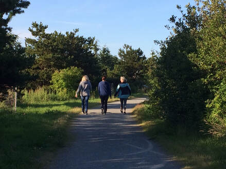 After work last week, I met Jack for a walk on the Oak Harbor Waterfront Trail. There was a huge park remodel last year that was part of the construction of the new Waste Water Treatment Plant. Just mentioning the WWTP puts a lot of “hikers” off, and this park in downtown Oak Harbor, isn't exactly a pristine wilderness. But if you haven’t been, try it. The City of Oak Harbor has done an exceptional job to make this a park with something for every age, ability and interest. And I’m impressed by how the City has provided miles of free public access to the waterfront. On the west end of the Waterfront Trail is Freund Marsh where we started our walk at a pretty little park on Scenic Heights Road. Spend a few minutes here to see the colorful displays, a rain garden, pervious pavement and a circular patio with benches that creates an echo if you talk while standing in the middle. From here a wide, gravel trail winds through a natural area with interpretive panels, benches, and bridges which is a good place for bird watching, or just to take a quiet walk, jog or bike ride. The City created ponds and planted snags to enhance the wetland habitat. If you want to see wildlife, come early in the morning and bring your binoculars. This west end of the trail is easily accessible from the bus stop at Walmart with just a 2 block walk downhill toward SW Bayshore Drive. Buses are running at a full schedule again, with more frequency to allow proper distancing. Hand sanitizer and face coverings are offered onboard for your safety. All Island Transit buses are free, ADA accessible and have room for 2-3 bikes on the bike rack. From this park entrance you can walk about a mile east to Flintstone Park and catch another bus back to Walmart or beyond. See the new schedule at www.islandtransit.org If you’re a parent or grandparent, this trail is a great place to bring the kids. After a walk through Freund Marsh, continue eastward across Beeksma Drive to enter Windjammer Park (also known as City Beach). You can go play on the beach to build driftwood huts, sand castles or go wading. Or continue walking beyond the bridge by the swimming lagoon to find the shipwreck, rocks and logs to climb on, or visit Bailey’s playground. (Bring hand wipes.) Sno-Isle Library has a story trail with pages of a children’s book just a few yards apart. There are benches where you can sit to have a snack, or lure the kids on with promises of a trip to Popsie’s candy store once you leave the park. Just walk one block north of Flintstone Park to historic Pioneer Way and turn right. If you’ve never been to Popsie’s, it’s a real treat! If you’re not a kid but still young at heart, you could launch a paddle board or kayak from the boat launch at the end of Beeksma Drive. Or shoot hoops at the courts nearby (if it’s not too crowded). Acres of lawn and a wide paved path along the water offer room to roam where you can walk a dog, or go for a jog, throw a Frisbee or sit by the lagoon. The trail is paved through Windjammer Park and then turns to boardwalk for the last stretch before entering Flintstone Park with a dock, restrooms and picnic shelter. It’s right across SE Bayshore Drive from Harbor Station, Island Transit’s bus hub in Oak Harbor. You can continue walking on the sidewalk all the way to the marina, and if the Navy allows, out on Maylor's Point, another natural area on the south side of the bay. As the sun sank low, we finished our walk with a stroll up to Pioneer Way for dinner at a favorite restaurant. Georgia Gerber’s Stumbling Ducks greeted us on the sidewalk. Maribeth Directions by Bus: Take the Route 1 or 6 to Oak Harbor and get off at Walmart. Walk two blocks south, crossing Highway 20 at the light, and you'll see the park entrance at the bend in SW Bayshore Drive. OR take Route 1, 3, 411W, 6 or 14 to Harbor Station and cross the street to Flintstone Park.
Directions by car: Take highway 20 to Oak Harbor. You may park at the Scenic Heights trail head on Scenic Heights road between Swantown Road and Walmart. Or continue along the waterfront to park at the end of Beeksma Drive, City Beach Road or Flintstone Park or along SE Bayshore Drive. For a map, click here: https://www.google.com/maps/place/Windjammer+Park/@48.285487,-122.6572276,17z/data=!3m1!4b1!4m5!3m4!1s0x548f8a3ff8bfff89:0x97649ace067b226b!8m2!3d48.2854835!4d-122.6550389 |
Authors
Maribeth Crandell has been a hiking guide in the Pacific NW for over 20 years. She's lived on Whidbey and Fidalgo Island for decades. As a frequent bus rider she easily makes connections between trails and transit. Archives by date
July 2024
Categories
All
|


 RSS Feed
