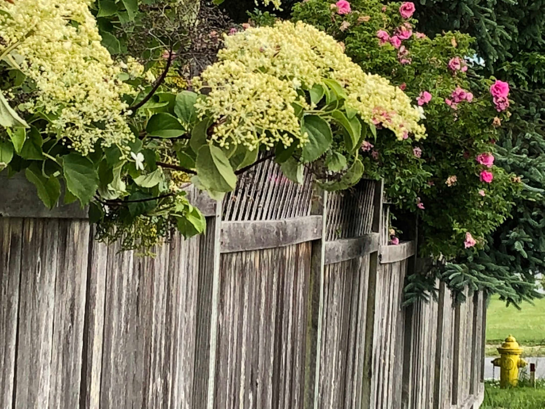
 I took Island Transit to Coupeville to get some photos for the Census committee. It’s one of the hats I’ve been wearing lately. As we passed the Elementary School, I thought about how they benefit from the Census by getting federal funds for Head Start, school lunches and special education. I got off the bus at the hospital, another agency that benefits. The bus pulled away and I realized that transit is also supported by Census numbers. As I walked north on Main Street I passed the Fire Station, the Boys and Girls Club, the Food Bank, the Road Shop, more beneficiaries of an accurate Census count. I crossed the street to ask if Sunshine Drip would help promote the Census and took a photo of them with a banner. Next door is the County Elections office and a ballot drop box. The Census also determines how many seats we have in Congress. I had some time so I walked the Kreuger Trail around town. On NE First Street I passed the Island County Human Services offices. Their programs assist the homeless, victims of domestic abuse, disabled, veterans and seniors. Billions of federal dollars are allocated based on our Census data. The closer we get to a complete count, the more everyone will benefit. It takes 10 minutes to answer 10 questions. We only get one chance every 10 years to get this right. Now is our chance. https://2020census.gov/ As I reached the corner of NE 1st and Wilkes I took my Census hat off and put on my Hike of the Week hat. This hike is about as close to home as you can get for a lot of people. As I passed the colorful condos, I noticed hearts in one window. With more people taking neighborhood walks due to the pandemic, people are putting signs, hearts and rainbows in their windows to cheer up passersby. It worked for me. Around the bend a deer grazed next to a kiosk that marks the short cut through the woods to Broadway. I stayed on Wilkes as the path dropped down passing homes and yards. Hyacinth and roses hung over a weathered fence. I inhaled their perfume. Then, stepping around the No Parking sign, I went along the edge of the village green where deer grazed peacefully. The library is closed, but still welcoming with outdoor benches and encouraging signs in the windows. Turning west I crossed the town parking lot and headed for Kreuger Street. A narrow trail led between a cattail marsh full of Red Winged Blackbirds and a pond where a Mallard swam out from behind yellow iris. I skirted the pond and walked between homes up 7th Avenue. A block later I turned left on Broadway. As I passed mailboxes and picket fences I saw more deer. The yards gave way to woods as I came to a bench where the short cut from Wilkes Street meets this trail. A buck crossed the road and entered the woods as I approached the church. The path winds between trees in front of the church, and then turns east crossing a wide open lawn between a little wetland and a community garden. The trail then enters the woods where I heard a cheery bell as a bike rider passed me “on the left”. The trail emerged from the woods and I followed the sidewalk on Birch Street toward the art school and back to the hospital. When I worked in Coupeville, I took this trail almost daily on my lunch break. As I boarded the bus to go home, I saw another professional on a “power walk” taking the same loop. This is not a wilderness hike. It’s a daily meditation, a place to walk the dog, push the baby stroller, go for a jog. It’s a short cut to school, a quick walk at lunch or a place for someone visiting the hospital to take a much needed break from a crisis situation. We all need these places in our lives. Thank goodness we have them. Bus Directions:
Bring a face mask for the bus. Take fare free Island Transit Route 1 bus to North Main Street in Coupeville. Disembark at the hospital and start your walk across the street by going down NE First Street. Turn right on Wilkes and follow this description in a counter clockwise loop. Driving directions: Take Highway 20 to North Main Street in Coupeville. Turn left at 8th Street and park in the parking lot next to the library. Start your walk by going west across the green (opposite of the library). You'll see a trail that leads around a pond on Kreuger Street. Turn right on 7th and left on Broadway. Follow this description in a counter clockwise loop.
0 Comments
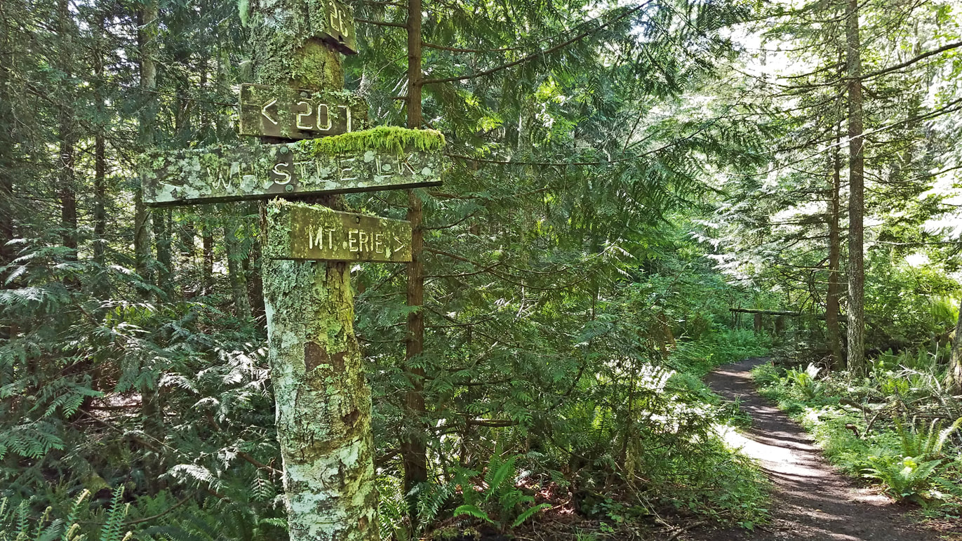
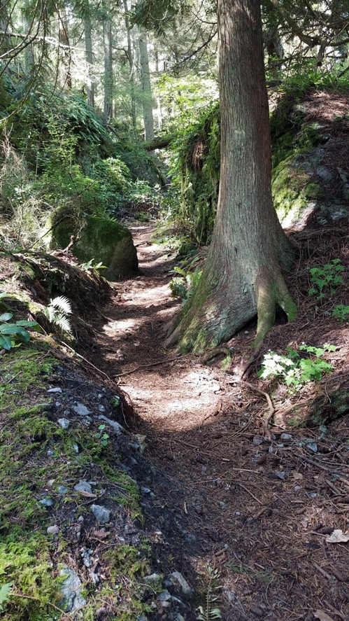
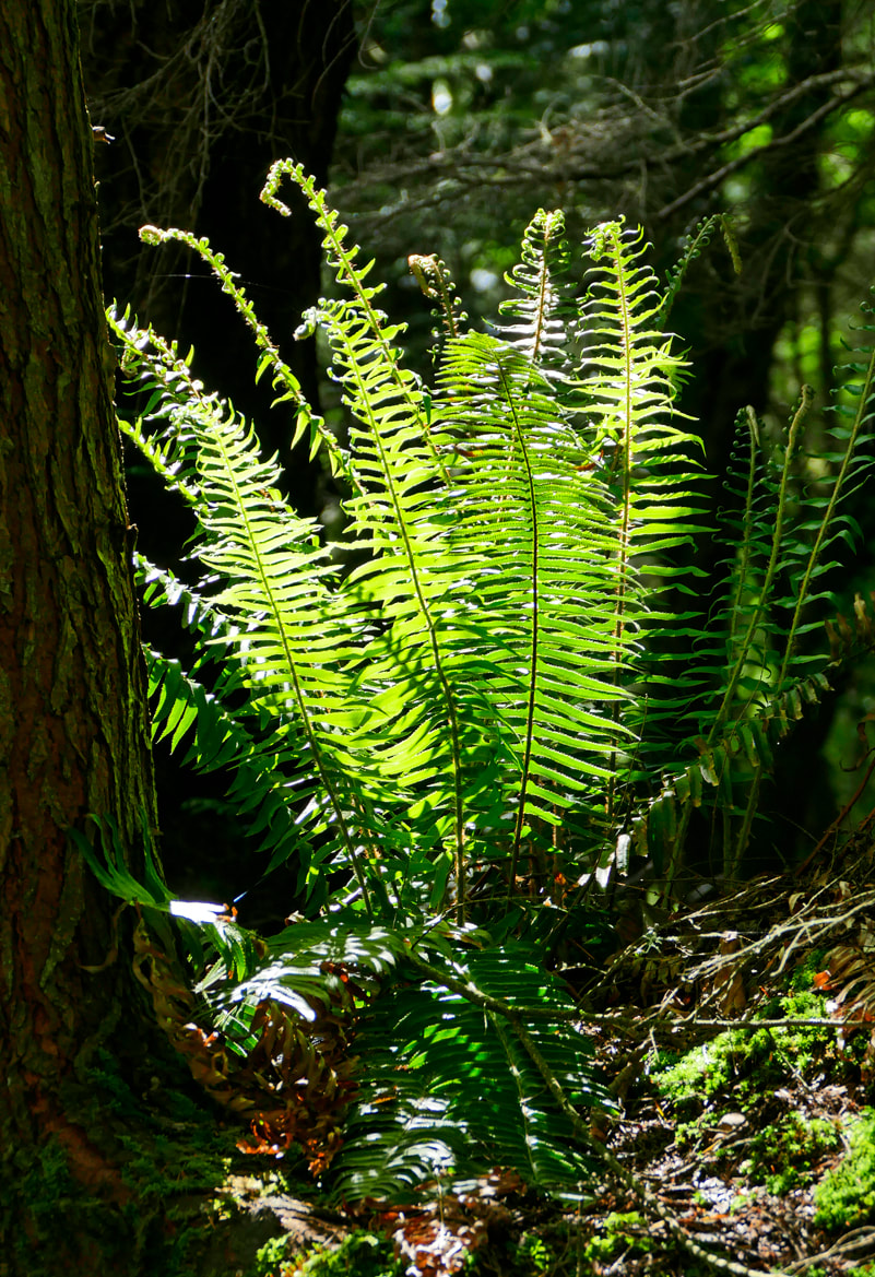
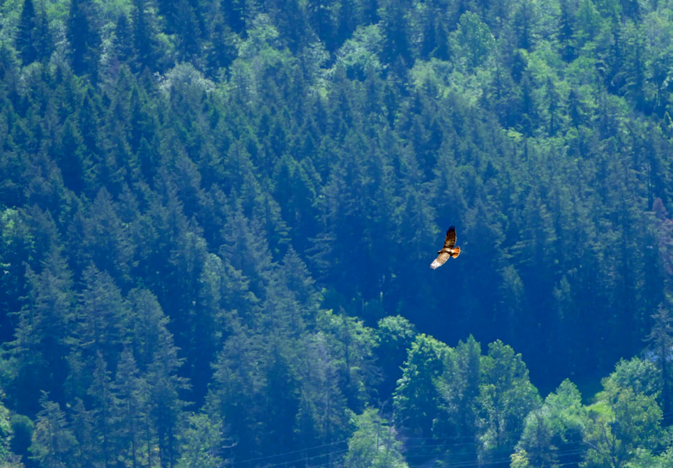
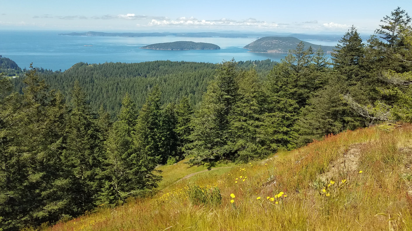 How often do you get a chance to climb two lovely mountains after breakfast and be home well before lunchtime? When I heard that the Mt. Erie road was remaining closed to prevent large gatherings at the summit, I knew where I wanted to go hiking next – the summit of Mt. Erie. Nearby Sugarloaf Mountain would be an added bonus to the adventure. Getting to the top of Erie is easy by car. Getting there on foot is a worthy challenge and worth the effort, and changes the entire perspective of “going to Mt. Erie”. I took Trail 313 from Heart Lake, followed Trail 21 through the maple-lined valley bottom to Trail 207, then began my ascent of Erie. The trail climbed and clambered through its many twists and turns as the wetlands and lowlands were left behind and the trail became rocky and steep and invigorating. The trail map described this trail and Trail 216, the final route to the top, as ‘difficult: steep hills, rocky, rooty." They are all of that. I meandered through rock clefts and ridges, over bare steep rocks, using roots as stairways and sometimes as handholds, always going up. My lungs were pleased to finally see a wooden sign that read “Summit”. I walked through an empty parking lot at the 1200-foot peak to the short, paved walkway that leads to the overlook. There was no one here. I lingered for half an hour, seeing absolutely no one except the very distant life of residences far below on the shores of Campbell Lake. Instead, I watched a dozen swallows feeding on a spring hatch of insects; and a hawk climb a thermal far below me, only to dive headlong toward Donnell Road a mile away, at maybe a hundred miles an hour, making me think he had lunch on his mind. After eating my own snack, I walked down the empty road to climb another peak. I wanted to see what the roadway would feel like without cars. It is now a safe and spacious, quiet and comfortable route for physical distancing from each other but still connecting us to the environments of the forest lands. 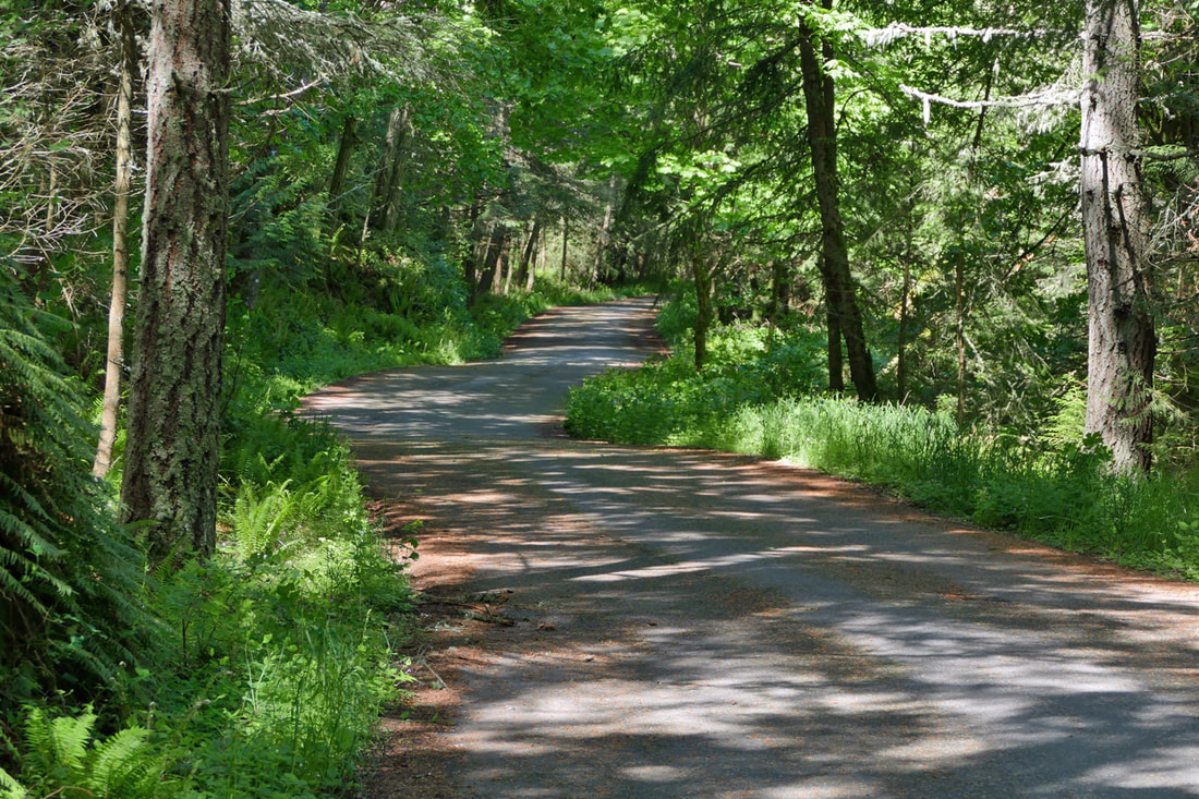 Trail 215 took me most of the way to the top of Sugarloaf Mountain. Sugarloaf is a shorter trail, a lower peak at just over a thousand feet, but challenging enough to remind you that you do have a beating heart. It is well worth the effort to reach its summit. Grasses were flowering with red heads; daisies and dandelions brightened up the meadows at the top. The sun painted a perfect picture of the islands in Skagit Bay and the San Juans. A pair of eagles circled together on a thermal west of Sugarloaf, starting just above the trees. In a minute or two their effortless circles took them well above me. I eventually descended on Trail 226 for variety, rejoining Trail 21 just before dropping down to Heart Lake Road and back to the parking lot. The Mt. Erie and Sugarloaf trails reminded me of hikes in the Cascades or Olympics; you climb peaks and descend into valleys, and see and hear nothing save the sights and sounds of the plants and animals who make the Anacortes Community Forest Lands their home. I counted over twenty species of birds I had seen and/or heard during my walk, and a few more I couldn’t identify. It felt like a wilderness hike. With the road closed, I earned the view from the summit, with my personal energy and horsepower getting me there. It totally changes the character of the Mt. Erie experience. Hiking allows us to travel at the speed of life, deliberate, delving into the joy of the trail. And all of this is here every day, on the doorstep of Anacortes, a short drive from most of Whidbey. We live in a most precious and amazing home. Sometimes it just takes a little extra effort. It’s worth it. jack Directions: Get a map of the trails! They can be found on the City of Anacortes Parks Department website or the Friends of the Forest website.
Mt. Erie is located south of Anacortes on Fidalgo Island in the Anacortes Community Forest Lands. To get there, take Highway 20 west from Mt. Vernon or north from Whidbey Island to the Campbell Lake Road intersection, at about Highway Milepost 46. Turn west onto Campbell Lake Road, then right on Heart Lake Road at the Lake Erie Grocery Store. Drive about a mile and a half to the Heart Lake parking area. The road to the top of Mt. Erie is closed at the present time. Be aware that all parking areas are restricted to 10 cars at a time for the large lots, and only 5 cars at the smaller parking area along the Heart Lake Road. If there are more cars than that, don't go. Come back another time or choose a different access route. There are several ways to get to Mt. Erie. Hike, bike, or drive your car to the Heart Lake parking area, as I did, or at the large parking area where the Mt. Erie road is blocked off, or start just north of the Lake Erie Grocery store, or start at Whistle Lake and follow Trail 201 to Trail 207, or come up with other creative ways. Just recognize that this is now a hike with an almost 1200-foot elevation gain, so come prepared to earn your way to the top. You'll be glad you did. 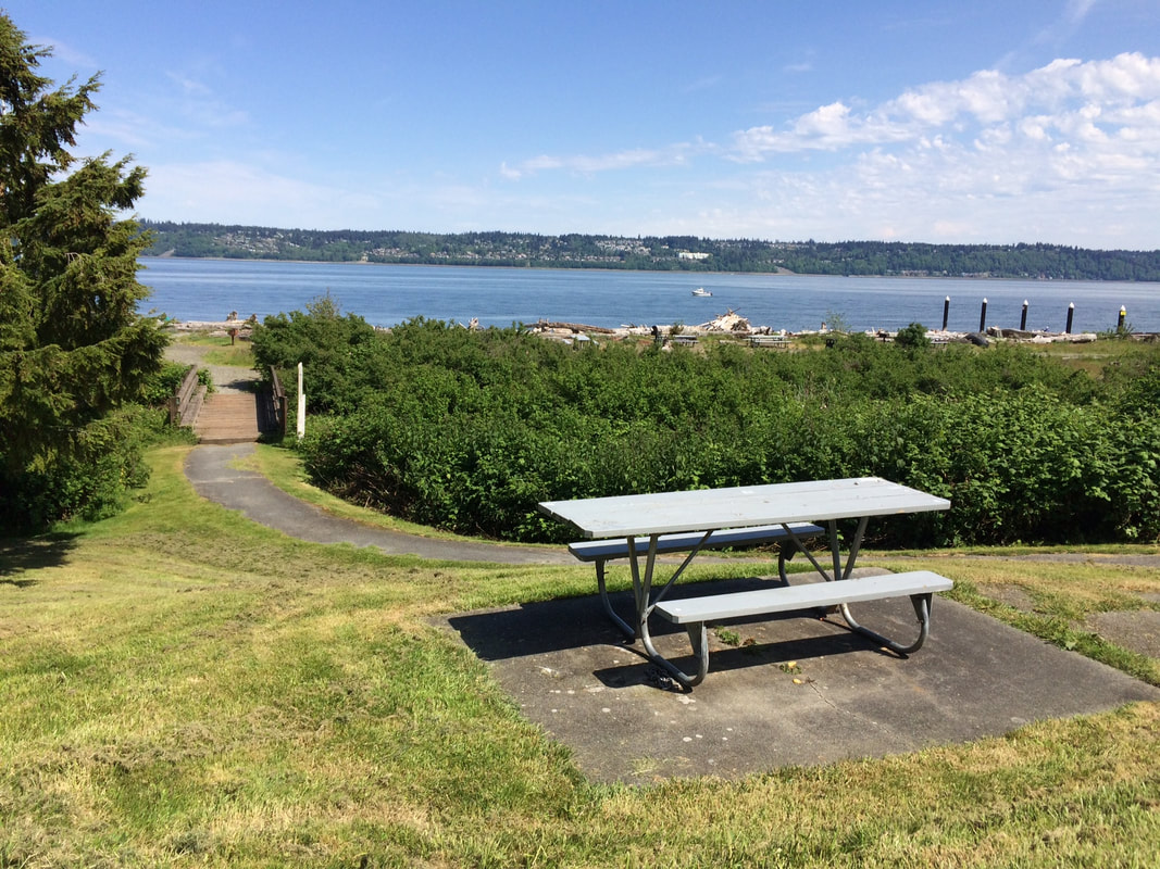 It was a steep climb and a hot day when we started up the Dorothy Cleveland Trail at Possession Beach Waterfront Park. We had just eaten our peanut butter and jelly sandwiches at a picnic table overlooking the beach. Other nearby tables were occupied by families grilling burgers and celebrating mom. It was a bright, sunny afternoon and unusually warm for the middle of May. I was grateful for the breeze coming off of the water. Crossing the footbridge at the trailhead, we stopped to study the map on the kiosk. That’s when we noticed the mosquitoes, so we started off at a brisk pace. The trail weaves and dips and soon emerges onto Franklin Road, a lightly used dirt road that services a few waterfront homes and nearby Possession Point State Park. But the trail begins again on the other side of the road so we crossed and continued. The hillside was lush and green with knee high ferns and hip high nettles. The alder and maple canopy provided a green parasol overhead shading us from the sun’s intensity as we kept climbing. There were benches and bridges and branches over muddy spots that seemed to have just recently dried up. Bird song and the sound of trickling water serenaded our stroll. A flight of stairs helped get us up the steepest section. Then the trail forked. Yogi Berra said, “When you come to a fork in the road, take it.” So we did. I went one way and my friend went the other. We soon met on the top of the ridge at a most surprising landmark… a water fountain. It looked like it belonged on a street corner or in a city park, but here it was in the woods. More surprising still, it actually worked! On top of the ridge, the trail circled around a large maple with a sturdy bench beneath it. Another twist of trail headed over to a large cedar, and other trails headed to nearby homes. We soon headed down again and were accosted by a furious woodpecker, who told us in no uncertain terms, that we had better be gone! Okay! Okay! We’re leaving! We managed to avoid the nettles but not the mosquitoes that were hungry for our bare arms and legs. Returning to the beach, the breeze brought some relief from our bug bites and we finished our hike with a refreshing view of the water. Later I read about Dorothy Cleveland. Those who have lived on Whidbey Island a long time will remember how she was a central figure on South Whidbey before her death in January of 2000. She was a member of the Port Commission so it seemed appropriate for a trail at this park, owned by the Port of South Whidbey, to bear her name. She was also a member of the League of Women Voters, the Langley City Council, the Langley Planning Commission, the Friends of the Langley Library, involved in the Island County Fair, the Historical Society, the Puget Sound Council of Governments, the Solid Waste Task Force, the National Association of Business and Professional Women, and so much more. She was instrumental in starting Island Transit where I work now, so I can thank her for my job. She was a force to be reckoned with. As it was Mother’s Day I found myself reflecting on my own mom. She passed away ten years ago, but she set me on the path I walk today. Like Dorothy Cleveland, she volunteered with several organizations. She was a gardener and my Girl Scout leader. She taught me the birds at the backyard feeder and the plants along our trail to school. As a family we camped all over the country. Mom instilled in me a love and understanding of nature that has shaped my life and brought me joy beyond measure. Thanks mom. Directions: from Highway 525 at Ken's Korner Shopping Center in Clinton, turn south on Cultus Bay Road and drive 6.7 miles to Possession Beach Waterfront Park. (Cultus Bay Road turns into Possession Point Road.) Look for the sign near the end of the road.
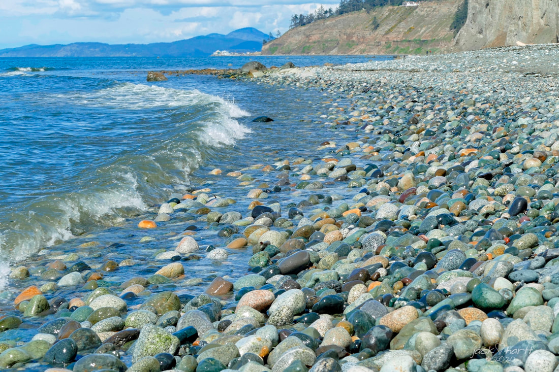 Crashhhhh, rushhhh ashore, washhhh back, inhale, Crashhhhh, rushhhh ashore, washhhh back, inhale… Waves along the shore are like breathing, always busy in the background, never-ending, unassuming. The bluff-lined hike between Hastie Lake Beach County Park and and West Beach Park to the north is a two-and-a-half-mile display of the power and fury of ocean meeting island. Or it can be a walk alongside towering bluffs and peaceful waters, depending on the weather. Either way, the waves are a constant companion. Sunday dawned on Whidbey with cold winds and dark clouds that roiled and boiled and then poured hard-driven raindrops. I headed north to West Beach expecting a drenching rain. But skies cleared, the sun beamed, and the seas settled down into light ripples instead. Thank you rainshadow! Still, West Beach is a raw and wild beach. Here is not the sweet design and beauty of Meerkerk Gardens or the grandeur and gentility of a forest walk at South Whidbey State Park. No, West Beach is a never-ending collision. The waves of the Pacific can come crashing into the two hundred-foot cliffs, and then it’s not a place for a picnic or stroll. Storm waves quickly chew up the sand and gravel in the bluffs, creating small landslides. The newly freed dirt is scoured away and carried northward, enlarging the beaches of West Beach, Joseph Whidbey State Park, and eventually the dunes of Deception Pass. But today, all was calm, all was bright. Starting at the south end, the beach is narrow where houses intrude into what used to be the actual beach, homeowners protected from ravaging storms only by beach-destroying armoring. What remains of the beach here is large grapefruit-sized cobble, difficult to walk on for very long. Fortunately, the houses soon retreat off of the beach, and the shoreline becomes spacious and natural, with the high tides creating log-strewn backshores. I passed one couple resting on a log and they greeted me by saying “you scared the birds away.” “They’ll be back,” was all I could think of as a reply to this greeting as I continued my stroll northward. And indeed they were. Whimbrels played leapfrog with me and other hikers much of the way up and back down the beach as they looked for meals along the water’s edge. Me, I just looked for the music of the water and the magic of the beach. Crashhhh, rushhhh ashore, washhhh back, inhale… I approached an older and younger woman walking a dog, with the dog running circles around them just for fun. The dog noticed me and came towards me like a boxer looking for a fight but wagging its tail and smiling mischievously. We became instant friends, and he then did circles around me as I caught up to the owners and smiled and chatted about the playfulness of “Bogey”. He danced with me awhile as I hiked past, then retreated back to the friendly faces of his owners. Cobbles became sand below the bluffs closer to the West Beach trailhead. Clam shells, crab shells, and the detritus of wrack and seaweed cast ashore by the most recent storm filled the lower beach line. Gulls dropped clams, hoping for some fast food. An eagle cast her gaze over us all, far above the busyness of the scene below. Sunlight danced on the waves as they broke shoreward, now just a background rhythm reflecting the bright sunshine of the clear blue Sunday afternoon sky. Two and a half miles up, two and a half miles back down, among gravel and sand, shells and seagulls, waves and light winds. The hike left my legs a little tired and my soul refreshed, my afternoon well spent with the waves and the wild and the wonder of the beach. Crashhhh, rushhhh ashore, washhhh back, inhale… I breathed deeply of the sea air, climbed into my truck and drove home, the sound of the waves still echoing in my mind and heart, and in my dreams of returning again. jack Most of the tidelands between the Hastie Lake Beach Park and West Beach were in public ownership, but not long ago the Whidbey Camano Land Trust acquired a quarter mile of beach near the halfway point to provide legal public hiking access all the way from the Hastie Lake Beach Park to the West Beach parking area. However, the lands south of Hastie Lake parking area are private. Please do not trespass in that direction.
Directions: From Highway 20, 4.4 miles south of Oak Harbor or 6.4 miles north of Coupeville, turn north onto Hastie Lake Road and drive to Hastie Lake Beach Park. The West Beach parking area is about 2.5 miles north on West Beach Road. |
Authors
Maribeth Crandell has been a hiking guide in the Pacific NW for over 20 years. She's lived on Whidbey and Fidalgo Island for decades. As a frequent bus rider she easily makes connections between trails and transit. Archives by date
July 2024
Categories
All
|

 RSS Feed
