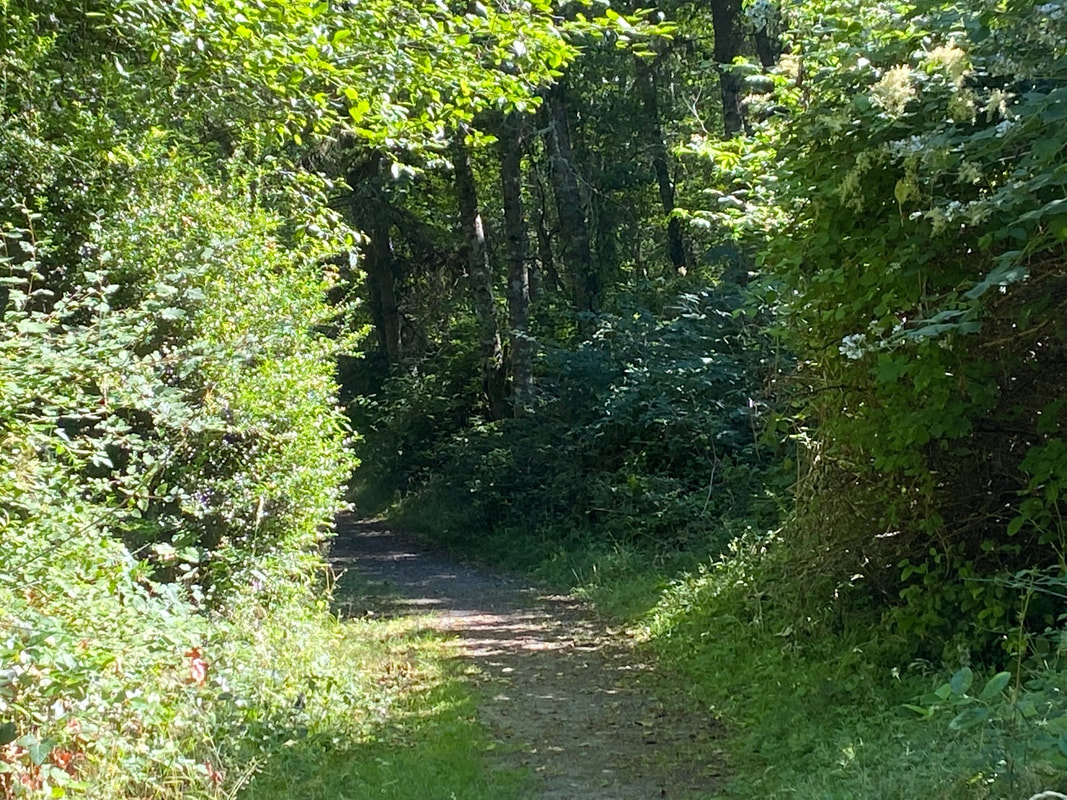
 It is a hot week. Many people go to a beach or a lake to chill out. To go for a hike after work in the late afternoon, I needed to find a place that is cool and green and shady. I know of just such a place. On my way home, I stood up next to the bus driver to point out the small sign on the road at Trillium Woods. The Smugglers Cove Road entrance is just a mile south of South Whidbey State Park. As I stepped off the bus I noticed just one other car in the parking lot. The trailhead kiosk had a yellow triangle to indicate who yields to whom. Mountain bikes yield to hikers and horses. Yet I saw none of the above on my 90 minute walk in the woods. At the start of the trail, I was reminded that many people visit these trails on horseback. People have been mostly good about picking up after their dogs, but horses leave much bigger piles behind. This one was fresh and almost completely blocked access to the foot bridge. Fortunately, there was a stout stick nearby that provided me with the tool needed to sweep it aside. There were more piles along the trails. I noticed coyote scat as well and stooped to examine the fur and bones inside. I have often encountered owls here, but have never found an owl pellet. What I did find were berries, salmonberries, native blackberries, red huckleberries, salal berries, Himalayan blackberries, and my favorite, thimbleberries. Some were at the very start of their fruiting season, and some were on their way out. I made a mental note to bring a bucket next time. Patrick’s Way is the main trail down the middle of this 700-acre wood. It’s wide enough for two horses to pass. Narrow paths head off right and left, all invitingly shady and dark with their alluring names, Dragon Fly Glade, Wild Berry, Peaceful Firs. A sturdy bench at a trail junction sat in full sun, but it was too hot for me. I walked on and turned at the Crossroads Trail where the bright sky bore down on the wide intersection of trails. As it narrowed and the canopy filled in overhead, I heard more bird songs, chickadees, nuthatch, song sparrow and Bewick’s wren. I walked through a spot that had flooded last winter but was now bone dry. The Uncle Buck Trail took me down to the lowest, lushest end of the park and I looped back on Burkholder. This was the first time in years that I’d been here and not seen anyone at all. No one walking, running, biking, or on horseback. But on a hot day like this everyone was probably off at the beach. I walked back the way I’d come through the cool, shady forest thinking of this heat wave, shattering previous records, and what we can expect in our climate crisis future. People in the city don’t get the benefit of our island forests. Concrete soaks up the sun and radiates it back holding on to it long after the sun’s gone down. Green spaces are cool places to live but a neighborhood with trees is expensive real estate. Those who can’t afford it are suffering right now and will be in the future. They say the best time to plant a tree was ten years ago. The next best time is now. Maribeth Thank you to the Whidbey Camano Land Trust and all the other organizations that protect our green spaces. For a map of Trillium Woods click here. Directions: On weekdays the fare free Island Transit Route 1 bus stops at the Smuggler's Cove Road entrance just 1 mile south of South Whidbey State Park. On Saturdays the Southbound Route 1 will stop by Highway 525 at Pacific Dogwood, just south of Classic Road. Give the driver plenty of notice that you want to stop. You can walk from the Pacific Dogwood side to the Smuggler's Cove side to catch the bus.
By Bike: Smuggler's Cove Road has wide shoulders and light traffic. Wear something bright to be visible to drivers. 2-3 bikes can fit on a bus bike rack unless the tires are too fat or it weighs more than 55 pounds. By Car: The Smuggler's Cove Road entrance is about 5 miles north of the light in Freeland, or 6 miles south of Greenbank Farm. From Freeland take Highway 525 north to Bush Point Road and turn left. This turns into Smuggler's Cove Road. Look for small signs on telephone poles and a gravel driveway and parking area large enough for horse trailers. The Pacific Dogwood entrance off Highway 525 is less than a mile south of the telephone booth at Classic Road or 3.7 miles north of the light in Freeland. Mobility: Patrick's Way is a wide gently sloping dirt trail. The side trails are narrow with some roots, but mostly smooth. The Smuggler's Cove Road entrance has many roots. The Pacific Dogwood entrance is on a paved road and then dirt and comparatively smooth. For the ADA loop trail take Highway 525 about 2 miles north of Freeland turn left onto Mutiny Bay Road. Take the next right on Bounty Loop. The trailhead parking is at the corner at the bottom of the hill.
0 Comments
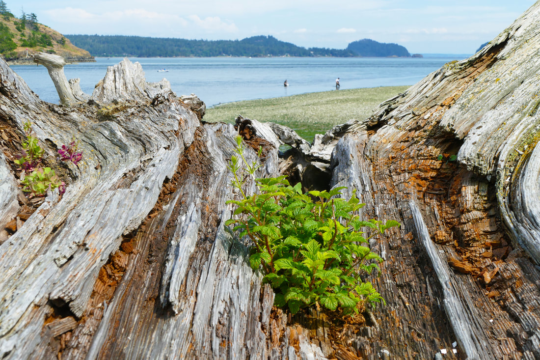 Ala Spit. The sun was high, the tide low, the parking lot full, and the beach swarming with people jamming as much summer into the day as they could. “Summer doesn’t start until July 5th around here,” I’ve always been told. It seems to be true once again. After a spring of cold and wet, here we are, the middle of July, the sun shining, the temps rising, and sleep neglected so we can enjoy every minute of whatever summer we have. “I … wanna soak up the sun” -- Sheryl Crow And the whole Pacific Northwest seems to be doing the same thing. We fill the beaches and boat launches; fields and trails hum with activity. Songs about summer play on the radio, smartphones, and any other device that gets us bopping to the beat of the summer sun. “Perfect song on the radio Sing along ’cause it’s one we know It’s a smile, it’s a kiss It’s a sip of wine it’s summertime” -- Kenny Chesney The sounds and songs of summer filled my mind on this crazy, lazy day. We have work to do, we have projects that need to be done, but not today, not this weekend. This was our day to enjoy life in the good ol’ summertime. “On an island in the sun, we'll be playing and having fun, and it makes me feel so fine” -- Weezer We walked up the west side of Ala Spit, where the beach alternates from muddy to sandy to gravelly and shuffles through all three again. Mt. Erie floated above and beyond us like a mint-chocolate ice cream cone. Boats launched from the shore and splashed around the point and brought out kids and brought back crabs. Two youngsters built castles near the edge of the water. Parents called them to join a potluck picnic. “Feel that salt in my hair almost there Got that wind in my hair” -- Little Big Town Music blared from gatherings of young people looking for love, middle-aged families building quality time together, but there was no one our age, interestingly, other than the two of us strolling the length and breadth of the beauty of Ala. “Steal a kiss, act a fool, hop a fence, find a pool flying free, like a drink, we’re Smooth like the summer” -- Thomas Rhett Kath observed that the trees here have two lives. First they grew on the bluffs around us; then they start a new life as artistically-shaped driftwood on the beaches and meadows, hosting new and different lives. At low tide we saw an abundance of clams squirting like Old Faithful, and the scattered empty clamshells higher up. We felt the youthful energy all around us, and we shared the memories of youthful beach parties of our own from half a century ago. “Summer breeze makes me feel fine Blowin’ through the jasmine in my mind” -- Seals and Crofts Going south on the east side, Hope Island lay tantalizingly close, its rocky shores and wrinkled trees contrasting with the open beach where we stood. Here, gravel crunched beneath our feet, the sun baked our bodies, and the cool waters between teemed with kayaks, rafts, and an occasional powerboat. Halfway down we left the water’s edge to hike the rest of the way through the salt-marsh trail. A young couple walked past us, hand in hand, smiling at each other with gazes like starlight. “All summer long, we sang a song And then we strolled on golden sand” -- Frank Sinatra Back at the car, shadows lengthened. People were starting to pack up to go home. This summer day was winding down; many more still heading our way, we hope. The cold rains and winds of winter will return soon enough. “And when the rain Beats against my windowpane I'll think of summer days again” -- Chad and Jeremy jack, and a lot of singers Directions: Troxel Road is a little over two miles south of the Deception Pass bridge on Highway 20. Go east on Troxel Road about 4 miles to Geck Road, a short spur that drops down to the beach into Ala Spit.
By Bus: There is no transit service in this area By Bike: the roads in this area are rolling, with narrow shoulders but minimal traffic. Mobility: the parking lot is graveled. Ala Spit has flat but rough trails with driftwood, mud, sand, and gravel. The beach is a mixture of driftwood, cobbles, mud, and sand. 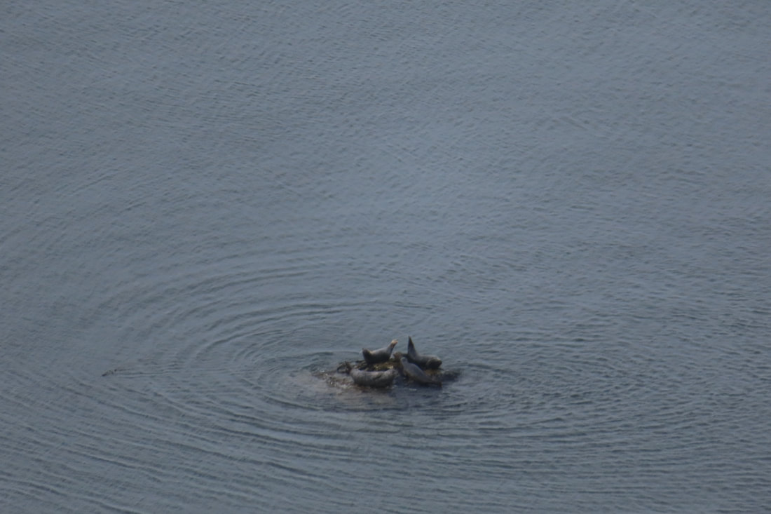 “Possession Point is the southern most point of Whidbey Island and, therefore closest to Seattle.” It shook me up a bit to read that on the Whidbey Camano Islands Tourism website. I was thinking it may be close by water, but a world away by nature. For me, driving there in a car, the way seemed long and convoluted. But I began to consider what it must be like to travel there by boat. The high bluff of Possession Point would stick up prominently. In fact, the place was dubbed Possession Point by Captain George Vancouver because when he and his crew explored the region in the summer of 1792, Peter Puget and Joseph Whidbey came ashore and claimed the land for the British Empire. The idea of taking possession of a place you visit for a short time seemed odd, uncomfortable and, in the broad scheme of things, temporary. The concept rolled around in my head all day. I went to explore the park with a friend. We arrived by car. Like those who arrived by boat, we needed to stretch our legs. We took the forest loop climbing up from the parking lot into the woods. We climbed and dipped and climbed some more through a forest of ferns and maples. At one point while we paused to catch our breath, we spotted an eagle’s nest at eye level through the trees. With binoculars we saw the parent bird drop off some food for the chicks. One chick covered the food with its wings, so the other couldn’t get any. That chick took possession of the food. We kept climbing and heard the great birds calling through the trees. Huffing and puffing we reached the overlook at the top of the bluff and stopped to drink water and share an apple. Before us was an expansive view of Puget Sound. We could see Seattle skyscrapers, ferries crossing from Edmonds to Kingston, sail boats and fishing boats making their way in all directions. Down in the water one rock rose above the tide and a half dozen seals took possession of it. We started down and took the trail to the beach emerging by the barn. A vacation house stood nearby where a family had taken possession for the weekend. They’d fully occupied the backyard and deck. Chairs circled a fire pit. An umbrella shaded a table. Roses climbed the trellis by the gate. Some of the family was on the beach exploring what the outgoing tide had revealed. Farther on, shellfish stalkers carried their shovels. A woman rowed by with a crab pot. Kayakers paddled south. A yacht parted the waters cruising north. Swallows swooped from bluff to beach, in and out of nesting cavities. A heron strutted along a gravel bar. We walked the cobblestone beach as so many had before us. Peter Puget, Joseph Whidbey, my friend and I, enjoying the day, the water, the sun, the summer warmth and took possession of Possession Point, if only for an hour. Maribeth Possession Point State Park provides a camp site for human powered boats on the Washington Water Trails. See the map here. Directions: From Highway 525 at Ken's Korner shopping center near Clinton, take Cultus Bay Road south for almost 5 miles. Cultus Bay Road will turn right but keep going straight on Possession Road for another 1.5 miles. Turn right on Franklin Road, a narrow, dirt road with many private beach homes. The State Park sign is at the end. You will need a Discover Pass to park inside the gate.
Bus and Bike: There is no bus service here. Bikes may travel down Cultus Bay Road on the shoulder, however Possession Road has no shoulder, and is hilly and curvy with poor visibility. Mobility: The walk to the beach is on a dirt road and a gentle grade. The hike up to the bluff through the woods is steep and can be muddy after a rain. The beach is sandy closer to the bluff and more rocky toward the point. 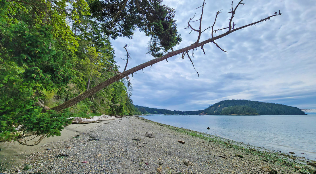 It’s been a couple crazy weeks of news. My mind, heart, and hopes were reeling from the stories, the backward decisions, the murderous actions, the disunity of politics. Then a friend shared this poem with me. When despair for the world grows in me and I wake in the night at the least sound in fear of what my life and my children’s lives may be, I go and lie down where the wood drake rests in his beauty on the water, and the great heron feeds. I come into the peace of wild things who do not tax their lives with forethought of grief. I come into the presence of still water. And I feel above me the day-blind stars waiting with their light. For a time I rest in the grace of the world, and am free. - Wendell Berry I don’t know about wood drakes, but I do know where there is still water, and the great heron feeds, and where the wild things are. And on days like this I like to go there, for re-creation, not for play but for peace. I needed to take a hike at Hoypus. Cornet Bay, on the east side of Deception Pass State Park, has an industrial feeling as boats large and small power through its waters, launch and come back again, large trucks towing them around. The Cornet beach itself used to be industrial, with creosote beams walling off the shoreline from the uplands, deserting it of life. Ten years ago, the beach was restored, the creosote removed, and so life returned. Volunteers planted the shoreline; nature rebuilt the marine life. On Independence Day we parked at the busy lot, walked out onto this new beach, then walked east to the wild seashore leading to Hoypus Point. The tide was low, turning to rise again. The engine noise and traffic jams faded away as we walked. We crunched on gravel large and small, strolling on sandy stretches and hurdling some beach-log hurdles. Trees grow down to the water’s edge, and even into the tideline. One cedar bowed down from above, then rose again to lean out over the waters. A Swainson’s called from a large fir, then flew down into an ocean-spray plant blooming in full glory. We watched it test a song, then fly off again to a new perch. A fly-fisherman tested the waters, using homemade flies. No luck so far, he said. He tied on a new fly as we passed, then resumed his fishing. The Hoypus shoreline gives unending views of Deception Pass Bridge, seemingly close enough to touch, graceful in its arch over the islands. We rounded the point. The beach became a bed of sand, then quickly changed to cobble. Skagit and Kiket islands came into view. An eagle cried its plaintive message. The deep woods stood as quiet sentinels. Small waves lapped their white noise. Now Kath could see the wide concrete pillar just east of the point. “What’s that?” she asked. “Before there was a bridge,” I shared, “the only way onto this end of Whidbey was by a ferry that went from here to Fidalgo. That was the dock’s foundation.” We sat on a nearby bench, listening to explosions of fireworks from Fidalgo, with the quiet of Hoypus in contrast. Eventually we took the trail back, a mile-long trek on the narrow, mostly-paved roadway. It is gated at Cornet Bay, providing a pathway free of cars. A middle-aged couple walked their dog, a young couple jogged past, and an older man cycled by. Song sparrows and flycatchers sang their stories. The bridge played peek-a-boo through the trees. Hoypus is a place for those who want a peaceful mile to wander, wide and flat enough for kids on bikes, for someone in a wheelchair, for a friend recovering from cancer, or like me, just wanting to find peace in a world of craziness. And for a time, I am free. jack  Note: A Discovery Pass is required to park at Cornet Bay. Be aware that on extremely busy boating days, such as July 1 and 2, the gate to Hoypus Point might be opened to allow additional parking.
Getting There: From Highway 20 just south of Deception Pass Bridge, at the light, go east on Cornet Bay Road about a mile and a half to the boat launch parking area. Walk east past the gate on the Hoypus Point Roadway, or take the beach if the tide is low. By Bus: Island Transit Route 411 W stops near the Cornet Bay Road intersection northbound from Oak Harbor and southbound from March's Point Park and Ride. These bus stops are about 1 and 1/2 miles from the trailhead. Cornet Bay Road has no shoulder. By Bike: Highway 20 is a busy, high speed road with mostly adequate shoulders on Whidbey, and mostly narrow shoulders on Fidalgo Island. Cornet Bay Road has little to no shoulder, but far less traffic. Mobility: Hoypus Point Road is suitable for wheelchairs, walkers, bikes, reduced visibility, children, and just about anyone. It is mostly paved, and level for nearly a mile. The last quarter mile is not paved and is narrow but gently sloped. |
Authors
Maribeth Crandell has been a hiking guide in the Pacific NW for over 20 years. She's lived on Whidbey and Fidalgo Island for decades. As a frequent bus rider she easily makes connections between trails and transit. Archives by date
July 2024
Categories
All
|
 RSS Feed
