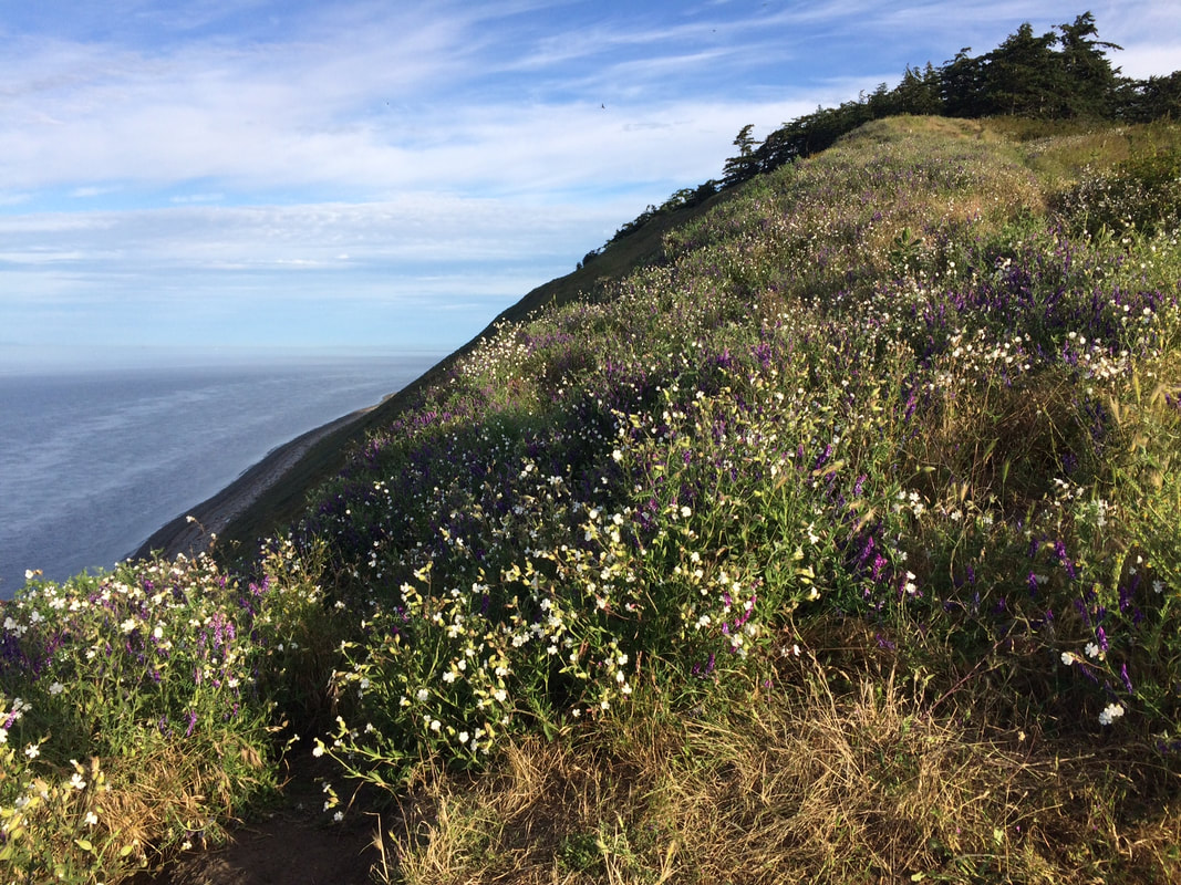
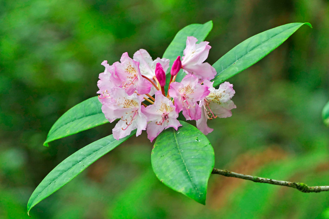
  It was early. The crisp cool air. The bright golden grain. A brilliant blue sky. Distant mountains framing a calm sea. Miles of wide open fields, scattered farmhouses and barns fenced in by pointy evergreen trees. Swallows dip and glide weaving and winging above the fields. Sparrows and blackbirds sing out from the hedgerows. It just doesn’t get any better than this! The well-worn track led to the cabin and the blockhouse of Jacob and Sarah Ebey, parents of Isaac Ebey who’d come earlier to settle the adjoining 320 acre parcel. Imagine a man of 61 walking with his wife and family and all they could carry over 2,000 miles in 1853. When they arrived they built this house and blockhouse and started farming. This land had been “cultivated” for thousands of years by the Salish who harvested camas and other foods here. The Donation Land Claim Act gave this land to the settlers who farmed it in the 1850’s. The Ebey family arrived early and got first pick. They chose well. The house and blockhouse were quiet on this bright morning as I passed heading toward Ebey’s Bluff. The Bluff Trail is the most popular trail on Whidbey Island and can often get crowded, so they posted a sign at the base of the Bluff suggesting other nearby trails that would allow for safe distancing. But I saw only 2 cars at the beach trailhead. I scanned the beach below and saw just 2 souls about 300 yards apart, and no one but me on the bluff. I like to get distance by going out early, which is easy to do when dawn comes at 4:30am. A riot of wildflowers climbed the bluff but after a long look at the water, I headed back to take the trail less traveled, the Pratt Loop. I took the Ridge Trail back toward the cabin and cut through a gap in the fence making my way westward. With the sun at my back I crossed the field on a mowed trail then turned north entering the woods where I passed through a tunnel of Ocean Spray in bloom. I was mobbed by a swarm of Bushtits with their cheery enthusiasm. A wren scolded me from a pile of branches to one side. A woodpecker tapped a limb just above a flicker in a tall snag. I heard a raven, quail, a nuthatch, a grosbeak, a towhee and got a glimpse of yellow rumped warbler. Good thing I forgot my binoculars or I’d be late for work! Passing a sturdy log bench, I entered a clearing with a handsome sheep barn and outbuildings. One wall supported a map of Ebey’s Landing National Historic Reserve. The Town of Coupeville, Island County, Washington State Parks and the National Park Service all have a seat at the table here. It’s a complicated governing body, but with help from the Nature Conservancy and others, they’ve preserved some of Whidbey’s early farms and open space much as they were 200 years ago. From here, the Kettles Spur trail branches off to the north and links with the paved bike path along Highway 20. There’s a kiosk and a bike rack where they meet. Bikes aren’t allowed on these trails, but feet have worn the grass down to bare dirt. Continuing eastward, I walked alongside a head high hedge with only a quick peek of the Sherman barn to the north. As I rounded the last curve I was met by a jogger, the only person I’d seen on this trail. The hedge separated me from the Sunnyside Cemetery and another blockhouse, built in the 1850’s. The Pratt Loop, though it's just a 1.3 mile walk has so much to offer, especially when you tie in a walk to the Bluff or a visit to the Sunnyside Cemetery where I stopped to pay my respects to the Ebey’s along with many of our Coupeville families. This early morning walk fueled me for the day. Directions by car: From Highway 20 in Coupeville at Main Street go north, and in less than a mile take Sherman Road south to Cemetery Road and drive all the way to the very end which is one lane, so drive slowly around the last curve. Park at the trail head. You can walk north to take the Pratt Loop Trail in a counterclockwise direction, or follow the trail south toward the Bluff. There are maps and information, a bike rack and pit toilets, at the trail head. The restrooms may be locked so come prepared.
Directions by bike or bus: 2-3 bikes fit on a bus bike rack on a first-come, first-served basis. Take the Route 1 bus to Coupeville and ask to get off at Sherman Road. You can walk or bike the Kettles Bike Trail that parallels the highway west about a half mile to the turn at the Kettles Spur Trail on your left. Lock up your bike and walk the Kettles Spur trail south to the Pratt Sheep Barn. Follow the signs.
0 Comments
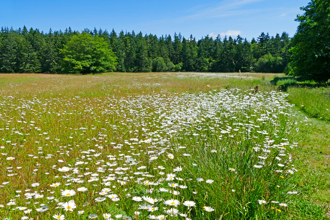 My dad was an avid fisherman, to put it mildly, and he hiked the high country once in a while to get to mountain lakes where he fished some more. Sometimes he brought me with him on those hikes as a tag-along, and the hiking bug grew within me. I eventually expanded my hiking to include beaches and deserts and snow and rock and islands and nearby neighborhood wanderings. But I still see him in his flannel shirt and faded green jeans guiding me upward as we headed toward a Cascade mountain jewel. We all have, or had, a father. We each have our own experiences growing up with or without our dads and their varying influence and care in our lives. Regardless of our upbringing, we are here today with half of their genes, a smattering of their habits, and a passel of memories that still touch us in many ways. Some we grow past, some we put up with, and some we build on for the future. And we all have a shared past from our forefathers, the generations who came before us and helped shape the landscape we know today. Many of those influences burden us today, such as in our race relations, our unsustainable lifestyles, and our ongoing us-versus-them approach to the world. On the other hand, we have the evidence of incredible gifts to us, gifts that we can care for and pass on to the following generations, such things as good character, a belief in civil rights, a growing awareness of our place in nature, and a legacy of places that were protected from development just because someone, some person in the past, made a decision to care about the future. One such place is Del Fairfax, on north Whidbey Island. Dr. George Fairfax of Oak Harbor donated the 50-acre property off Zylstra Road in 2007 and named it in honor of his wife of 56 years, who had passed away the previous year. George and his father had purchased the land in 1973 for investment purposes. Fairfax is happy he made the donation. “We raised six children. My five (surviving) children supported my idea of donating the land. Money doesn’t interest me anymore. Nature interests me more.” Wanting it to remain unspoiled for future generations, their generosity became a gift to us all, and a legacy for the future. I first saw the fields and forests last year on a delightful Sunday morning hike with a friend, highlighted by a welcoming committee of deer in the meadow and a leisurely lunch and inspired conversation along the sunny trail. Wind in the meadows - YouTube video, 7 seconds I returned this year to relive the memories and look forward to new ones. The deer were elsewhere, but the trail and meadow were all as I remembered them. The sun beamed as I entered the beginning of the trail. I read about the history and silently thanked the Whidbey Camano Land Trust and the local site stewards for continuing to preserve this special place. I heard Swainson’s thrushes, black-capped chickadees, nuthatches, warblers and towhees as I followed the shy half-mile trail through the deep woods, emerging back into the sun at the 10-acre meadow to the north. It's only a little over a half mile to walk around the entire meadow. But the distance traveled isn't the point. There’s a feeling at the meadow, a feeling of contentment, of joy and well-being. Walled in by a tall forest on all four sides, and filled with daisies and grasses, and untouched other than by a mowed trail around the perimeter, I feel like it was my private reserve for the morning stroll, shared in passing with a neighborhood family group, two local birders, and a couple walking their dog. A hawk soared above, an eagle watched nearby, swallows darted among the grasses, song sparrows sang melodies, the forest hummed along, thrushes whistled the blues, growlers growled in the distance, squirrels chattered, and insects buzzed. The song they all sang was of peace. I rested at the halfway point on the bench at the northeast corner, not that I needed a rest but because I just wanted to take in the beauty and life and simple grace of a gift given by a father for all of us, to the whole world, a gift for people and plants and wild animals and winds seen and unseen, and a gift of dreams to come, of a future built on the dreams of our fathers. jack "If you do not know where you come from, then you don't know where you are, and if you don't know where you are, then you don't know where you're going. And if you don't know where you're going, you're probably going wrong." - Terry Pratchett How did your father shape your hiking interests? Let us know. Directions:
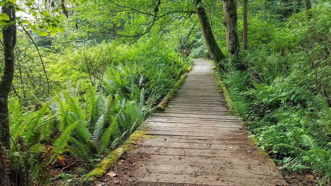
From Highway 20, 4.3 miles north of Coupeville, turn left onto Zylstra Road and drive 3 miles to the Fire Station. From Highway 20 in Oak Harbor, take Swantown Road and then an immediate left onto Fort Nugent Road. Drive 2 miles and turn left onto Zylstra Road. Go about another 2 miles to the Fire Station. Park along the fence across from the Fire Station, leaving lanes clear for fire vehicles. 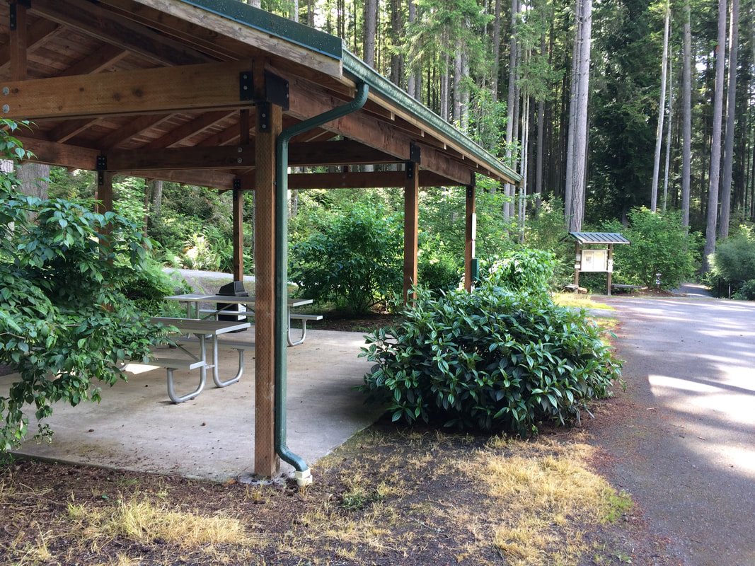 First I want to congratulate all of our graduates! These are weird times to be in school and especially for those graduating. Thanks to our teachers and school staff and to our students for doing their best in these trying times. We're all proud of your achievements and wish you all the best for a promising future. My niece just graduated from her college course last week. There was no graduation ceremony so I took her on an outing to celebrate. She'd been riding her bike everywhere she went for the last 3 months, so she rode circles around me on Fidalgo and Guemes Islands. Then we put the bikes away and took a hike on Whidbey.  The Trustland Trails beckoned as the sun emerged from a cloudy sky. I counted 8 cars in the parking lot but we didn't see anyone for the first half hour of walking. This network of trails on 200 acres offers plenty of room to spread out. We took the route on the periphery with other trails crossing through the middle. These trails weave through a shady forest with lush ferns and shrubs. I'd last hiked here in winter so the green landscape was surprising and nurturing. We frequently heard the drumming of woodpeckers on snags creating towering critter condos. Slugs raced across the trail tripping us up. Birds hid in the salmonberry and salal as we were led on by their songs. Most of the trails are wide enough to walk side by side, or to pass people with a dog on a leash, or to step aside while kids rode by on bikes racing wildly through the woods. We climbed the hill in the middle on a new trail that was added last winter and came to a steep drop-off where yellow tape and not one, but two signs warned us to stay back. (I was glad the young cyclists were not on this trail.) Most of the trails were gently sloping or almost flat. This drop off provided a sense of topography. One of the great features of the Trustland Trails is a beautiful ADA loop about a half mile long. In the middle of a hectic day, I've stopped here to take 10 or 15 minutes to walk this loop as a way to get centered, stretch my legs and breathe. This wide, gravel path is well groomed for folks in wheelchairs, or kids on bikes, or people who are perfectly ambulatory who just want a quick, easy break. A friend told me when her father was in his last months of life, he enjoyed coming here. She pushed his wheelchair around this loop and both of them benefited from the peace and quiet. These trail heads are just off the highway so easy to access by car or the Southbound Route 1 bus. There are neighborhoods nearby that access these trails from the opposite direction. Some come here daily to walk their dogs, ride their horse or just take a stroll with a friend. Trail maps are posted at the start and at turns within the park. There's a picnic shelter (but no restrooms) at the entrance. As we returned to the parking lot and paused, others emerged from the different trails, a young family, a couple with bikes and some old friends with their new dog. These trails have a feeling of community, a favorite family-friendly haunt and a local secret. Maribeth For a trail map click this link: swparks.org/wp-content/uploads/2019/12/Trustland-Trails-Map-2019.pdf Directions by Bus: Bring a face mask to wear on the bus. Take the Island Transit Route 1 Southbound just south of Bayview on Whidbey and ask the driver to stop at Craw Road. Walk just 200 feet to the park entrance on the right. When catching the bus from here after your hike, you can only catch it on the Southbound lane. Flag the bus with a flashlight or bright colored hat or scarf. You can ride south to the ferry and go north from there.
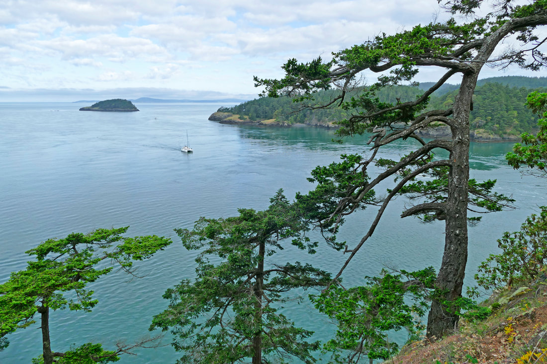
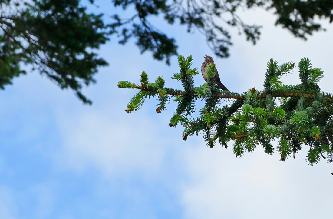
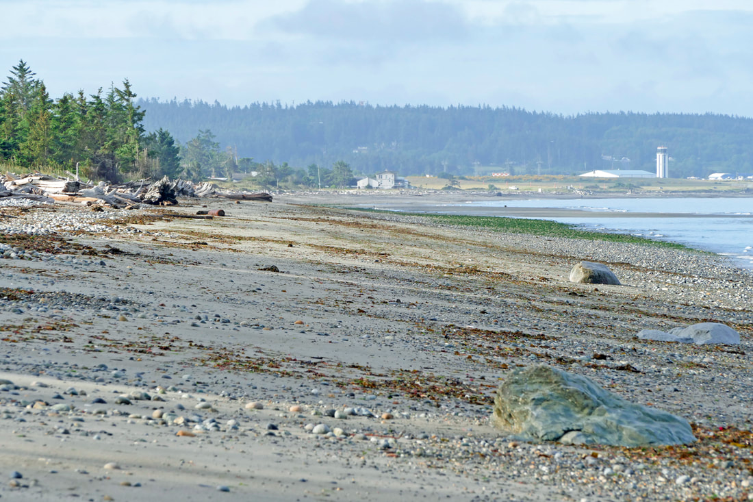
Directions by car: Take Highway 525 on Whidbey 1.3 miles south of the Goose Grocers in Bayview and turn right on Craw Road. Or drive north from Clinton. About a mile north of the light at Maxwelton Road turn left on to Craw Road and take the next right into the park. 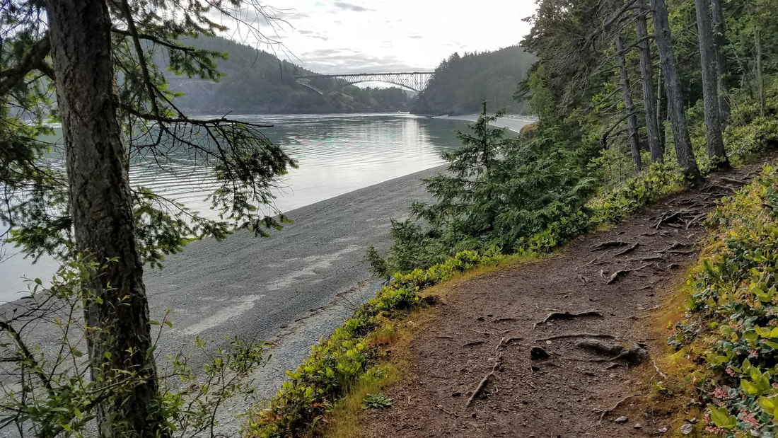 People ask me which of the trails we write about is my favorite. I always joke that it is the last trail I just walked, whatever trail that may be, as I am captured by whatever that trail has to offer. But when given a choice, there are a handful of trails that always draw me back to them whenever I have a chance to visit. North Beach is one of those trails. Morning commuters raced across the Deception Pass bridge, taking quick glances at the beauty of the Pass while bracing themselves for a full day of work. The muted summer sun fought its way through drifting morning clouds to highlight the smooth water of the Pass. The tide was almost done ebbing, with slack an hour or so away. I parked at the empty parking lot at the south end of the bridge, put my Discover pass on my dash, and strolled down the trail toward North Beach. Immediately I found a quieter world away from the traffic, and an amazing world of wind-sculpted trees, rocky headlands, and a sweep of beach stretching out before me for over a mile. I dropped into the shadowed, cool old-growth woodlands next to the beach and had to choose: hike the beach westward and the trail back, or trail first and then the beach? I’m a beach guy. I walked out onto the beach and felt the sun warming the day, smelled the life of low tide, heard a dozen bird songs in my first dozen minutes on the beach, and saw a wide open beach-way leading westward on sand and stones. There isn’t much life in this intertidal zone, as it is swept four times a day, ripped more precisely, by tides racing by at up to 8 knots. So I wandered from the edge of the beach to the edge of the woods and back again, finding a myriad of sparrows and warblers and creepers in the forest and the gentle swishing and lapping of water at the shoreline. I turned frequently to see the changing view of the bridge, rising above me and silhouetted by the sun. The water glistened as I approached West Point. The tide was low enough that I walked completely around the point on beach cobble, coming out on West Beach where an eagle looked from his perch toward the Navy base a few miles south. No one was here either. The parking lot was empty. The campground was empty, scheduled to open soon I hear. But for now, there was only the sound of yet more birds, calling to each other in this urgent time of spring. I began my trek back by passing the amphitheater, hoping it will be packed with people next month for Arts in the Parks and interpretive programs. For now it is quiet, a kind of a hush all over the park. The trail parallels the shoreline all the way back, sometimes close to the water, sometimes a dozen feet from the cliff edge, but with peek-a-boo views all along the trail, especially at the west end. Again I heard the choir and chorus of all the bird species around me. The AdventureTerra climbing tree stood alone but inviting to ascend to its top once again, a magical adventure the last time I did that. Old-growth Douglas fir trees fill this corner of the park, creating a cathedral far grander and holier than anything made with hands. 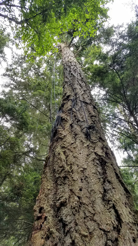 Soon I was back in the lower parking lot where an open restroom awaits those who need it. I wandered back out to the beach – I know, that’s not a surprise. The tide had just turned, but the beach was still wide enough to walk underneath the headland that usually separates Little North Beach, directly under the bridge, from the main stretch of North Beach. A family of geese that had played near me at West Point had made their way here too at the same time. I let them be as I walked inland, back to the trail, and back to the parking lot at the bridge. North Beach is one of my favorites for many reasons, but mostly because I feel like I have been in the heart of wilderness, the heart and soul of beauty and holiness at our far northern tip of Whidbey Island. What are your favorites, and why? jack Directions:
From Highway 20 turn west at Cornet Bay Road a mile south of the Deception Pass bridge and enter the park; follow the signs to the North Beach parking area. Or simply park at the bridge and walk down from the south end parking area. Be sure to display a Discover Pass when you park anywhere in the park. |
Authors
Maribeth Crandell has been a hiking guide in the Pacific NW for over 20 years. She's lived on Whidbey and Fidalgo Island for decades. As a frequent bus rider she easily makes connections between trails and transit. Archives by date
July 2024
Categories
All
|


 RSS Feed
