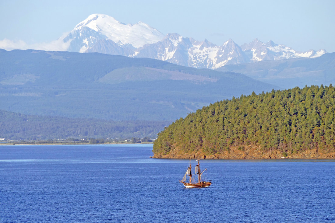
 Anacortes was bustling on this busy day, humming with a Waterfront Festival, car shows, art tours, and tourists basking in a weekend of warmth. Now evening shadows grew as the day waned. What better way to finish this day than a visit to Cap Sante, I told myself. It’s not a long trail, and it’s right in town. Having been set aside by townspeople when Anacortes was in its infancy, Cap Sante and its trails are a world apart from today’s city life. Or maybe not. I like to earn the view at the top, so I parked near the marina at Rotary Park, headed up through the disk golf course, past my old house, up 6th Street and then down 5th Street, saying hello to a former neighbor, then into the park at its northeast corner. Just off the trail lies the remnants of the amphitheater where nearly a century ago Anacortesans watched tribal canoe races and boat parades. This evening had a more unusual treat, the “Lady Washington” under sail offshore. I could see it out near Hat Island, tacking on a track back to the marina for the night. Sailing ships fascinate me, the way they fly with the power of the wind, reminding us of an era long ago of rope and leather and wood and canvas. The trail climbs up through ancient trees on the east side of the cape. I picked up a plastic cup someone had left alongside the trail, earning karma points. At the top I discarded it in the garbage bin and emerged into a crowded parking lot. Lady Washington was getting closer, and people were gathering to see it. I ran across the glacially smoothed rocks to get a better view. Passengers on the ship waved as they passed below the cape, but with no sails aloft, using its diesel engine. Oh well. Sharing the hilltop with me were a young couple cheering on the ship, another man taking pictures of his mountain bike, two women in formal dresses heading to a wedding in town, and assorted others marveling at the view as they sat in their cars. Oh, and a raccoon pulling garbage out of the can, then towing it into the nearby brush to feed a growing family. Seagulls and vultures circled above in the strong breezes rising up the western slope. Sunlight blazed on Guemes Channel, the sun approaching the top of Cypress Island. Eventually I headed down the new trail on the west side, a gentle graveled path leading back to Rotary Park at the bottom near the marina. Smoke. I smelled smoke -- that distinct smell of burning wood and brush. There was a large fire here three years ago that blazed through the grasses of this bald and scorched several trees. It couldn’t be happening again. I followed my nose until I found the source: the mountain bike man had a small fire burning in the dry grassy meadow. Rather than confront him, I alerted authorities, and after a lengthy conversation with them to explain where I was, I saw the man riding his bike out of the meadow and down the trail. I ran to where the fire had been and found… wet scattered ashes. I followed down the same trail and heard brush crunching not far away in the woods. I stopped. Another crunch. I turned to see a body moving through the woods, and then recognized it -- a mama deer. It broke a branch and ate the leaves. I relaxed. I ended up at the gazebo at the south end of the Rotary Park trail, just before sunset. Sailboats rocked in the evening breeze, their halyards clanging. I skipped and danced along the paved path back to where I had started; the moon rose, and the sun finally said good night on this most precious day. Directions: From Highway 20 entering Anacortes, take the R Avenue exit, and follow this road to 4th Street. Turn right, then turn right again on T Avenue to get to Rotary Park, or continue on 4th up to an actual 't' intersection. Turn right and stay on this road to the top of Cap Sante.
By Bus: Accessible by Skagit Transit 410 bus at 10th and Q; a short walk around the marina to Rotary Park. By Bike: See above driving directions. Or park at the park and ride on March's Point and take the Tommy Thompson all the way to Cap Sante, avoiding traffic! Accessibility: the Rotary Park trail is wide, flat, and paved the entire way. The trail to the top is steep and graveled. The view at the top is accessible by vehicle.
0 Comments
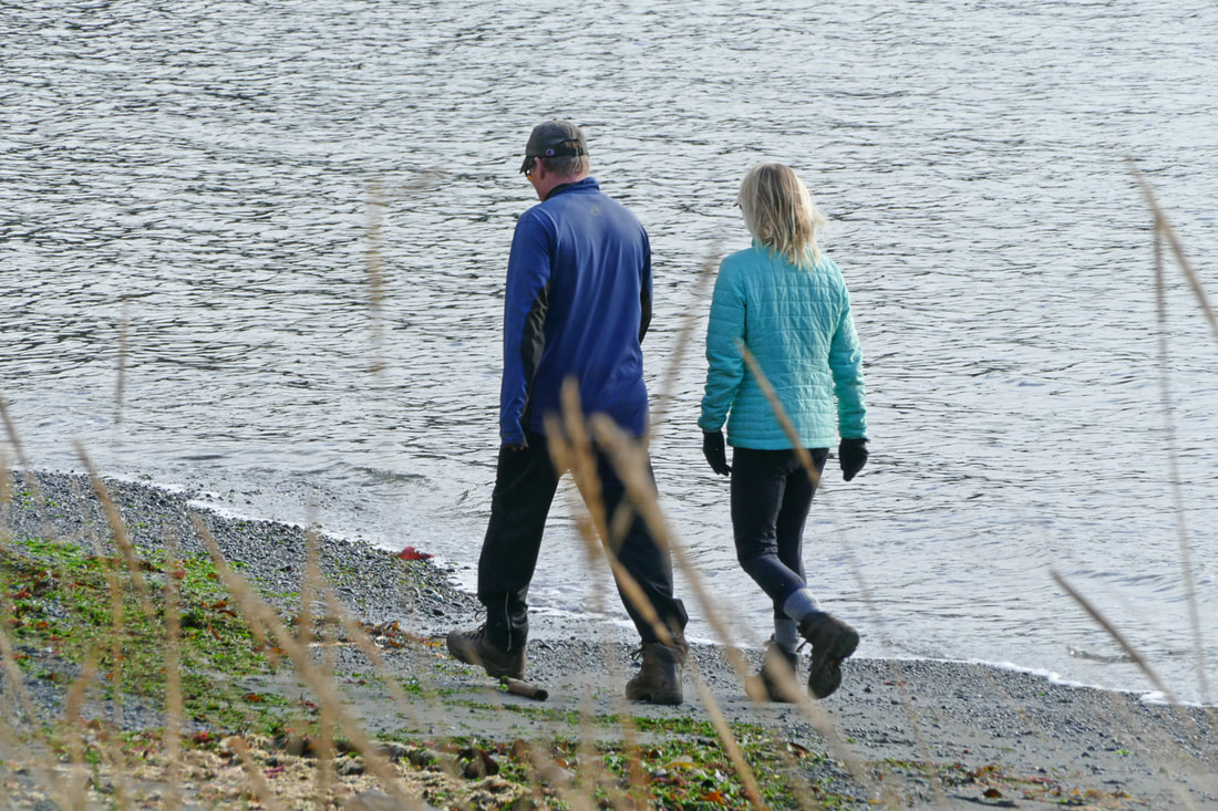
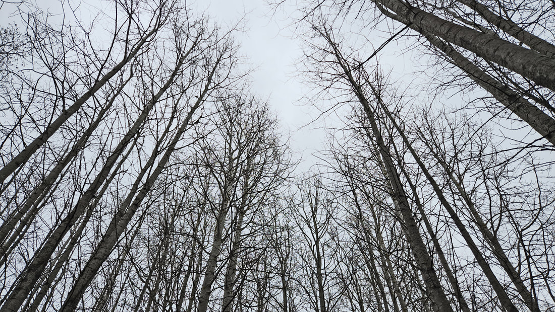 Last Week 35 degrees. Rain threatened. Winds gusted. Cold nipped our noses as we arrived at the ballfields at Volunteer Park. High school teams of men and women practiced baseball, lacrosse, soccer, and band music. Sirens wailed along nearby city streets. We walked behind the fields and fences into the woods and wilds. The urban sights and sounds became muted memories. No songbirds sang of spring today. Strong breezes whipped the tops of birches and alders, whispering secrets to the cedars and firs. I took shortcuts and longcuts among the ponds and backwaters. Crunching through frosted grass, we found a pond half frozen with the thinnest film of ice. What do you do when you stand next to lake ice? You step on it! I tapped the surface with my toe and it shattered into a liquid mirror. At the top of an alder, catkins fluttered on branches like dancers looking for partners. Three people passed us as we stood. Two were joggers, whose eyes stared straight ahead, passing without a smile or word. Then a woman strolled along. She stopped to ask what we were looking at. The tops of the alders, we said, and she said she didn’t know the trees here, but she was glad that we were looking up as it reminded her to look up too. She continued on her way, still looking up at the dances high above us. Leafless maples waltzed with clouds. The music of the wind sighed to us earth-dwellers down below. A drizzle began. We shivered a little, wrapped our coats tighter, and walked on. Looking out over the many ballfields surrounding these woods, hundreds of people played, busy with sport and competition and teamwork. The forest stood apart, an island of wet and wild surrounded by playgrounds and pavement and the ever-present murmurs of the city in the distance. The marshes and woods danced, mostly alone. Winter’s grip held tight. A week later... 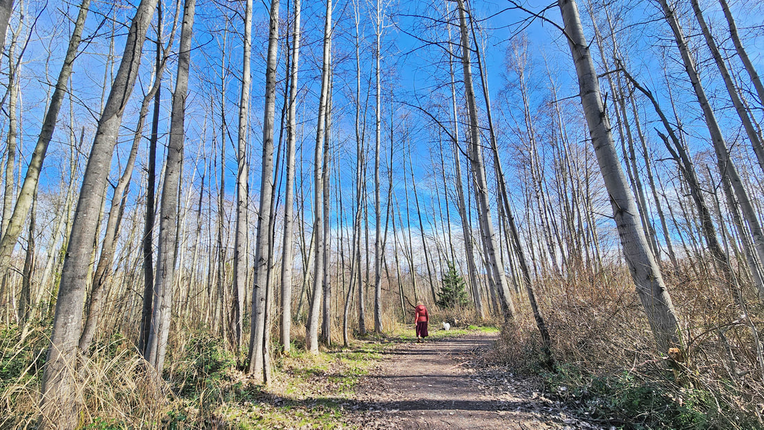 …today is just that kind of day a day so etched in sunlight that you take a hammer to the snowglobe releasing the inhabitants so they can walk out, holding hands and squinting into this larger dome of blue and white - Billy Collins It's 55 degrees. It’s high noon, the sun high and bright and joyous. The warmth made us feel high too, squinting into this sky-globe of blue and white, not really needing a coat as we walked along, giddy with the miracle of spring’s hope. Where ponds last week sported skins of ice, today their liquid surface reflected bold rays of sunlight, framed by grasses springing from the earth. Male mallards and goldeneyes paddled and maneuvered to be close to the females, exploding into flight at times. Chickadees, robins, sparrows, thrushes and finches sang to loved ones nearby, their songs filling the air with sweetness. Indian plum dangled white flowers as their leaves burst forth, a brilliant splash of bright-green beauty. We wandered among the ponds and woods, aimless and spirited, like pixies dusted with the magic of life, returning from the darkness of the past few months, nay, even from last week. We danced carefully along side trails thick with mud, soft and squishy underfoot. The main trail is firm and dry, leading us through the forest of birches and alders. Rivulets sparkled as they flowed alongside the trail. As we entered the hall of maples, moss clung to their trunks, glistening and gleaming golden green. Sap rises through the trunks, unseen except for the swelling of buds at the tips of the branches. Bird songs continue, here a nuthatch, there a towhee, and somewhere a hairy drilling for food. The playfields are empty, students inside their classrooms, probably looking out the windows, thoughts miles from their studies, seeing the hope of spring spreading throughout the campus, throughout this park, throughout the town, throughout all of our hearts and dreams. Spring is coming! jack Directions: From 12th and Commercial in Anacortes, go west on 12th Street to G Avenue. Turn left and go two blocks to the parking area. The trails start to the south, behind the fences of the ball fields.
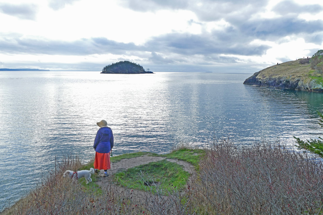
By Bus: Take Skagit Route 410 from March's Point or downtown Anacortes west to 12th Street and G Avenue. By Bike: the roadways in the downtown Anacortes area are mostly gently sloped. Traffic on 12th can be heavy at times; parallel roads are a good alternative. Mobility: the trails in the park are paved near the ballfields, and graveled in the woods, with some elevation gain and side slope toward the south end of the park. 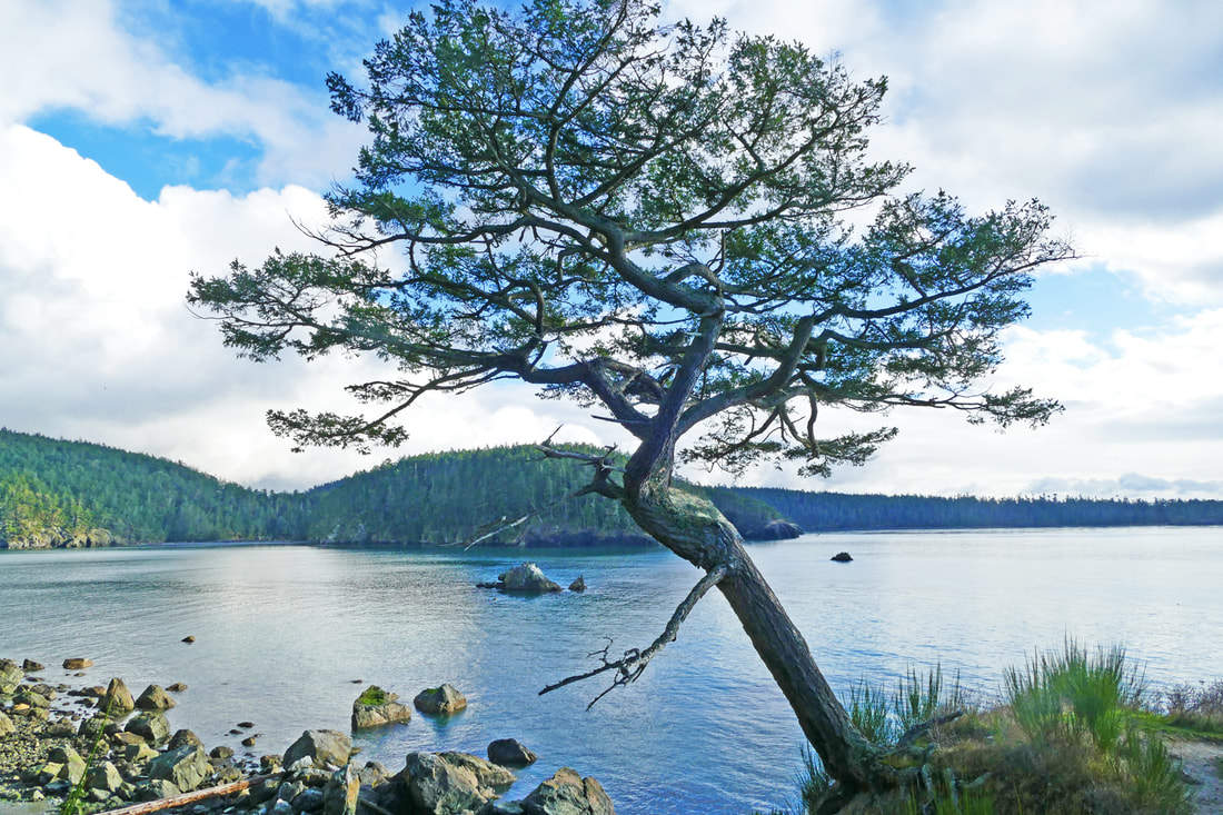 Touchstone: (noun) a fundamental or quintessential part or feature. We all have them: moments, places, and actions in our lives that become the essence of who we are and the directions we take. They may be events that happen to us, choices we make, or the heritage we are raised in that indelibly stamps us and sets the course of our lives; or that creates a turning point, a new awareness, a new venture, a new us. Think about yours for a few minutes. And I invite you to read on about some of mine, and for others, residing along one of my favorite trails close to home. The afternoon had sunshine breaking through the clouds after a dreary wet morning. Kath and I parked at the southern parking lot of Bowman Bay to hike out to Rosario. It’s a meaningful place and week for us. To begin with, this is where we first met, this very same hike. The parking lot sits on land that used to be an alder wetland, the backshore to the beaches of Bowman Bay, once home to a diversity of wildlife. During the Forties the Department of Fisheries filled it in to raise salmon and other marine fishes -- an ironic twist, right? Do the wildlife remember their ancestral home? We walked north past the CCC museum, shelter, and campground. In the Thirties the CCC harvested local trees and gathered rocks to build the shelter, ranger house, and parking areas. Their intent was to build facilities that complemented the landscape, that blended in naturally. They succeeded with quintessential features of the park. I glanced over at the campground. One of my life touchstones sits there. It’s the campsite where my family tented when I was three, where I looked at fish tanks during the day, listened to stories around a campfire in the evening, and slept to the lullaby of lapping waves at night -- fundamentals indelibly stamped upon me. Kath and I hiked up the steep hill toward Rosario. People streamed by. One group of women stopped Kath and said, “We need you”! They were on a scavenger hunt, and needed a stranger, a blue coat, and a dog. Kath provided all three! Sunlight glistened on the water and a blue kayak; madrone trees glowed as hikers passed by; oyster catchers chattered as they landed on a tiny rock island below us. On that first hike together, we had heard oyster catchers here; I had asked Kath then if she knew what they were just from the sound. She did! Today we hiked on, finding a middle-aged couple sitting on the bench not far from Rosario. A family had donated the bench years ago. Their daughter had loved this place; she died from cancer at the age of 18. Their gift became one of their touchstones. We dropped down to the promontory jutting out into Bowman Bay just east of Rosario. It was here that I proposed to Kath a year ago this week. She said yes! -- after some deliberation on her part, and for me a few missed heartbeats! This point will always be one of our touchstones, of course. Coming in to Rosario, gaggles of people wandered everywhere on this holiday weekend. This was once home for local tribes. Home -- the beaches and marine waters at their doorstep, the uplands with cedar shelters and homefires burning, where families gathered, children played, and where their ancestors still reside. It still is their home, with KoKwalAlWoot a reminder to us all as she stands firmly planted in the earth, sharing her story to any who will listen. After a potty break, it was time to head back, having unwrapped some of the stories we carry, and celebrating others we find along the trail, where countless touchstones reside on sacred ground. Directions: From Highway 20 just north of the Deception Pass bridge, turn onto Rosario Road and take an immediate left onto Bowman Bay Road. Park in either of the parking lots available and follow the trail north (to the right).
By bus: There is no nearby bus service to this area. By bike: Rosario Road is narrow and hilly, but with far less traffic than Highway 20. Mobility: The trail is graveled, flat and wide at Bowman Bay, but becomes steep and rough as it heads to Rosario. 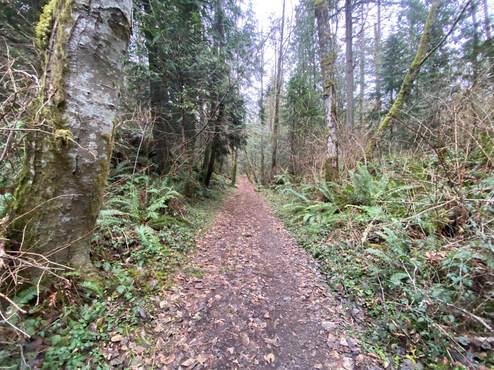 It was a grey day. A wet road led to the trailhead. I parked between cedars and fir, the only car in sight. The woods greeted me like an old friend. We embraced. When was the last time I’d visited Whistle Lake? Last summer? Yes, swimming with a friend by a rocky outcrop on the west side. And the time before that it was covered in snow! Many trails I seek in their best season, with wildflowers, or golden leaves. But the Anacortes Community Forest Lands are wonder filled year-round, each season offering its special gifts. All the lakes, wetlands, forest, and hills are linked together by miles of trail options and days, weeks, months of happy exploration. I came to walk to the lake, as I had many times before. After that I had no agenda. The old forest road to the lake is wide with a gentle grade, an easy walk. It’s framed by huge cedars at the start then by a rock face on one side and a tree lined shore on the other. I reminisced as I walked, remembering when I’d lived nearby and walked my dog here. How I’d seen people of every age in summer swimsuits, toting an air mattress or rubber raft up this trail. In winter cross country ski tracks traced the route through the snow. On this January day, the lake was calm. I heard voices along the west side, so I turned east. All the trails are marked and numbered, so if I’d brought a map, I’d be able to track my route with some accuracy. If I’d brought a map. But I’d walked these trails so many times, I felt confident without one. The trail followed the lakeshore around the east side until it reached a rocky shore. I took a seat, had a snack and a sip from my thermos. A row of cormorants were evenly spaced on a log suspended over the water, looking like clothes pins on a line. I gazed across the lake to the curving summit of Mount Erie rising in the distance. The south end of the lake has a rock face where teenagers jump in, screaming, but not today. Madronas leaned out over the rocks, stretching skyward at the water’s edge. One old tree that had shed its papery, red bark, revealed a puckered-up surface below. A long hollow gouge left only the outer shell still thriving. I turned away from the water, the usual route I used to take with my dog, on to trail 29, which is more narrow with some twists and turns, ups and downs. I could have turned left on the first trail, or the next, but wanted to lengthen my walk so I kept going, a little beyond where I’d been before. I have a good sense of direction, a natural compass, but on a grey day, with no visual clues like mountain peaks or town spires, I wasn’t sure. This trail wasn’t familiar. Still, I kept walking. Whenever I thought the trail should wiggle to the left, it would inevitably wiggle to the right. I came to an overlook and spied the Sharpes Corner round-about, Skagit Valley, and the North Cascades. I hoped this trail wasn’t leading me down to Highway 20. Eventually, the wiggles started turning toward the west. Even with the ups and downs, switchbacks and rock faces, I felt I was finally moving in the right direction. Near the end of my hike, I met two women and asked how far I was from the main trail. They insisted on guiding me until I could see it and knew I was just a short stroll from the parking area. I had to laugh. I love getting lost. It makes me more aware of my surroundings, working my mind as much as my muscles. It was a longer walk than expected, but a better one. Aren’t we fortunate to have so many trails that we can get lost now and then? I rewarded myself with tea and cookies at the corner store. Maribeth You may want to bring a map. Directions: From the round-about on Commercial Avenue in Anacortes, go south to the top of the hill. Turn left at the T onto Fidalgo Ave. and left again on Hillcrest. Turn right on Whistle Lake Road and follow the signs. The road will turn left and then right onto a dirt road before it ends at the parking area. Please don't leave valuables in the car.
By Bus and Bike: The nearest bus stop is on R Avenue and 33rd, 3 miles away. For a cyclist the hill from Commercial Ave. to Fidalgo Ave. could be daunting. There are no bike lanes, but the speeds are low. The road narrows as you approach the lake. Mobility: The main trail to the lake is wide and smooth with a gentle uphill grade. Other trails around Whistle Lake vary widely from rough and narrow to smooth with room for two people to walk side by side. |
Authors
Maribeth Crandell has been a hiking guide in the Pacific NW for over 20 years. She's lived on Whidbey and Fidalgo Island for decades. As a frequent bus rider she easily makes connections between trails and transit. Archives by date
July 2024
Categories
All
|

 RSS Feed
