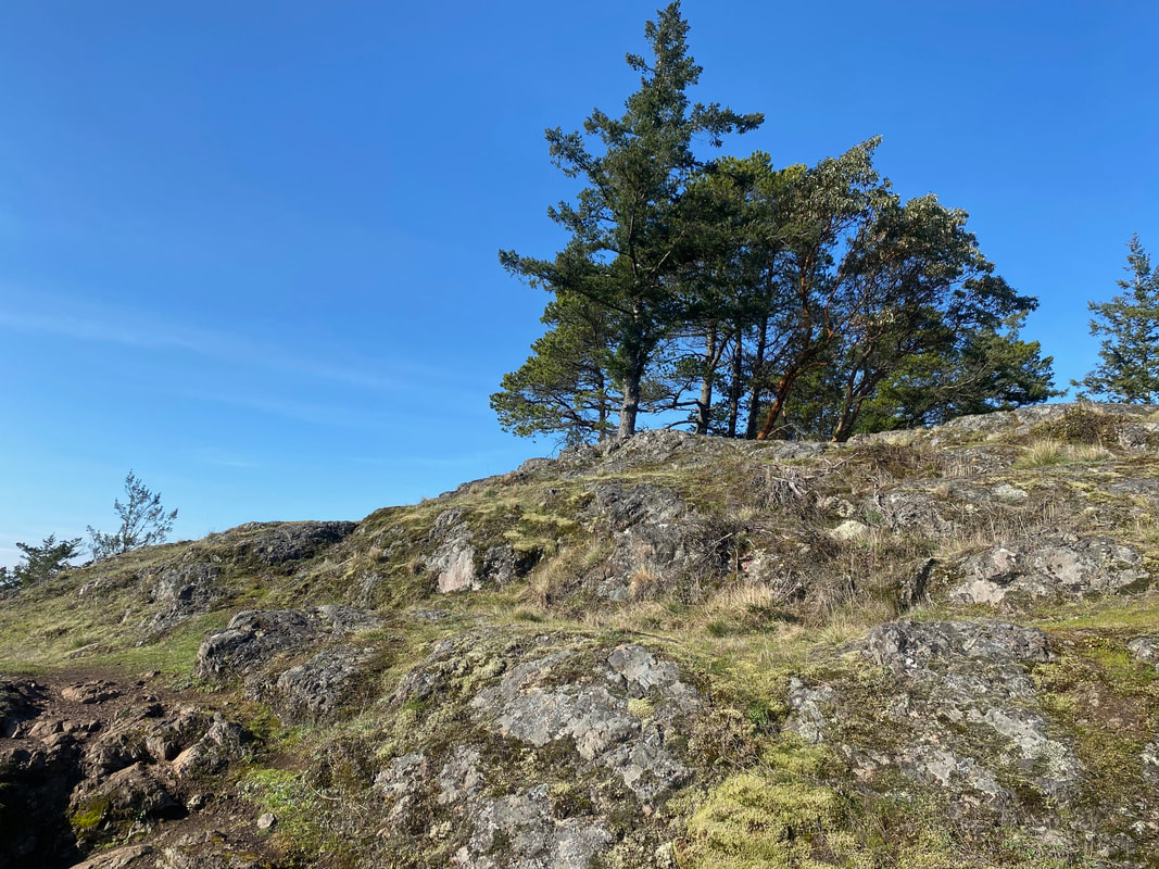
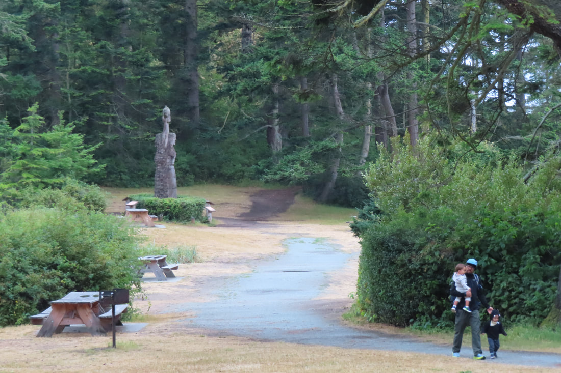
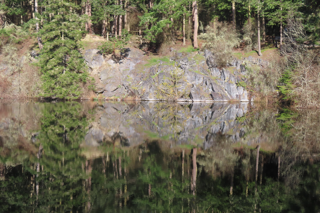
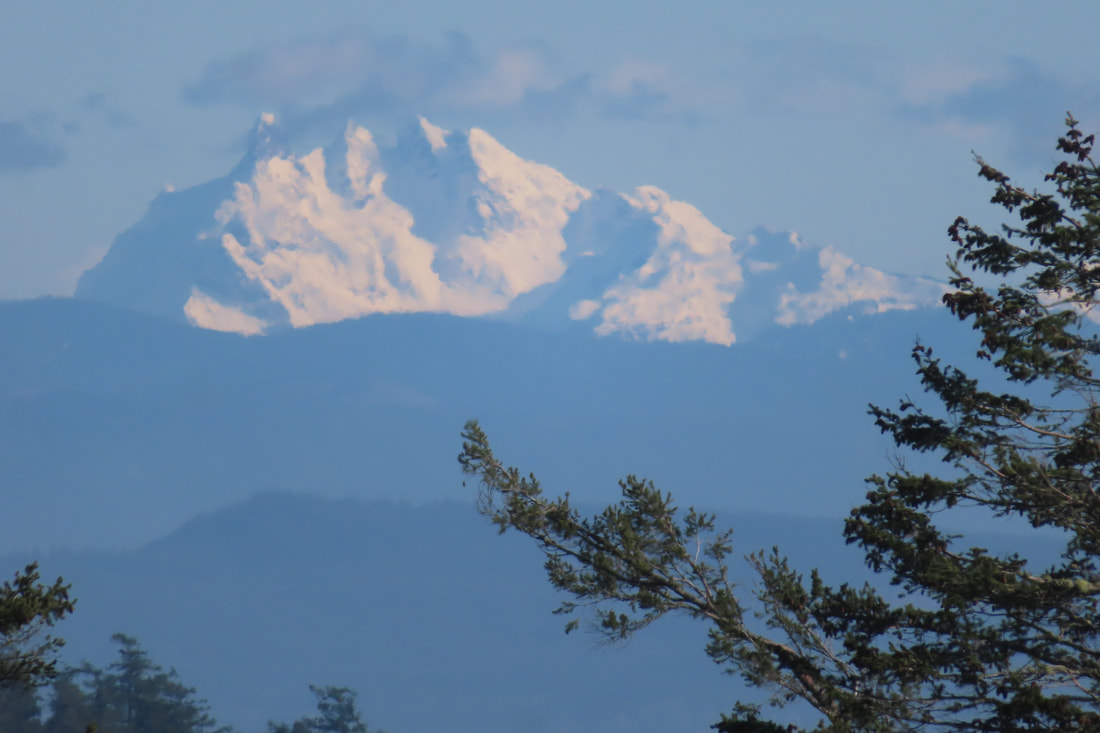
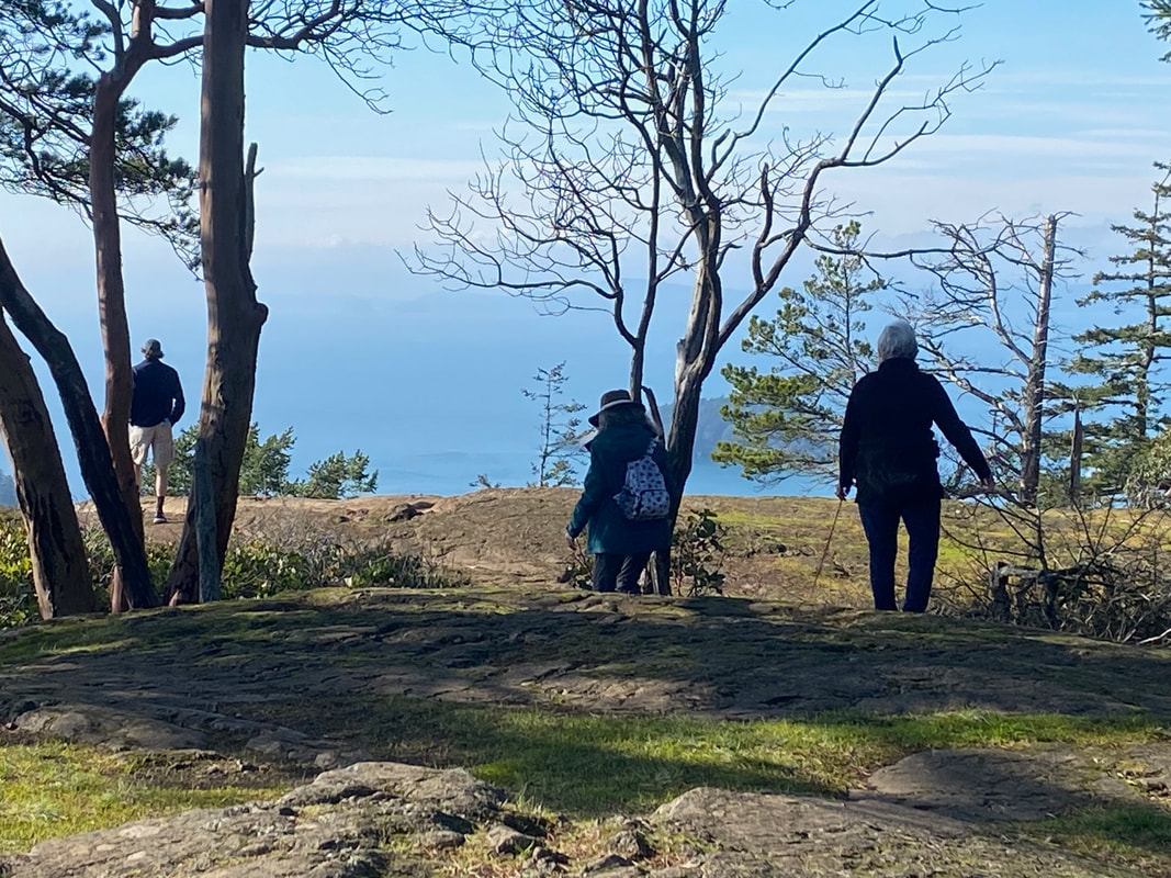
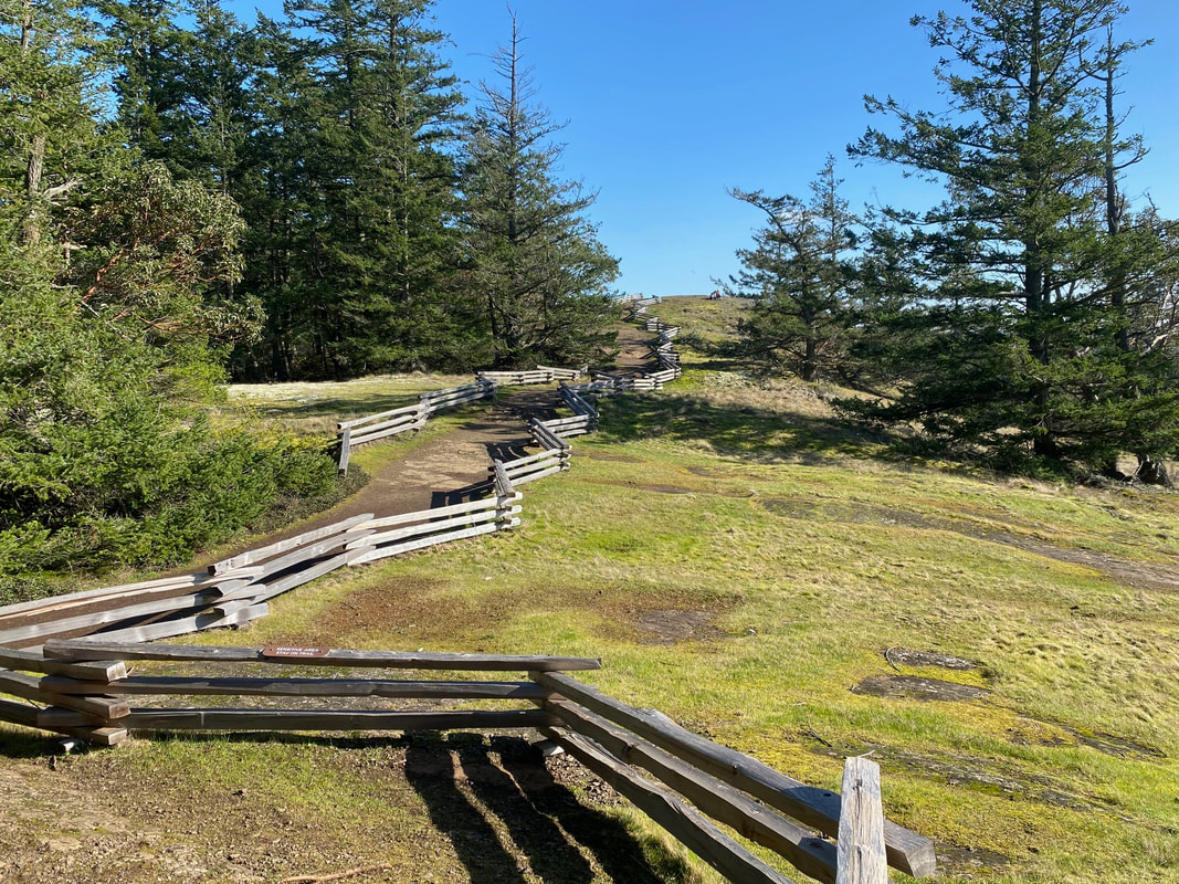
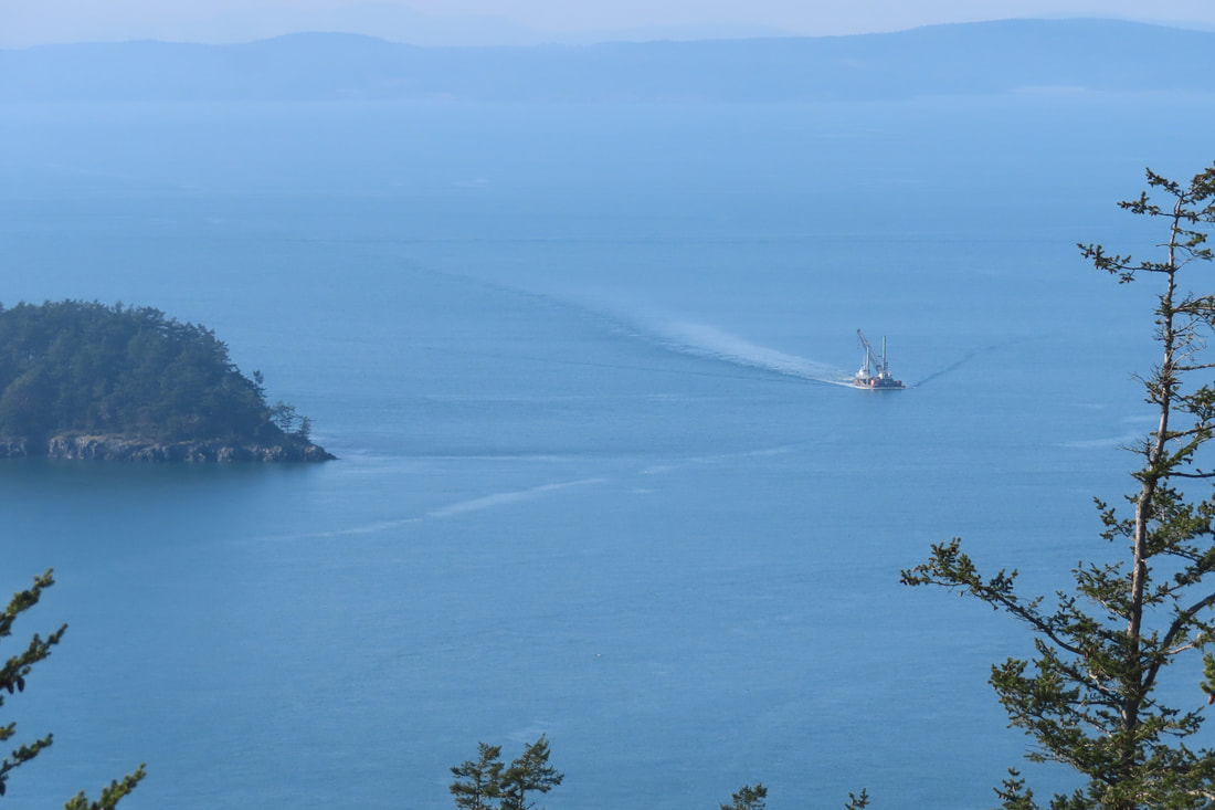
 March comes in like a lion, but remember, last Friday? It was a sunny, spring-like day. Not quite spring, but close. A sneak peek. I caught the 411W bus to Deception Pass and stepped off at the store. I strolled by the gas station, passed through the parking lot, and slipped out the back into Quarry Pond campground. Like stepping through the wardrobe, I felt like I’d entered a different world. With just 90 minutes before I needed to catch the bus back, I walked steadily to the left until I came to the trailhead and entered the forest. Tall trees shaded the sun as I followed the signs to the Discovery Trail. I noted that this was also the route of the Pacific Northwest Trail between the coast of Washington and Glacier National Park in Montana. But today, I had a less ambitious goal, to climb to the summit of Goose Rock. There are different routes one can take to Goose Rock. The Perimeter Trail follows the north edge of Cornet Bay and then spirals up the north side. But I took the Discovery Trail and then turned on to the Summit trail for a more direct approach. I’d been in hibernation all winter and needed some exercise. The steep ascent got my heart thumping. I stuffed my hat into my pack, tied my coat around my waist and kept climbing. In a half mile I realized the trail had leveled off a bit. I was almost there. Suddenly the canopy opened up and there was blue sky overhead! A split rail fence appeared trailing off to the east. A couple sat not far away, so I turned west and had the rocky summit to myself. Sitting to catch my breath, I sipped some water and stuck my face into the sun. To the east the icy summits of the Cascades rose above the clouds. To the south the highway snaked toward town. To the west I watched a boat approach little Deception Island. And to the northwest another small boat was passing Sares Head in Sharp Park. In the distance the San Juan Islands and Olympic Mountains beckoned and teased. Such a beautiful day, I had to remind myself it was still February! A cool breeze reminded me it’s not quite spring. After a while, more hikers arrived. I smiled and took my leave to give them the same solitary summit experience I’d enjoyed. What goes up, must come down. I reversed my route and was soon descending the steep slopes I’d so recently climbed thinking, “Why do I always forget my walking stick?” I passed a few hikers, one with a nice dog. We stopped for a moment to chat and then journeyed on. My walk down went much faster than my climb up. Soon I was back on the gentle Discovery Trail walking at an easy pace. I noticed subtle things along the way, shelf fungus on a rotting stump, a snag full of woodpecker holes, the constant songs of kinglets and chickadees around me. I looked for skunk cabbage but didn’t see any… yet. I still had plenty of time to get an ice cream at the store before going to the bus stop at Cornet Bay Road. Maribeth For a park map click here: 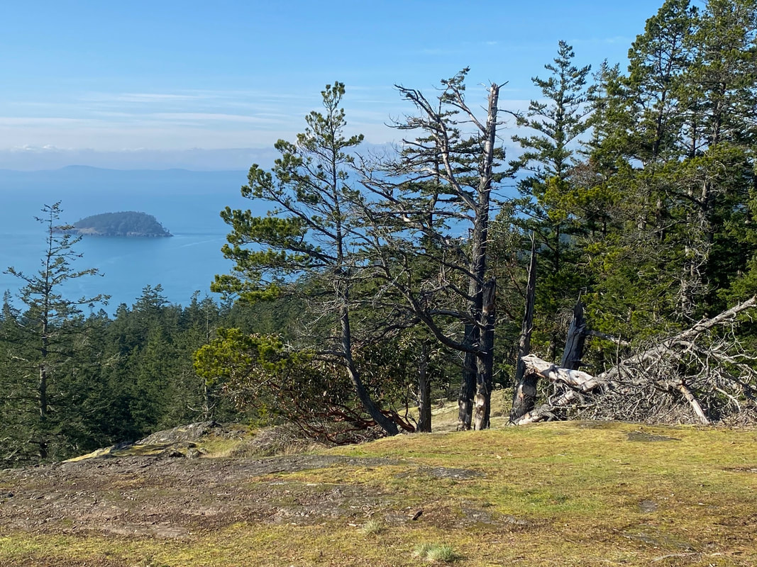 Directions: Highway 20 goes over Deception Pass Bridge between Whidbey and Fidalgo Islands. Just south of the bridge park your vehicle at the park office, or get off the bus at the store, and find the well-marked trails just off the back of the parking lot. You may also park at the south side of the bridge with a Discover Pass.
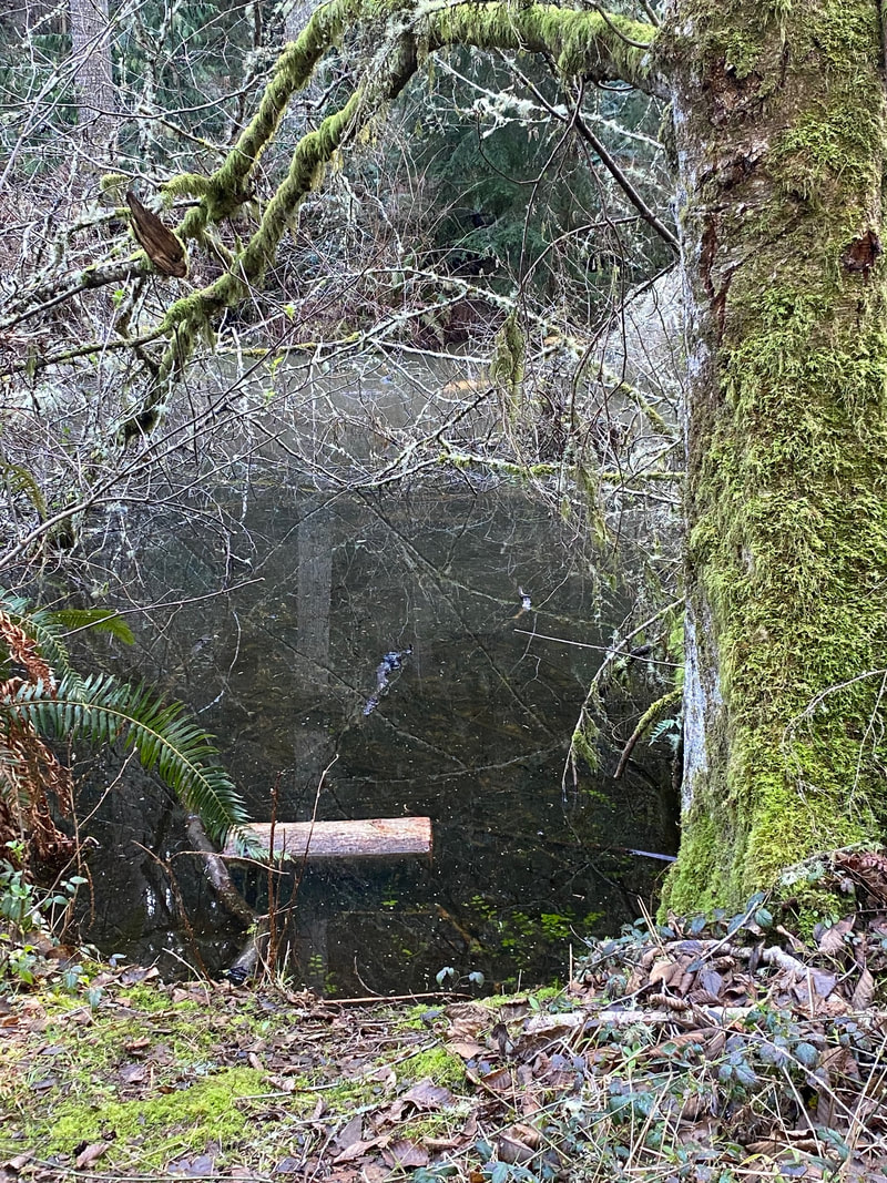
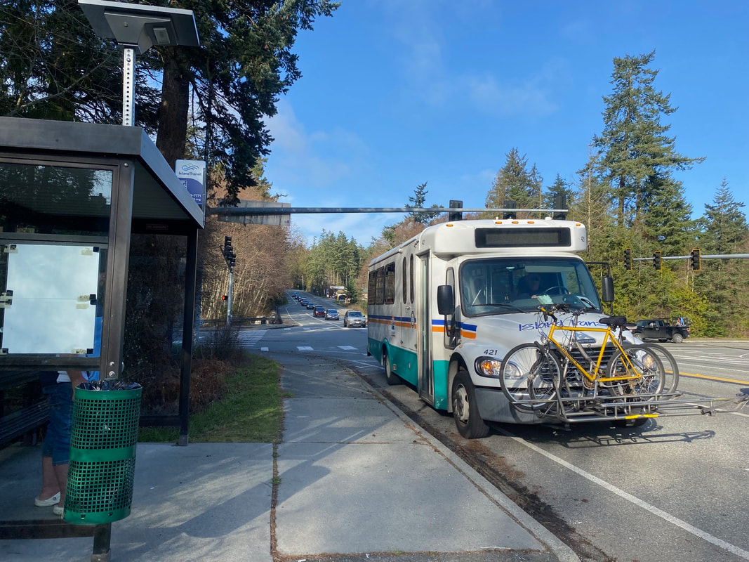
By Bus or Bike: A good way to avoid the summer traffic jams is to take the bus. Island Transit offers fare free bus service 7 days a week. The 411W Northbound bus stops at the store just south of Deception Pass bridge. You can catch this bus at Harbor Station in Oak Harbor. Or catch the southbound 411W at March’s Point park and ride near Anacortes. The southbound bus stops at the Cornet Bay intersection, so cross at the light and walk to the store to start your hike from the back of the parking lot. See the bus schedule here: Two bikes can fit on a bus bike rack on a first come first served basis. Cyclists use this route riding on the shoulder, but please walk your bike if you’re crossing over Deception Pass Bridge. Wear bright clothes and use your lights as this is a heavily traveled road. Mobility: The Quarry Pond campground has a picnic table at the pond and paved roads through the campground. The Discovery Trail is gentle, but the Summit Trail is steep with roots and rocks. A hiking stick is helpful.
0 Comments
 At a trailhead the other day I met some young people among the parked cars. One asked me, “What is your favorite song?” “Goodness.” I said ”That’s a hard question. There are so many.” I have a song in my head almost all of the time. Usually, I’m not even aware, so I paused to listen closer. Caledonia, I told her, a Scottish folk song of longing for loved ones and a well-loved place. It’s like being asked, “What’s your favorite trail?” There are so many, and they’re each like songs that come to mind and linger, replaying fond memories from years gone by. They say you can never step twice into the same river. It's the same for trails. Ever changing, season to season, morning or night, in thick fog or bold sunshine, alone or with friends, the time we saw otters, or the bay filled with kayakers. Today I had an errand that took me across Deception Pass, so I made a stop, to visit a well-loved place, with a favorite song in my head. From Rosario I walked among tall trees making my way between the old log and stone structures, by the rocky shore. Turning away from the Maiden, I passed the Discovery Center and took the trail as it climbed the bluff and hugged the shoreline of Bowman Bay. Madronas seem to dance in their red leotards stretching out over the water. Sturdy Douglas fir, sculpted by wind and weather, looked like bonsai trees on the bluff. A steady stream of boats plowed the waters of Deception Pass, their wakes rhythmically washing the beach. I climbed the hill stopping often to view the bay, looking for otters or seals. A kingfisher sounded. A raven croaked. A flicker flashed its white rump as it swooped along the shore. Chickadees and cedar waxwings called from the same tree, the same branch, singing in harmony. The quiet peace, seeped in with the soft drizzle. Rocky cliffs, adorned with sedum and licorice ferns, rose to one side, a drop to the blue grey water on the other. A red octopus madrona twisted around a dark spire of fir on the bank as if to quietly capture it. A soft cloud layer muffled the sounds of rolling waves below. Entranced I walked until voices from the campground woke me from the spell. I smelled food cooking, caught a glimpse of bikes and campers, and a rainbow flag aloft. Coming out into expansive lawns I admired the CCC shelter built a century ago. Then I climbed the rocky bluff to return. This walk holds a special place in my heart. Just a half hour before or after work, a welcome break in a busy day, a relaxed walk on a weekend with friends. This short trail is a world apart and yet, at the center of it all. A quintessential northwest experience, water, islands, boats, forest, headlands, log and stone shelters, a carved maiden standing guard over the sacred home of her ancestors. Like a favorite song, Caledonia, a song of longing for loved ones and a well-loved place. Let me tell you that I love you and I think about you all the time. Caledonia, you’re calling me, now I’m going home. If I should become a stranger, you know that it would make me more than sad. Calendonia you’re everything I’ve ever had. Listen to Dougie McClean sing it with friends. Maribeth Directions: From Highway 20 at Deception Pass bridge, go north and take the first left onto Rosario Road. In about a mile, turn left onto Cougar Gap Road, and left to the park entrance. Bring your Discovery Pass to park inside the gate.
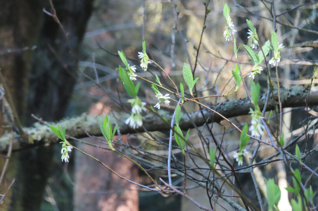
Bus and Bike: The nearest bus stop is about 3 miles away at the store on the south side of the bridge. This is a busy, winding road with no shoulder so not recommended for bikes. Mobility: The areas at either end of this trail are gentle and open. The trail between has rocky, hilly sections with steep drops on one side. 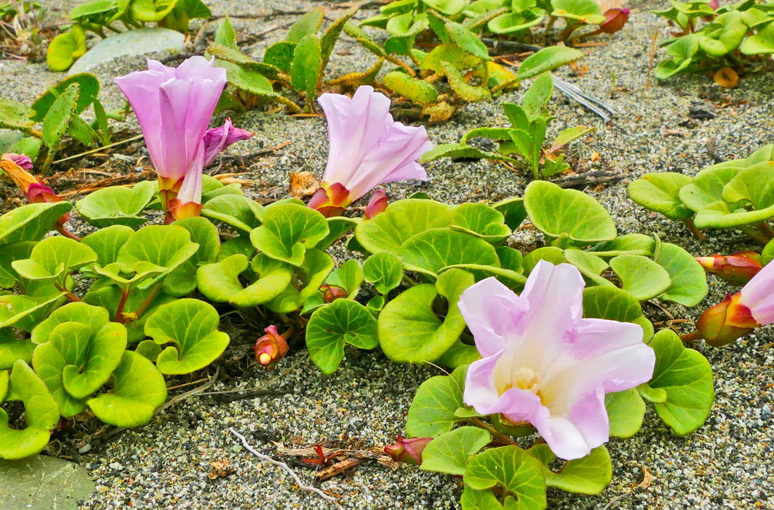 One hundred years ago this coming Saturday, a child was born who would become a beautiful, loving and giving human – my mother. Deception Pass State Park had been born just a year earlier, though as we all know, the land and its life have been here since time immemorial. Individual trees, flowers, critters, and others have come and gone, some here for just a few days, some a few centuries. Each leaves their legacy, their lives a foundation for the future. “We spend precious hours fearing the inevitable. It would be wise to use that time adoring our families, cherishing our friends, and living our lives.” -- Maya Angelou I chose to spend some morning hours at the Dunes Trail. This hike is oh so familiar to me, yet it is different each day, each hour. This is also a fragile area, where one off-trail footstep can disrupt dozens of lives. Today was as new as the dawn of eternity. The air was still, the lake still, the sea still. The islands around me stood quiet in their green fir coats. The distant Olympics poked their peaks above rolling clouds. It didn’t take long for my heart to join into that stillness, as I absorbed their peace, their acceptance every day of the life they have been given. The parking lot was nearly empty. A man sat alone in his car, taking in the view out over the straits to the San Juans, the Olympics, and even Japan were it not for the curve in the earth. Walking toward the dunes on the west trail, I found a couple familiar faces heading my way. We hadn’t seen each other since I retired, and we greeted with the comfort of old friends. They said they missed me, as I did them; here they were, still walking the trails nearly every day just like they have for decades. I then met up with an even older friend, one about 800 years old or so, give or take a century. This tree must have danced in delight as it grew; it never fails to make me smile and lighten my step as I look at its waving arms. Flowers bloomed nearby, rooted in grains of sand, soil as ephemeral as the next windstorm. Their beauty held nothing back, explosions of color displayed in their short-lived joy. At the south end of the trail, a boardwalk leads to the beach, which I had to take, of course. The only sounds were the surf and the seagulls, a seductive symphony that never grows old. I turned inland, walking among the forested groves, the waves quieter here, songbirds taking the lead. Salal and roses were in full bloom, light green growth on the yews and firs brightening the woods. Back at the lake, sunlight glowed through billows of clouds. “To the attentive eye, each moment of the year has its own beauty, … every hour, a picture which was never seen before, and which shall never be seen again.” ― Ralph Waldo Emerson The beach called again so I wandered north to the tidepools at West Point. Life is fragile here too, delicately balanced between the tides. Looking back through the parking lot, I saw once again the scene of so many of my work-life memories, and childhood memories as well. Looking back in time, it was my father who gave me my work and service ethic, and my mother who gave me my love ethic. She passed too soon from this life at the age of 68, leaving a hole in my adult life and the lives of her grandchildren and others. But she also left the legacy of her love, a blooming flower that never fades. “We are fragile creatures, and it is from this weakness, not despite it, that we discover the possibility of true joy.” -- Desmond Tutu Directions: From Highway 20 one mile south of the Deception Pass bridge, turn west into Deception Pass State Park. Follow signs to West Beach. Walk south. Or north.
by Bus: Take bus 411W from Oak Harbor or March's Point to the park entrance one mile south of the Deception Pass bridge. By Bike: Highway 20 in this area is hilly, very busy much of the day, and with narrow shoulders throughout much of route. Mobility: The Dunes Trail is paved and flat. 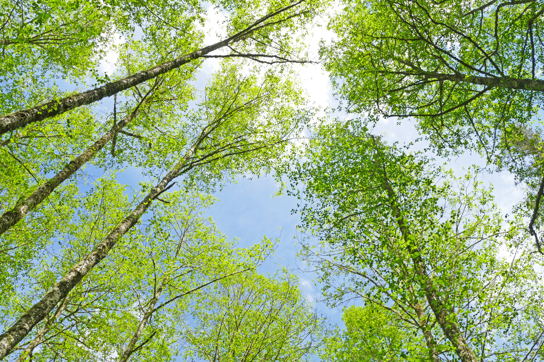 You know that feeling, when bird songs fill the dawn of morning, when the air is actually warmish for the first time, when the bare brown earth disappears under bows and flows of freshly emerging green growth, when sunshine sweetens your smile, and sweat actually beads on your skin. Spring drew on … and a greenness grew over those brown beds, which, freshening daily, suggested the thought that Hope traversed them at night, and left each morning brighter traces of her steps. – Charlotte Brontë You remember those days in school when studies slackened because you were skipping class to be outside somewhere, anywhere, absorbing the fragrances and hormonal therapy of spring. Or was that just me? It’s spring fever. That is what the name of it is. And when you’ve got it, you want—oh, you don’t quite know what it is you do want, but it just fairly makes your heart ache, you want it so! -- Mark Twain Well, that’s how it was for Kath and me, after enduring last week’s weather full of cold and rain, rain, rain, and then this day arises, promising kind-of-blue skies and slightly warmer air. The sun peaked out enough to say “come play with me,” and we joined up with him on a hike at Dugualla. In springtime, love is carried on the breeze. Watch out for flying passion and kisses whizzing by your head. -- Emma Racine Defleur Yes, there was still mud the entire three miles of trail. But everywhere, green filled the sidelines, filled the treetops, filled the woodlands and nostrils and hopes and dreams. Life bloomed and blossomed as if a door had been opened and floods of flowers poured out. Songbirds filled the skies with unchained melodies – grosbeaks, warblers, sparrows, nuthatches, chickadees, finches and robins, one handing the song over to another as we walked along. They know what spring means! The first real day of spring is like the first time a boy holds your hand. A flood of skin-tingling warmth consumes you, and everything shines with a fresh, colorful glow, making you forget that anything as cold and harsh as winter ever existed. – Richelle Goodrich Trees lay tangled on the forest floor from the storms of winter. It became a game of how to get over, under, or around them. But they lay amid forests of newly budded fellow trees, springing green and glowing brightly. It was such a spring day as breathes into a man an ineffable yearning, a painful sweetness, a longing that makes him stand motionless, looking at the leaves or grass, and fling out his arms to embrace he knows not what. -- John Galsworthy Fragrances filled our noses: skunk cabbage, elderberry, nettles, firs, the mud of low tide, the catkins of alders and blossoms of maples. Bees buzzed on huckleberry flowers, hummers hummed on salmonberry, even a mosquito whined and then dined on my hand. Can words describe the fragrance of the very breath of spring? -- Neltje Blanchan Hardly a sound of civilization interrupted our bucolic wanderings. Dropping down to the beach we found low tide, Mt. Erie rising above shimmering water, seaweed glistening, and sand between our toes. Climbing back up from the beach, panting a little and sweating a little too, gave us the satisfaction of knowing we were alive, close to the wild heart of new life, life emerging and exploding and embracing the power of spring. Smiles on the faces of hikers, bikers, and horse riders reflected the sparkle we enjoyed as the miles flew by. Happiness? The color of it must be spring green. – Frances Mayes Our shoes and Murphy’s belly were laden with the smell and substance of wet dirt as we rounded the last bend and headed back to our car. In the spring, at the end of the day, you should smell like dirt. -- Margaret Atwood We did. And sunshine. jack Directions: On Highway 20 north of Oak Harbor, take Sleeper Road east to the end of the road. Parking for about 15 cars now.
By bus: There is no bus service on Sleeper Road. By bike: Sleeper Road is hilly but quiet. Mobility: There is a gate with a rough trail to get around it. The trails at Dugualla are hilly, a mixture of gravel and dirt, and mostly narrow once you get past the first half mile. Fallen trees are a jungle gym in a few places. |
Authors
Maribeth Crandell has been a hiking guide in the Pacific NW for over 20 years. She's lived on Whidbey and Fidalgo Island for decades. As a frequent bus rider she easily makes connections between trails and transit. Archives by date
July 2024
Categories
All
|
 RSS Feed
