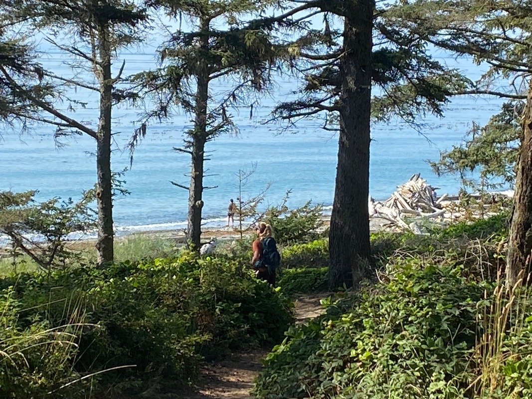
 Peering through the tall trees, the blue water framed by silver driftwood was inviting. But I decided to save the beach for last. Instead, I turned to walk the Bluff Trail which led me by underground spotting stations with views across the water and on to the camouflaged gun battery. Unlike Fort Casey that was built before airplanes were invented, Fort Ebey is well hidden from the water and the air. Constructed during WWII the fort was built to guard the entrance of Puget Sound. But the only shots fired were those for practice. Now the guns are gone, and the battery is empty. The fort echoes with the sounds of people exploring the twists and turns of the tunnels. An interpretive panel outside shows a diagram of the primary battery. I stopped there briefly to take in the sweeping view over the water toward the Olympic Mountains. It was late afternoon. The grassy field below was scorched by weeks of hot, dry days. The sun bore down on this west facing slope. I was about to continue on the Bluff Trail, but a very slow-moving group started on the narrow trail ahead of me. It made me pause. Why not take a new route? I turned around. Just beyond the restrooms was a trail that led… I had no idea where, but I was out to explore. Venturing into the woods, I came upon a sign that said Water Tower which piqued my curiosity. As I approached, it emerged out of the trees like some forgotten fortress. Thick timbers crossed to form a tall, angled structure. It stood silent, stately, a manmade thing hidden by the forest. From there I walked weaving through second growth forest with very little underbrush. Gradually, native rhododendrons filled the understory catching the light through the lacey canopy. Then salal crept in and formed thick hedges on both sides of the trail. I took the lovely Raider’s Creek trail along a cool shady ravine lined with ferns. Tall alders and cottonwoods stretched overhead. Bird songs cascaded down from the treetops to the berry bushes by the trail. Chickadees, juncos, kinglets peeped. Ravens croaked, towhees called, and flickers barked. A Pacific wren sang its long, sweet song. A woodpecker drilled nearby. I crept up with my camera ready. It darted to the other side of the tree. Like so much of this hike, just out of sight, hidden from view. I stumbled upon the wide, Old Entrance Road, with a leafy canopy arching overhead. As the sun came slanting between the trees, I saw below me a sparkling pond. The path guided me to it where a boardwalk led me back toward the trailhead, but I turned the other way to circle the pond. A sign saying PNT reminded me that this is part of the Pacific Northwest Trail connecting hikers from the coast of Washington to Montana. I’ve met PNT thru-hikers that walked the beach from the Coupeville ferry up to this trail. From here they go over the island to the Deception Pass Bridge, through the Anacortes Community Forest Lands and continue going east. I saw no one that day but followed the trail by the pond for a peaceful view over lily pads toward a distant dock. Though I was well away from the beach, I could hear a foghorn’s mournful cry, then the clang of a buoy. Climbing up from the pond to the bluff, I scared a family of quail. As I passed, the little chicks hid in the wild rose thicket. Returning to the beach, I found myself with people again. A couple were crabbing from kayaks. A man threw a branch for his dog. Others leaned against the driftwood to soak up the sun. I took the trail from the beach back to my car with a long look over my shoulder, peering through the tall trees, gazing at the blue waters. Maribeth There are 25 miles of hiking and biking trails here so if you'd like a map, click here. Directions: From Highway 20, four miles north of Coupeville, turn west on Libbey Road. Turn left onto Hill Valley Drive which leads into the park.
Bus and Bike: The Route 6 Island Transit bus stops at the corner of Libbey and West Beach Road, about a mile from the park entrance. The Route 1 bus stops at the corner of Libbey and Highway 20, about a mile and a half from the park entrance. The park entrance road is hilly with no shoulder but low traffic. Mobility: These trails are narrow but mostly a gentle grade and well maintained. They are not suitable for someone who uses a mobility device.
0 Comments
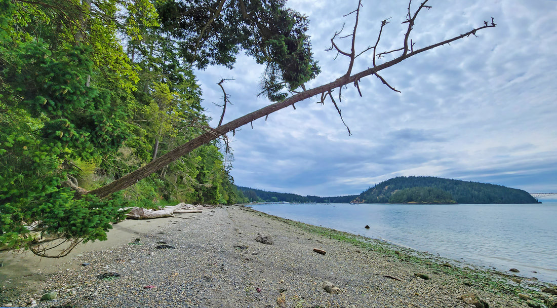 It’s been a couple crazy weeks of news. My mind, heart, and hopes were reeling from the stories, the backward decisions, the murderous actions, the disunity of politics. Then a friend shared this poem with me. When despair for the world grows in me and I wake in the night at the least sound in fear of what my life and my children’s lives may be, I go and lie down where the wood drake rests in his beauty on the water, and the great heron feeds. I come into the peace of wild things who do not tax their lives with forethought of grief. I come into the presence of still water. And I feel above me the day-blind stars waiting with their light. For a time I rest in the grace of the world, and am free. - Wendell Berry I don’t know about wood drakes, but I do know where there is still water, and the great heron feeds, and where the wild things are. And on days like this I like to go there, for re-creation, not for play but for peace. I needed to take a hike at Hoypus. Cornet Bay, on the east side of Deception Pass State Park, has an industrial feeling as boats large and small power through its waters, launch and come back again, large trucks towing them around. The Cornet beach itself used to be industrial, with creosote beams walling off the shoreline from the uplands, deserting it of life. Ten years ago, the beach was restored, the creosote removed, and so life returned. Volunteers planted the shoreline; nature rebuilt the marine life. On Independence Day we parked at the busy lot, walked out onto this new beach, then walked east to the wild seashore leading to Hoypus Point. The tide was low, turning to rise again. The engine noise and traffic jams faded away as we walked. We crunched on gravel large and small, strolling on sandy stretches and hurdling some beach-log hurdles. Trees grow down to the water’s edge, and even into the tideline. One cedar bowed down from above, then rose again to lean out over the waters. A Swainson’s called from a large fir, then flew down into an ocean-spray plant blooming in full glory. We watched it test a song, then fly off again to a new perch. A fly-fisherman tested the waters, using homemade flies. No luck so far, he said. He tied on a new fly as we passed, then resumed his fishing. The Hoypus shoreline gives unending views of Deception Pass Bridge, seemingly close enough to touch, graceful in its arch over the islands. We rounded the point. The beach became a bed of sand, then quickly changed to cobble. Skagit and Kiket islands came into view. An eagle cried its plaintive message. The deep woods stood as quiet sentinels. Small waves lapped their white noise. Now Kath could see the wide concrete pillar just east of the point. “What’s that?” she asked. “Before there was a bridge,” I shared, “the only way onto this end of Whidbey was by a ferry that went from here to Fidalgo. That was the dock’s foundation.” We sat on a nearby bench, listening to explosions of fireworks from Fidalgo, with the quiet of Hoypus in contrast. Eventually we took the trail back, a mile-long trek on the narrow, mostly-paved roadway. It is gated at Cornet Bay, providing a pathway free of cars. A middle-aged couple walked their dog, a young couple jogged past, and an older man cycled by. Song sparrows and flycatchers sang their stories. The bridge played peek-a-boo through the trees. Hoypus is a place for those who want a peaceful mile to wander, wide and flat enough for kids on bikes, for someone in a wheelchair, for a friend recovering from cancer, or like me, just wanting to find peace in a world of craziness. And for a time, I am free. jack  Note: A Discovery Pass is required to park at Cornet Bay. Be aware that on extremely busy boating days, such as July 1 and 2, the gate to Hoypus Point might be opened to allow additional parking.
Getting There: From Highway 20 just south of Deception Pass Bridge, at the light, go east on Cornet Bay Road about a mile and a half to the boat launch parking area. Walk east past the gate on the Hoypus Point Roadway, or take the beach if the tide is low. By Bus: Island Transit Route 411 W stops near the Cornet Bay Road intersection northbound from Oak Harbor and southbound from March's Point Park and Ride. These bus stops are about 1 and 1/2 miles from the trailhead. Cornet Bay Road has no shoulder. By Bike: Highway 20 is a busy, high speed road with mostly adequate shoulders on Whidbey, and mostly narrow shoulders on Fidalgo Island. Cornet Bay Road has little to no shoulder, but far less traffic. Mobility: Hoypus Point Road is suitable for wheelchairs, walkers, bikes, reduced visibility, children, and just about anyone. It is mostly paved, and level for nearly a mile. The last quarter mile is not paved and is narrow but gently sloped. 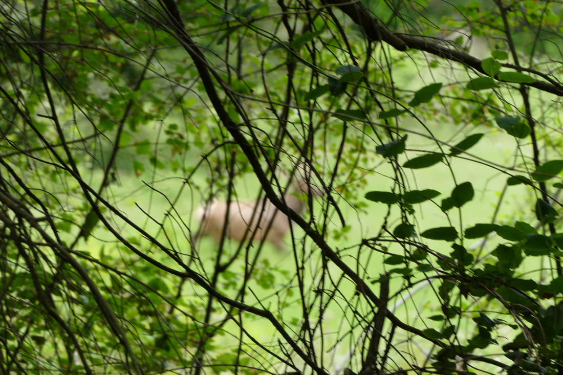 Hiking a new trail brings surprises. However, we certainly didn’t expect the variety and size of surprises we encountered this week when we explored the newly opened Strawberry Point trail! News of the trail-opening the previous week encouraged us to explore it for ourselves. As we drove down, I shared with Kath about what we might expect: typical Whidbey, forested habitats of various ages, some meadow and farm fields, rolling terrain, the usual. There would be no shorelines or hilltop vistas, just rambling woods for the most part, I said. Nothing out of the ordinary. I did mention that an elk had been roaming this part of the island for ten years now. “An elk?” she asked. “The only one on the island; quite lonely I am sure,” I said. “But rarely seen.” I was feeling that this hike would be through pretty predictable terrain with familiar forest and feathered friends; I wasn’t expecting much. I like trails with dramatic drop-offs, wild and woolly scenery, majestic mountains or waves crashing on windswept beaches. “My name is Jack,” (“Hello, Jack”) “...and I’m a trail snob.” What would this trail provide? This 208-acre preserve includes rolling topography and a diverse mix of forest, wetland and meadows, preserved because of two generous landowners. In 2018, Donald Borgman donated 88 acres to the Whidbey Camano Land Trust as a nature preserve, and an additional 39 acres having an agricultural conservation easement. Last year, Gretchen Luxenberg donated her adjacent 110 acres, doubling the size of the Strawberry Point Preserve. We parked in the ample parking area and looked at the bulletin board, showing a map of the property and trail. The first four-tenths of a mile were recently completed; more will be built later this year. So it’s not a long trail by any means. As we entered the woods, a light sprinkle of rain began to fall. All was quiet. Soft, light-green new growth graced the tips of spruces, firs and hemlocks. Birds of all kinds flittered around, some familiar faces and tunes, and then some not as well known. The Merlin app helped us identify a few; several poked their heads out long enough for us to identify more, such as a Swainson’s, cedar waxwings, brown creepers, a downy and a pileated, and an eagle high above. The trail twisted and turned, rose and fell, passing through old woods, giants standing tall, many lying on their side hosting new growth, past snags with fungi, insects, and baby birds. Ferns filled hillsides; roots twisted across the trail like snakes seeking sunshine. This was astounding, so alive! Within a hundred yards my senses had come alive, my pulse quickened, my interest heightened. Surprises abounded around almost every corner -- a sweeping flow of lily of the valley, a twisted tree, seeds drilled into a tree trunk, birds fighting in the brush beside us. We entered a deeper, serene forest of maple and swordfern, then broke out into a grassy field surrounded by woods. We felt like we had traveled back in time a hundred years, to a time of rural life, a slower pace, a richer experience. Murphy smelled it before we saw it. We looked where he was looking, and what was that moving out of the trees? A big, solid, regal-looking elk, standing his ground, aware of us but not concerned. We gasped in amazement at his grandeur. He moseyed through the meadow, in no hurry. After several minutes we eventually returned down the trail. The sprinkles became rain. The route back was now a friendly path home. My soul felt full, mesmerized by the magnificence of life here, the life that surrounds us in protected settings such as this, where the human touch is light, where fields and forests can be alive and free. A woman passed us at the beginning, anxious to see what was ahead. I wonder what she found. jack Directions: From Highway 20 north of Oak Harbor, just south of 'the jets', go east on Fakkema Road, turn right at Taylor Road, left at Silver Lake Road, and follow this as it becomes Strawberry Point Road. The preserve will be on your right just past Stick Point Lane, before the road bends back west. It is well signed from the roadway.
By Bus: there is no bus service in this area. By Bike: the roads are quite rolling, lots of ups and downs, with narrow shoulders but very light traffic. Mobility: the trail is full of dips and doodles, roots and slopes and uneven ground of all kinds. 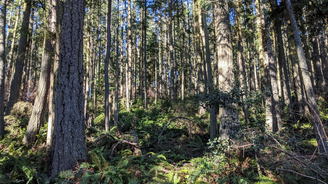 There are many trails in our book that offer magnificent views from hilltops or bluffs. There are many beaches we can walk alongside our Salish Sea. There are trails around lakes and through meadows galore. But sometimes I like to withdraw into nothing but woods, and follow along trails that lead nowhere but into the trees, through the trees, and eventually back to where I started, though I’ve been changed. Such is the case at Hoypus Hill. There is no destination but the forest. The trails meander left and right, up and down, across and through the many shades of environments here. A Rhody forest on the west end is thinking about stirring for spring. Ferns in Fern Alley look tired from the winter weather, but they are emerging anew once again. Alder buds are swelling; osoberry and salmonberry flowers are showing this year’s colors. Spring is gathering its breath, ready to come forth with a shout. Our route was never a decision, just a result of feeling like taking a left here, a right there, a left at the next intersection, and see where we end up. We ended up in the middle of the woods, in the middle of a reverie of peace, in a state of relaxation, refocused by the experience of our hike here. And we grew an attitude of gratitude for those who protected this forest, who kept it from the saw and kept forever our reverence of the forest life that abounds within. Hoypus Hill was logged a couple of times in the past century, as recently as the 1980s. Then DNR transferred it to State Parks for ‘use’ as a park, to become a future old growth forest in a few generations of people, or in just one generation of trees. Sure, it could have been developed into tracts of housing, or logged yet again for the lumber to build some of those houses, or turned into paper, or a church building and parking lot. But here it is, ‘just’ a forest, deep woods, quiet and serene, living and deep and holy. A friend of ours recently posted a picture taken from her saddle as she rode her horse Gracie toward these trails, the woods and ferns filling the scene around her. Her only comment was “Take me to church, Gracie.” A mile away rises the busyness of the park, the hubbub of cars and power boats and pedestrians crossing above or beneath the bridge. Here at Hoypus all we could hear was the soft breath of breezes in the branches, the slow pace of our footsteps along the soft trail, and our occasional whispered words expressing the tranquility of being here. Mostly we walked in silence and sacredness, becoming aware of the details of emerging plants creating green carpets on hillsides; of ankle-high nettles ripe for a salad; of fallen trees becoming rising seedlings; of bare branches swaying above us ever so gently, like hands raised in thanksgiving. Karle Wilson Baker once said “Today I have grown taller from walking with the trees.” Thoreau grew even more: “I took a walk in the woods and came out taller than the trees.” I don’t know if I felt taller or smaller, seeing the size and age of some of these trees, knowing that their world is so much more rooted and grounded in the earth and sky than the one I would soon return to. I do know that I am humbled by the hour or two I spent within the forests of Hoypus Hill. When you don’t believe in yourself We will When you’re worried We aren’t When you’re afraid We are not When you feel alone We are with you We are the trees The mountains The rocks The grass The earth beneath your feet The everythingness of everything That you are a part of too. -- Anastasia Allison jack Directions: From the Deception Pass Bridge, drive south 1.2 miles to Ducken Road. Head east on Ducken to the road end. The trail begins from this parking lot.
By Bus and Bike: Island Transit Route 411W goes from Oak Harbor along Highway 20 toward Anacortes. It stops at the store just north of Cornet Bay Road when northbound, and just south of Cornet Bay Road when southbound. By request it can also take Troxell Road to Ducken Road, leaving you just a half mile from the road end on Ducken. Bicycles have a challenging time on Highway 20, but if you take the back roads from Oak Harbor you will find more rural and quieter roadways. Mobility: Stay on the main logging road and the trail is wide and mostly well compacted dirt, with a few somewhat steep slopes. The single track trails are a variety of tread and terrain. The trails are somewhat muddy in places right now, but well maintained mostly. |
Authors
Maribeth Crandell has been a hiking guide in the Pacific NW for over 20 years. She's lived on Whidbey and Fidalgo Island for decades. As a frequent bus rider she easily makes connections between trails and transit. Archives by date
May 2024
Categories
All
|
 RSS Feed
