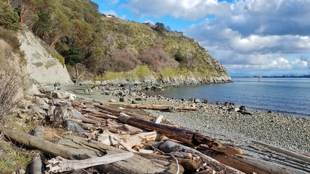
 With a little time to play and a sunny afternoon in Anacortes, I knew where I wanted to explore: Cap Sante, the popular viewpoint overlooking the harbor and city. But I wanted to experience it from the bottom up, earning the view from the top by starting at the shoreline of Rotary Park. I parked at the north end of the harbor in the parking area for Rotary Park – thank you Rotary! -- near the Anacortes Yacht Club headquarters. I strolled the paved walkway southward along the water’s edge, passing several dog owners happy to let their best friends wander the walkway with them, exploring the new smells of spring. Along the water’s edge, hooded mergansers chattered away in a personal conversation. Toward the bluff, the disc golf course opens up the forest that once hid in ivy and mystery. In just over a quarter mile I arrived at the south end of the park, where a small shelter, benches, and several picnic tables invite your use. I walked down to the water’s edge on the south, and looked up at Cap Sante rising a couple hundred feet above the beach. Deer trails traverse the southwest facing slope, not maintained and certainly not generally safe for human use. The slope is covered in rows of rose bushes, repelling foolhardy attempts to penetrate through, and slippery grass meadows scattered among the bedrock of the headland. Occasional piles of litter cast off from the parking area above spoil the slopes of this city park. At the top, of course, the views are stunning, with Baker rising above Guemes and Hat Island on a clear day, the steam stacks on March Point to the southeast with oil tankers waiting in line to unload, and the town of Anacortes nestled along the shores of Fidalgo Bay, leading to views westward over the San Juans beyond. A hundred years ago or more Cap Sante was an island at high tide. A “duck marsh” separated the headland from the center of town. Early pioneers recognized its park and recreation values, and purchased it from the Bowman family, one of the founding families of Anacortes. The town was named after Amos Bowman’s wife, Anna Curtis Bowman. The headland was named by Anna for a landmark of her childhood days in Quebec, Canada, also called Cap Sante looking over the St. Lawrence River. In my humble opinion, the beaches of the original in Canada share some similarities with ours, but the headland in Anacortes is far more dramatic and awe-inspiring. Returning back to the car led me to more dogs taking their owners on a walk, cherries flowering near the water’s edge, a couple people enjoying an intimate lunch on a picnic bench, and several more on other park benches resting and soaking up the sun as the spring-like air filled us all with joy, health, and hope. Cap Sante is French for Cape Health. Directions:
From Highway 20 entering Anacortes, take the R Avenue exit, which turns into Q Avenue. Drive to the end at 4th Street and turn right. Turn right again at T Street and drive to the end of the road, angling left at the oddly configured five way intersection. Park in the large lot next to the paved trail.
0 Comments
Your comment will be posted after it is approved.
Leave a Reply. |
Authors
Maribeth Crandell has been a hiking guide in the Pacific NW for over 20 years. She's lived on Whidbey and Fidalgo Island for decades. As a frequent bus rider she easily makes connections between trails and transit. Archives by date
April 2024
Categories
All
|
 RSS Feed
