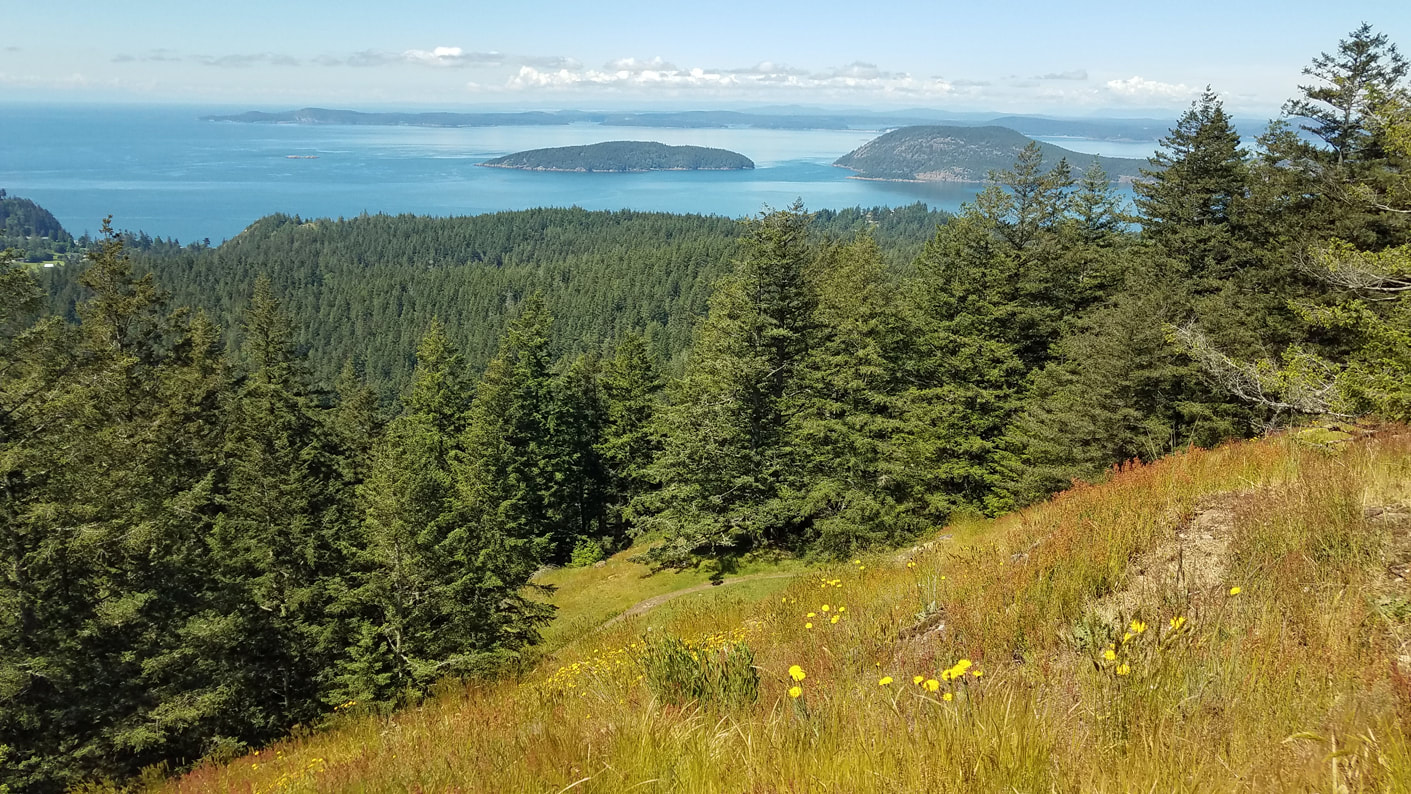
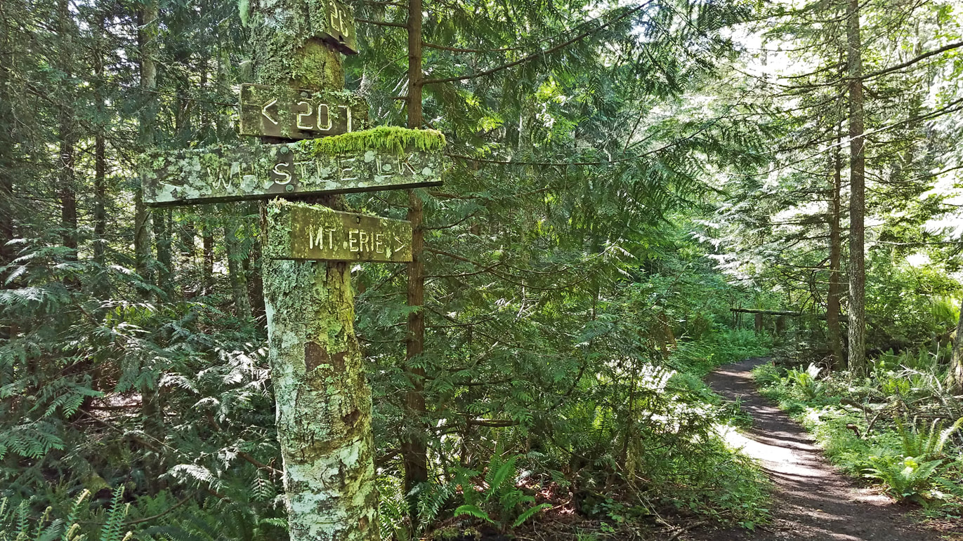
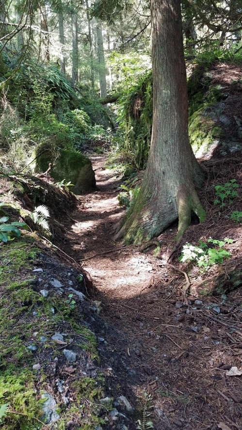
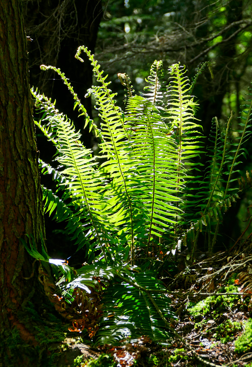
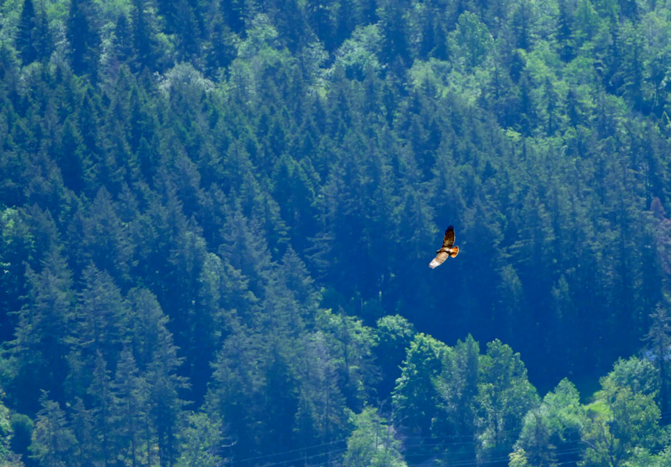
 How often do you get a chance to climb two lovely mountains after breakfast and be home well before lunchtime? When I heard that the Mt. Erie road was remaining closed to prevent large gatherings at the summit, I knew where I wanted to go hiking next – the summit of Mt. Erie. Nearby Sugarloaf Mountain would be an added bonus to the adventure. Getting to the top of Erie is easy by car. Getting there on foot is a worthy challenge and worth the effort, and changes the entire perspective of “going to Mt. Erie”. I took Trail 313 from Heart Lake, followed Trail 21 through the maple-lined valley bottom to Trail 207, then began my ascent of Erie. The trail climbed and clambered through its many twists and turns as the wetlands and lowlands were left behind and the trail became rocky and steep and invigorating. The trail map described this trail and Trail 216, the final route to the top, as ‘difficult: steep hills, rocky, rooty." They are all of that. I meandered through rock clefts and ridges, over bare steep rocks, using roots as stairways and sometimes as handholds, always going up. My lungs were pleased to finally see a wooden sign that read “Summit”. I walked through an empty parking lot at the 1200-foot peak to the short, paved walkway that leads to the overlook. There was no one here. I lingered for half an hour, seeing absolutely no one except the very distant life of residences far below on the shores of Campbell Lake. Instead, I watched a dozen swallows feeding on a spring hatch of insects; and a hawk climb a thermal far below me, only to dive headlong toward Donnell Road a mile away, at maybe a hundred miles an hour, making me think he had lunch on his mind. After eating my own snack, I walked down the empty road to climb another peak. I wanted to see what the roadway would feel like without cars. It is now a safe and spacious, quiet and comfortable route for physical distancing from each other but still connecting us to the environments of the forest lands. 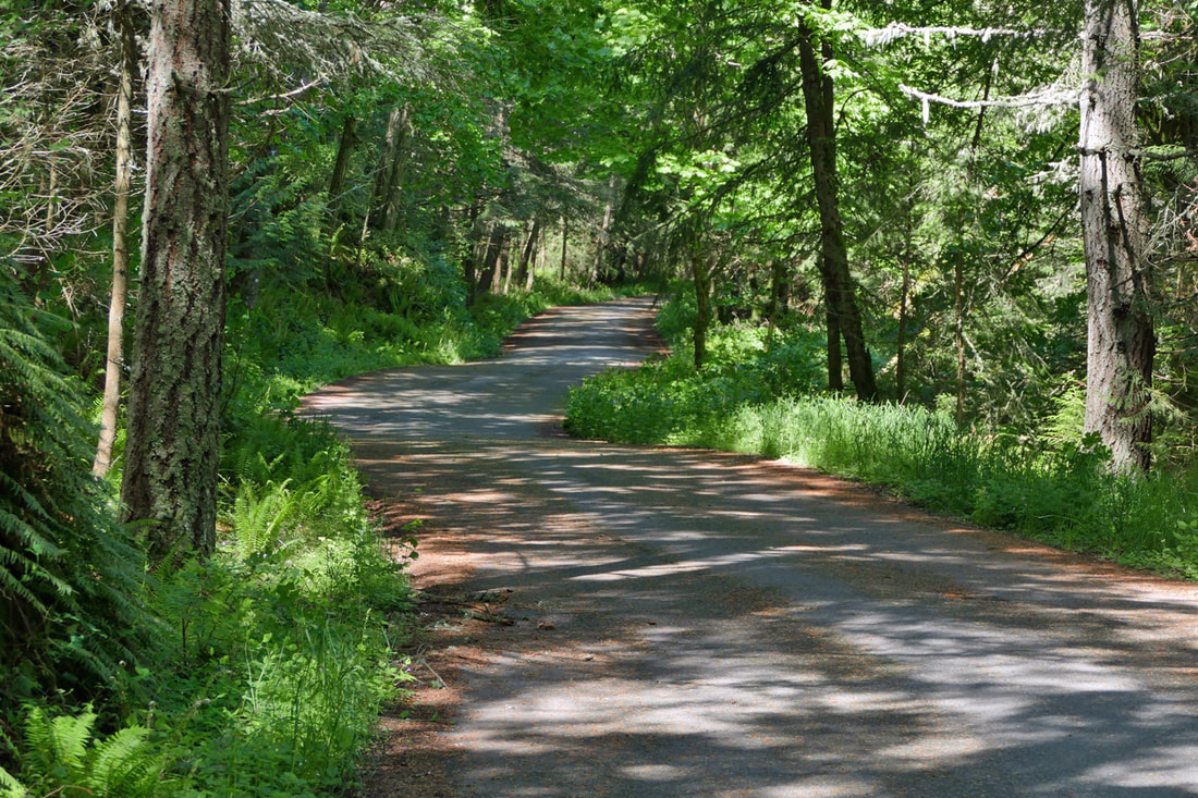 Trail 215 took me most of the way to the top of Sugarloaf Mountain. Sugarloaf is a shorter trail, a lower peak at just over a thousand feet, but challenging enough to remind you that you do have a beating heart. It is well worth the effort to reach its summit. Grasses were flowering with red heads; daisies and dandelions brightened up the meadows at the top. The sun painted a perfect picture of the islands in Skagit Bay and the San Juans. A pair of eagles circled together on a thermal west of Sugarloaf, starting just above the trees. In a minute or two their effortless circles took them well above me. I eventually descended on Trail 226 for variety, rejoining Trail 21 just before dropping down to Heart Lake Road and back to the parking lot. The Mt. Erie and Sugarloaf trails reminded me of hikes in the Cascades or Olympics; you climb peaks and descend into valleys, and see and hear nothing save the sights and sounds of the plants and animals who make the Anacortes Community Forest Lands their home. I counted over twenty species of birds I had seen and/or heard during my walk, and a few more I couldn’t identify. It felt like a wilderness hike. With the road closed, I earned the view from the summit, with my personal energy and horsepower getting me there. It totally changes the character of the Mt. Erie experience. Hiking allows us to travel at the speed of life, deliberate, delving into the joy of the trail. And all of this is here every day, on the doorstep of Anacortes, a short drive from most of Whidbey. We live in a most precious and amazing home. Sometimes it just takes a little extra effort. It’s worth it. jack Directions: Get a map of the trails! They can be found on the City of Anacortes Parks Department website or the Friends of the Forest website.
Mt. Erie is located south of Anacortes on Fidalgo Island in the Anacortes Community Forest Lands. To get there, take Highway 20 west from Mt. Vernon or north from Whidbey Island to the Campbell Lake Road intersection, at about Highway Milepost 46. Turn west onto Campbell Lake Road, then right on Heart Lake Road at the Lake Erie Grocery Store. Drive about a mile and a half to the Heart Lake parking area. The road to the top of Mt. Erie is closed at the present time. Be aware that all parking areas are restricted to 10 cars at a time for the large lots, and only 5 cars at the smaller parking area along the Heart Lake Road. If there are more cars than that, don't go. Come back another time or choose a different access route. There are several ways to get to Mt. Erie. Hike, bike, or drive your car to the Heart Lake parking area, as I did, or at the large parking area where the Mt. Erie road is blocked off, or start just north of the Lake Erie Grocery store, or start at Whistle Lake and follow Trail 201 to Trail 207, or come up with other creative ways. Just recognize that this is now a hike with an almost 1200-foot elevation gain, so come prepared to earn your way to the top. You'll be glad you did.
0 Comments
Your comment will be posted after it is approved.
Leave a Reply. |
Authors
Maribeth Crandell has been a hiking guide in the Pacific NW for over 20 years. She's lived on Whidbey and Fidalgo Island for decades. As a frequent bus rider she easily makes connections between trails and transit. Archives by date
April 2024
Categories
All
|

 RSS Feed
