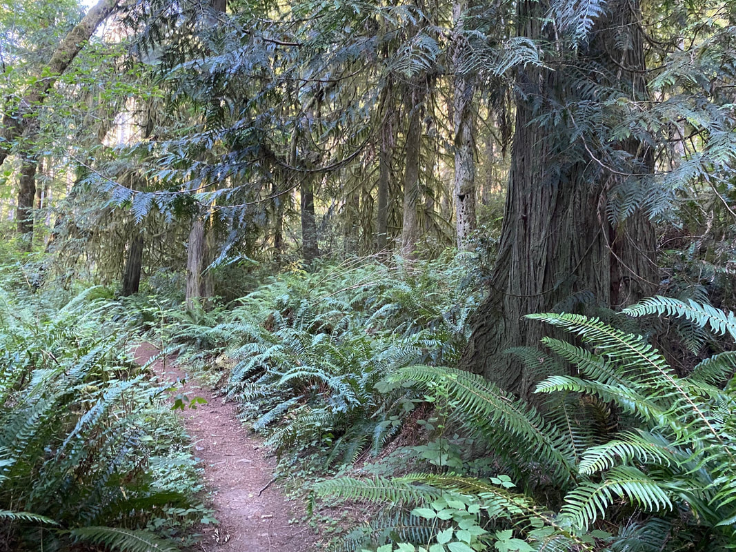
 I wanted to be in Langley by 7, so I thought, why not go early and stop by Putney Woods for an evening stroll. There was still some heat in the day. The arch at the trailhead was shimmering in the late afternoon sun. I took a picture of the trail map on the kiosk. I’d been here enough to know there's a maze of trails and it would be easy to get lost, which is fun when you have the time. But this evening I had just an hour and a half. Studying the map, I decided to go toward the Metcalf Woods as I’d not traveled that way before. Putney Woods is over 600 acres and it’s connected to Saratoga Woods, another 100 acres. Add Metcalf Woods and you have 15 miles of trails to explore. I’d met equestrians on these trails before, but not this evening. It was quiet. From the Trail of the Wild Fell, to the Canter Berry Trail, to the Coyote and Wile E. Coyote Trail, I walked in solitude and silence. At the start the trail is wide and smooth. Parts of the forest were thick with undergrowth, salal, ferns and evergreen huckleberry. But some sections were void of underbrush. The forest floor was littered with logs lying at odd angles like in a game of pick-up-sticks. A breeze brushed the treetops swishing branches this way and that under a blue summer sky. As I continued the trail narrowed with dense hedges on each side. I couldn’t see very far ahead. But I heard voices and came upon a couple at a trail intersection studying their map. I did the same referring to the photo on my phone at every trail crossing. With a quick greeting we went separate ways. I took the Spider Web and then Stix Varia and kept walking on to the North Leg Saratoga Loop. Something was coming down a steep hill just ahead. A mountain biker applied the brakes as he came around the corner, surprised to see me but smiling. He was off again in a moment. This end of the forest has some slope to it with larger cedars and firs. A junco hopped among downed logs. A chickadee sang out from the salal. A spotted Towhee sent a warning from the brush. I heard a nuthatch and a woodpecker high up in the trees. The owner of the private land on the south edge of the woods had signed the property saying basically, you may walk here if you stay on the trails. And if you get hurt, that’s on you. Seems reasonable. I appreciate their willingness to share this woodland with us. The Whidbey Camano Land Trust helped protect these woods. Island County owns it now and maintains it with help from the Backcountry Horsemen and other volunteers. It’s a community effort. As I came to another trail crossing, I found a mountain biker just stopping to read the sign. He said he enjoyed trying to figure out where he was without a map. But he wasn’t on a schedule. For me it was getting late. I picked up the pace and circled back on the South Leg of the Saratoga Loop. The sun was low. I was walking fast, until I saw a brown creeper on the side of a large fir tree. It zig-zagged upward pecking at the bark as it went. I heard an owl call in the distance, which reminded me to move on. Surrounded by tall evergreen shrubs I was thinking I'm glad we don’t have to worry about lions and tigers and bears, when a huge beast appeared! The biggest, friendliest puppy one would ever want to meet at twilight in the woods. I stepped aside to allow room for the enormous and energetic animal to pass. With a quick lick of my hand, we parted, a sweet end to my evening stroll. Maribeth For a trail map click here. Directions: From Highway 525 on South Whidbey, turn north at the light on Bayview Road. Drive 1.8 miles to Andreason Road and turn left. At the next stop sign, turn right on to Lone Lake Road. Within a mile you will see the large gravel parking lot on the right.
By Bike and Bus: The closest bus stop is at Bayview Park and Ride 3.6 miles away. You may bike the road which is mostly level, 40mph with a paved shoulder. Mobility: The trails closest to the parking area are the smoothest and most level, but trails get more narrow with more roots and steepness the farther you get from the trailhead.
0 Comments
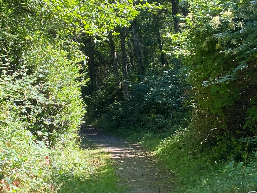 It is a hot week. Many people go to a beach or a lake to chill out. To go for a hike after work in the late afternoon, I needed to find a place that is cool and green and shady. I know of just such a place. On my way home, I stood up next to the bus driver to point out the small sign on the road at Trillium Woods. The Smugglers Cove Road entrance is just a mile south of South Whidbey State Park. As I stepped off the bus I noticed just one other car in the parking lot. The trailhead kiosk had a yellow triangle to indicate who yields to whom. Mountain bikes yield to hikers and horses. Yet I saw none of the above on my 90 minute walk in the woods. At the start of the trail, I was reminded that many people visit these trails on horseback. People have been mostly good about picking up after their dogs, but horses leave much bigger piles behind. This one was fresh and almost completely blocked access to the foot bridge. Fortunately, there was a stout stick nearby that provided me with the tool needed to sweep it aside. There were more piles along the trails. I noticed coyote scat as well and stooped to examine the fur and bones inside. I have often encountered owls here, but have never found an owl pellet. What I did find were berries, salmonberries, native blackberries, red huckleberries, salal berries, Himalayan blackberries, and my favorite, thimbleberries. Some were at the very start of their fruiting season, and some were on their way out. I made a mental note to bring a bucket next time. Patrick’s Way is the main trail down the middle of this 700-acre wood. It’s wide enough for two horses to pass. Narrow paths head off right and left, all invitingly shady and dark with their alluring names, Dragon Fly Glade, Wild Berry, Peaceful Firs. A sturdy bench at a trail junction sat in full sun, but it was too hot for me. I walked on and turned at the Crossroads Trail where the bright sky bore down on the wide intersection of trails. As it narrowed and the canopy filled in overhead, I heard more bird songs, chickadees, nuthatch, song sparrow and Bewick’s wren. I walked through a spot that had flooded last winter but was now bone dry. The Uncle Buck Trail took me down to the lowest, lushest end of the park and I looped back on Burkholder. This was the first time in years that I’d been here and not seen anyone at all. No one walking, running, biking, or on horseback. But on a hot day like this everyone was probably off at the beach. I walked back the way I’d come through the cool, shady forest thinking of this heat wave, shattering previous records, and what we can expect in our climate crisis future. People in the city don’t get the benefit of our island forests. Concrete soaks up the sun and radiates it back holding on to it long after the sun’s gone down. Green spaces are cool places to live but a neighborhood with trees is expensive real estate. Those who can’t afford it are suffering right now and will be in the future. They say the best time to plant a tree was ten years ago. The next best time is now. Maribeth Thank you to the Whidbey Camano Land Trust and all the other organizations that protect our green spaces. For a map of Trillium Woods click here. Directions: On weekdays the fare free Island Transit Route 1 bus stops at the Smuggler's Cove Road entrance just 1 mile south of South Whidbey State Park. On Saturdays the Southbound Route 1 will stop by Highway 525 at Pacific Dogwood, just south of Classic Road. Give the driver plenty of notice that you want to stop. You can walk from the Pacific Dogwood side to the Smuggler's Cove side to catch the bus.
By Bike: Smuggler's Cove Road has wide shoulders and light traffic. Wear something bright to be visible to drivers. 2-3 bikes can fit on a bus bike rack unless the tires are too fat or it weighs more than 55 pounds. By Car: The Smuggler's Cove Road entrance is about 5 miles north of the light in Freeland, or 6 miles south of Greenbank Farm. From Freeland take Highway 525 north to Bush Point Road and turn left. This turns into Smuggler's Cove Road. Look for small signs on telephone poles and a gravel driveway and parking area large enough for horse trailers. The Pacific Dogwood entrance off Highway 525 is less than a mile south of the telephone booth at Classic Road or 3.7 miles north of the light in Freeland. Mobility: Patrick's Way is a wide gently sloping dirt trail. The side trails are narrow with some roots, but mostly smooth. The Smuggler's Cove Road entrance has many roots. The Pacific Dogwood entrance is on a paved road and then dirt and comparatively smooth. For the ADA loop trail take Highway 525 about 2 miles north of Freeland turn left onto Mutiny Bay Road. Take the next right on Bounty Loop. The trailhead parking is at the corner at the bottom of the hill. 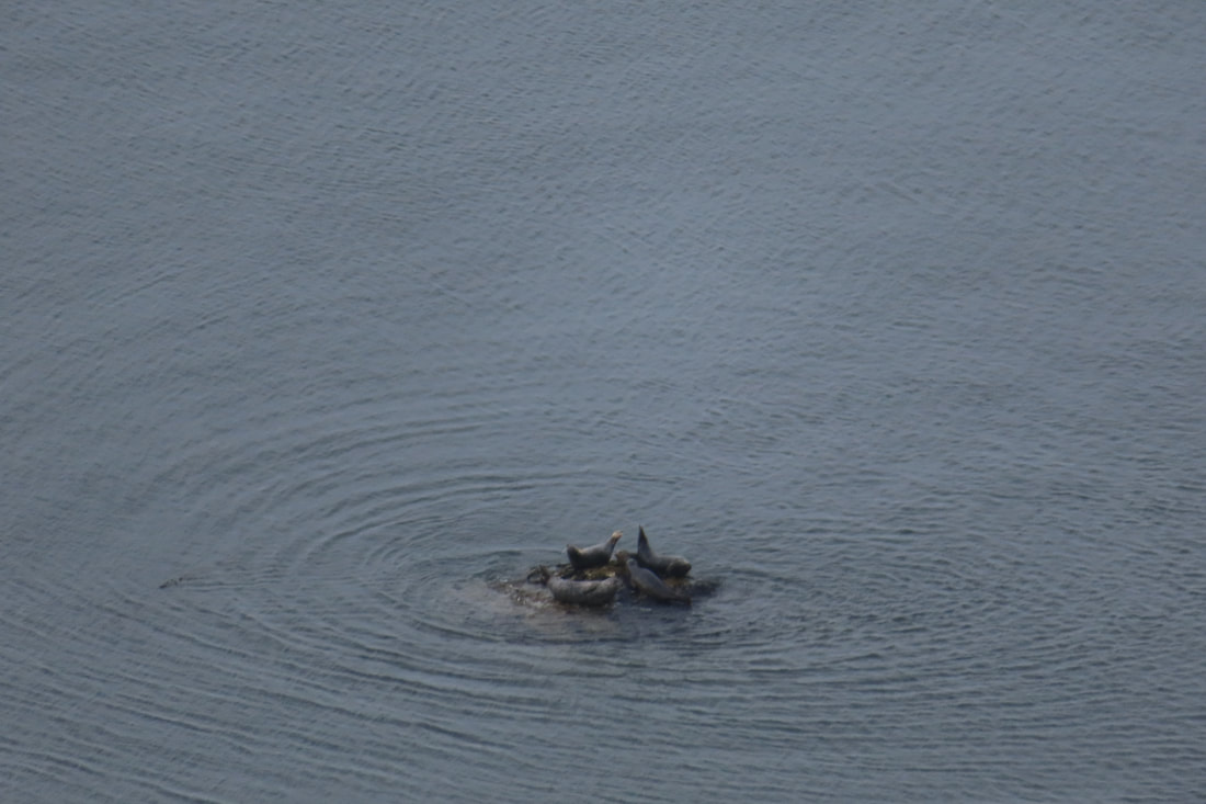 “Possession Point is the southern most point of Whidbey Island and, therefore closest to Seattle.” It shook me up a bit to read that on the Whidbey Camano Islands Tourism website. I was thinking it may be close by water, but a world away by nature. For me, driving there in a car, the way seemed long and convoluted. But I began to consider what it must be like to travel there by boat. The high bluff of Possession Point would stick up prominently. In fact, the place was dubbed Possession Point by Captain George Vancouver because when he and his crew explored the region in the summer of 1792, Peter Puget and Joseph Whidbey came ashore and claimed the land for the British Empire. The idea of taking possession of a place you visit for a short time seemed odd, uncomfortable and, in the broad scheme of things, temporary. The concept rolled around in my head all day. I went to explore the park with a friend. We arrived by car. Like those who arrived by boat, we needed to stretch our legs. We took the forest loop climbing up from the parking lot into the woods. We climbed and dipped and climbed some more through a forest of ferns and maples. At one point while we paused to catch our breath, we spotted an eagle’s nest at eye level through the trees. With binoculars we saw the parent bird drop off some food for the chicks. One chick covered the food with its wings, so the other couldn’t get any. That chick took possession of the food. We kept climbing and heard the great birds calling through the trees. Huffing and puffing we reached the overlook at the top of the bluff and stopped to drink water and share an apple. Before us was an expansive view of Puget Sound. We could see Seattle skyscrapers, ferries crossing from Edmonds to Kingston, sail boats and fishing boats making their way in all directions. Down in the water one rock rose above the tide and a half dozen seals took possession of it. We started down and took the trail to the beach emerging by the barn. A vacation house stood nearby where a family had taken possession for the weekend. They’d fully occupied the backyard and deck. Chairs circled a fire pit. An umbrella shaded a table. Roses climbed the trellis by the gate. Some of the family was on the beach exploring what the outgoing tide had revealed. Farther on, shellfish stalkers carried their shovels. A woman rowed by with a crab pot. Kayakers paddled south. A yacht parted the waters cruising north. Swallows swooped from bluff to beach, in and out of nesting cavities. A heron strutted along a gravel bar. We walked the cobblestone beach as so many had before us. Peter Puget, Joseph Whidbey, my friend and I, enjoying the day, the water, the sun, the summer warmth and took possession of Possession Point, if only for an hour. Maribeth Possession Point State Park provides a camp site for human powered boats on the Washington Water Trails. See the map here. Directions: From Highway 525 at Ken's Korner shopping center near Clinton, take Cultus Bay Road south for almost 5 miles. Cultus Bay Road will turn right but keep going straight on Possession Road for another 1.5 miles. Turn right on Franklin Road, a narrow, dirt road with many private beach homes. The State Park sign is at the end. You will need a Discover Pass to park inside the gate.
Bus and Bike: There is no bus service here. Bikes may travel down Cultus Bay Road on the shoulder, however Possession Road has no shoulder, and is hilly and curvy with poor visibility. Mobility: The walk to the beach is on a dirt road and a gentle grade. The hike up to the bluff through the woods is steep and can be muddy after a rain. The beach is sandy closer to the bluff and more rocky toward the point. 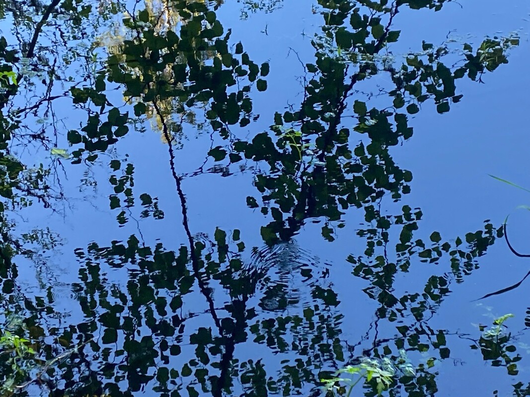 It was a bright sun-shiney day. I had done my share of yard work and run some errands in town. The sun was low by the time I was done, but before going home, I decided to stop by the Freeland Wetland Preserve. The last time I’d been there it was snowing. What a difference the seasons make. The old barn and neighboring cabins seemed to glow in the afternoon sun as I started for the trailhead. It’s spring, at last, and there were flowers blooming at every turn. Buttercups smiled up amidst the small cedars that had been planted and fenced near the trailhead. A clump of purple columbine stood out among them. As I ventured further into the woods, lily of the valley spread out at my feet. The carpet of heart-shaped leaves boldly spring out of the damp soil as if they’d never left. Around the corner the delicate fronds of lady fern reached out over the trail. And the dainty white flowers of the native blackberries climbed over downed logs. Thimbleberry blossoms promised more to come. My attention went from the forest floor to the wide expanse of wetland as I stood at the edge, looking and listening. Yellow water lilies on the surface of the water beamed with light from the setting sun. Red-winged blackbirds sang, “Mukilteeeee-o, Mukilteeee-o.” I could see swallows swooping and gliding over the cattails in the distance. A great blue heron launched and rowed low across the water settling among the alder branches on the far shore. There were robins and song sparrows calling constantly and high in the treetops many small voices chirping and chatting together, but without my binoculars, I couldn’t see who they were. I decided to come back early the next morning. This time I was prepared. I wore a green jacket to blend in and go under cover. I brought my camera, binoculars, and the new phone app I’m just learning to use, called Merlin. It’s like having an expert birder in your pocket. Merlin listens to the bird calls and then lists the birds that are singing and even shows a little picture of the songsters. I didn’t want the birds to know they were under surveillance. So, I stopped and sat still in different spots on a bench, or a log, here and there. Merlin caught the calls of the usual characters, the robins, song sparrows, chickadees, towhees, a downy woodpecker, red-winged blackbirds and a heron. There was a chipping sparrow, house finch, pacific slope flycatcher, an olive sided flycatcher and wood pewee. I was thrilled, but it got better! It listed an orange crowned warbler and yellow warbler, birds I only see in the spring. Then I moved upslope into the cedar grove, it told me the bird calling consistently on my left was a black-headed grosbeak, the one on my right was a Western Tanager! I don’t know all of these bird’s calls, but I know what most of them look like, so I looked. I looked hard. I scanned with binoculars. I stood for several minutes in one spot trying to catch a glimpse, but no. These birds were under cover. The spring flush of foliage had provided the cover they need to feel safe, find food and build nests. It makes them very hard to see. So just go and listen. If you get really lucky, you may actually see some. And if you’re very, quiet and clever, you may even get a photo. Good luck with that. Maribeth Whidbey Watershed Stewards owns and maintains the Freeland Wetland Preserve. Click this link to learn about their educational programs and their Spring Matching Challenge. A generous, anonymous donor will match any donations contributed before June 1st up to $5,000. Donate online or mail to: Whidbey Watershed Stewards, PO Box 617, Langley, WA 98260. Directions: From Highway 525 in Freeland at the light, turn north onto Main Street and follow it east to Newman Road. Turn left and look for the sign on the right.
Bus and Bike: The Route 1 fare-free Island Transit bus comes through Freeland six days a week and stops nearby (800 feet away) at the corner of Main Street and Newman Road. A bus bike rack can hold 2-3 bikes. Newman Road is a mostly level and lightly traveled road. Please wear bright clothes while riding a bike. Mobility: This trail is short and mostly gentle. However, there are some obstacles including a tree that has fallen, and a few significant roots across the trail that may be challenging for those with mobility issues. |
Authors
Maribeth Crandell has been a hiking guide in the Pacific NW for over 20 years. She's lived on Whidbey and Fidalgo Island for decades. As a frequent bus rider she easily makes connections between trails and transit. Archives by date
May 2024
Categories
All
|
 RSS Feed
