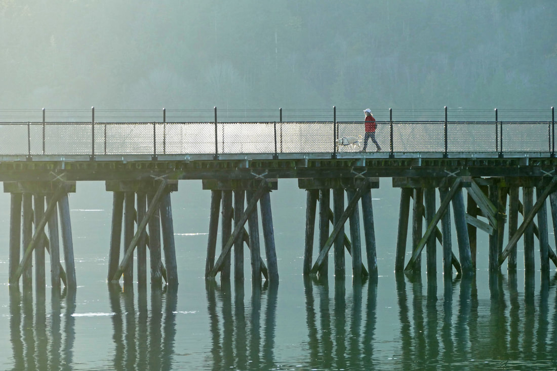
 This land is glacial land Along Fidalgo Bay rises a ridge of dark cedars and firs, a silent witness to the past. A few thousand years ago, a mile-thick sheet of ice retreated from this land, scraping and carving the landforms we see today. Cold-adapted trees seeded back in, leaving forests thicker than dog’s hair on the backs of our hills, and gravelly lakes in the dales. This land is wild land Grebes and great blues, buffles and loons, salmon and seaweeds, seals and seagulls and many others returned too, their new home a perfect web of shared habitats. Abundance filled the shores of the Salish Sea. This land is Samish land As the ice melted, the first peoples also found their way here, and have called this their home for thousands of years. They developed a culture interwoven with the tides and seasons of life along the Salish Sea. Their descendants and traditions live on, celebrated at the tribal center along Weaverling Spit. This land is immigrant land A couple hundred years ago, the tribes welcomed some sailing ships passing through, and opened their arms and lands to these unusual people with white skin, funny clothes, and strange ways. These new people removed the forests to build a town, changed the land to grow vast fields of new foods and raised animals large and small. This land is industrial land The new people kept making changes. They filled the beaches for plywood mills and fish canneries. They filled the marshes for boat harbors; they dammed the lakes for water to be piped down to the town. They built railroads to carry these goods far away and bring in other goods. They shipped in oil from around the world and cooked it right here, for trains to take it to others for burning as fuels. The land hummed with energy, with industry, with growth. This land is shared land But a new age has dawned. The factories have been removed, some of the beaches restored. The remaining forests still stand, protected for the future. Growth is measured and managed. And where the railroad once ran, a pathway now stretches from town to March’s Point, along and over the water of the bay. I kept singing “This Land” as Kath and I hiked west from the refineries on the Tommy Thompson trail. The late-fall sun brightened people’s spirits. The air was calm, the waters flat. The “Tommy” bustled with walkers, strollers, bikers, and joggers, in bunches, in pairs, or alone. We watched from the trail as shorebirds floated and dove in the waters of Fidalgo, gathering a Thanksgiving meal a stone’s throw from our feet. Herons squawked overhead, loons sparkled majestically in the backlit waters. Mallards and teals scooted among the brush of a wetland. We approached the campground and tribal center. Leaving behind the scores of people still streaming along the trail, we walked out to the beach on Fidalgo Bay, more natural and appealing than before thanks to the restoration work being done by the tribe. The sun was getting low now, so we headed back. People who had passed us as we headed west were now returning to town. Baker floated above the steaming stacks of the refinery. Brilliant madrone berries stood out from their dark green leaves, turning the shores into a holiday display. Cottonwoods on March’s Point blazed golden in the sunset. The water lay like molten silver dimpled with ducks on both sides of the trestle. The sky is wide open here, tempting our minds and hearts to soar. My heart overflowed with thankfulness that we have this trail that bridges people and nature, the past and the present, the local and the global. This trail is a shared heritage, keeping us active, and bringing us back to our roots, the stories of this home that we share. This land belongs to us all. jack And a heartfelt thank you to our readers at this season of Thanksgiving. Maribeth and I have enjoyed bringing you four years of trail stories now, sharing our love of these lands and trails. And a respectful and grateful thank you to those who help protect these lands, and those who build and maintain these trails that we enjoy. Happy Thanksgiving! We are blessed beyond measure. Enjoy this video of our walk, condensed down to just two minutes. https://youtu.be/BLK8Knd44Bk Directions: In Anacortes, R Avenue is closed right now between 22nd and 34th, so take one of those two streets to go east from R Avenue to pick up the trail. That's one reason we started at the east end of the trail, on the west side of March's Point, about a 3/4 of a mile north of Highway 20, where there is very limited parking.
By Bus: Island and Skagit Transit go to March's Point Park and Ride; then walk or bike the 3/4 mile to the east end of the trestle. Or take the Skagit Transit 410 bus into Anacortes, get off at 10th and Q, and walk east to reach the path along the waterfront. By Bike: see the directions above. The trail is ideal for biking too. Mobility: the entire trail is paved (except for the planking on the trestle), wide, relatively flat, free of cars except where it crosses roadways, and full of adventure waiting for you.
0 Comments
Your comment will be posted after it is approved.
Leave a Reply. |
Authors
Maribeth Crandell has been a hiking guide in the Pacific NW for over 20 years. She's lived on Whidbey and Fidalgo Island for decades. As a frequent bus rider she easily makes connections between trails and transit. Archives by date
May 2024
Categories
All
|
 RSS Feed
