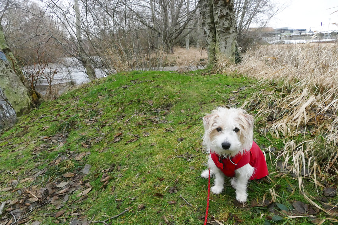
 I’m Murphy, a dog and a hiker too. I took my doggy-dad, Alpha-Jack, to hike at Volunteer Park. He said it was a new year. I didn’t understand. Every day is new, full of hope for trails to explore, new friends to discover, and new smells to sniff and follow. And maybe a ball to chase and a treat to eat. I knew Alpha-Jack had a ball and a treat in his pocket. We parked at the ballfields and walked between them to follow the trail behind the fences toward the woodlands. The trail here was nothing but hard-packed ice. We slipped on our paws and stuttered along. We saw that some thoughtless dog-owner had chosen to not pick up their dog’s doo-doo, leaving it right on the trail. How crude and rude! Soon we came to the trail that leads into the woods. I could smell all kinds of life here, the stories of animals big and small written in the scents of their passing. This trail was kinder to our paws, covered with gravel, needles, and just a smattering of snow. I took a side trail where we saw a heron fishing in an opening in the ice-covered pond. Cattails stood like popsicles; bare trees reached up dark and silent. Alpha-Jack seemed lost in thought. I was so present and trying to be aware of everything around me. My human had a camera in his hand and kept taking pictures of me, and of trees and the sky and things. I don’t understand that either, all this focus on what you can see, and saving it for when you can’t be there anymore. All I see is shades of blue-gray or yellow-gray, so sight is not my main interest. A decent scent tells me so much more! I smell stories that humans have no clue about, everywhere we go. Alpha-Jack misses nearly everything that’s out here, only seeing with his eyes. Back on the main trail he saw and I smelled a collie up ahead with a couple humans. We caught up. Tiegan the collie and I sniffed hello to each other. I wanted to play with him, but he just looked at me and smiled. Alpha-Jack talked to the women walking with Teagan, friends of his, then we moved on. Soon we could hear song sparrows, a Pacific wren, and kinglets flitting through the branches in search of sustenance. Wish I could find something to eat too. I actually did, but Alpha-Jack tugged my leash pulling me away from whatever smelled so rottingly good. We emerged from the wetlands into a drier maple and fern forest. Snow lingered here. Views opened up. The sun tried to share a ray or two. Moss glistened on the tree trunks. We walked as if in a sacred cathedral. Near the school we turned back to retrace our steps. I knew what that meant! Ball-toss! I pulled at the leash, and Alpha-Jack had to run to keep up with me. We passed trees, tantalizing new smells, bird songs, even Teagan and his humans again, then alders and reeds and rushes as I rushed on back. At the end of the woodland trail, I smelled an animal nearby. Then I saw it – a rabbit in the underbrush! I turned to chase it, but Alpha-Jack hung tight to the leash and it ran away without me. Darn leash. Soon we came to an open field of grass. A black lab was out there chasing a ball. Then I was free of my leash and I saw my ball flying away in front of me! I ran out and caught it as it bounced, and brought it back to Alpha-Jack, who threw it again, and again, and again, and again… We eventually leashed up and walked back to the car. He gave me a treat as he seat-belted me in. This is a good day. murphy Directions: From Commercial Avenue and 12th Street in Anacortes, go west on 12th Street to G Avenue. Turn left and go two blocks to a large parking lot at the ballfields. Follow the trails around the ballfields to their backside to find the trail through the woodlands. Total roundtrip walk is about a mile and a half.
By Bus: Skagit Transit Route 410 goes east and west along 12th Street By Bike: Anacortes has several good bike routes. 12th Street is quite busy and narrow; I prefer going west on 8th, then left (south) on G Avenue Mobility: the trails around the ballfields are paved until you get to the backside, then they are gravel, wide, and fairly level. The trail through the woodland is gravel with some soft areas.
0 Comments
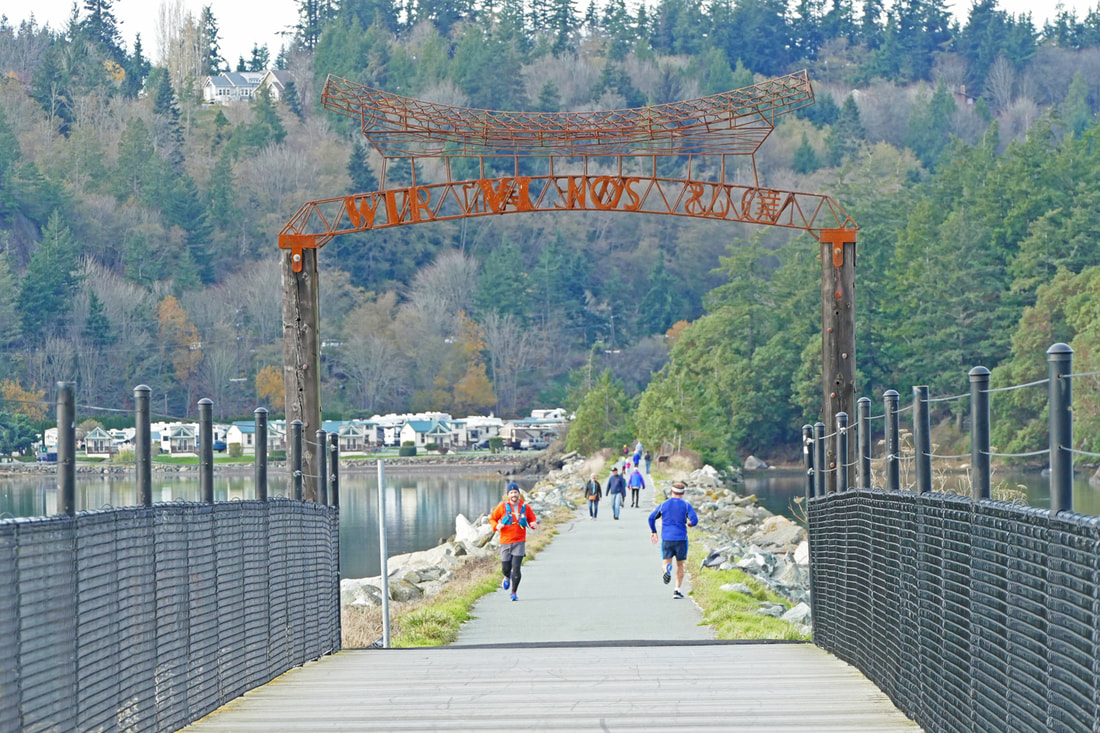 From its northern end, the Tommy Thompson trail in Anacortes is an urban delight, passing the working waterfront, stores, restaurants, condos and apartments, then cutting between boatyards and shipyards, crossing quiet streets, to eventually join up with the sea. It hugs the shore like a beloved, side by side until it finally climbs over it, a quarter-mile long trestle across Fidalgo Bay with the waters below teeming with seals, loons, buffleheads, mergansers and more. Gulls drop shellfish onto the hardened planks to open up pre-packaged meals. Arching over the trestle is a sculpture with the single word “WE” written in several languages, reminding us of who creates these trails, who restores them when they are damaged, and who benefits from them day after day from this day forward. We do. And we are grateful. The trail used to be a railway, built in 1890, when Anacortes boomed as a promised hub of a transcontinental railway. The railroad brought in lumber from the North Cascades (after Fidalgo Island ran out of enough trees) for the many, many mills along the bay. Anacortes used to be called the “city of smokestacks” because of all its mills. They eventually shut down and the railroad stopped running. The route is named for Tommy Thompson, a passionate local railroad hobbyist. In the late 1990s, Tommy proposed to run his train from the Depot to March Point using the unused railway trestle over Fidalgo Bay. It was a wonderful vision, but Tommy passed before it could happen. Town planners then had the grand foresight to open the route as a recreational trail, creating a special experience to travel by human power between the March’s Point Park and Ride and downtown. Today was sunny and very cool; I layered up. I headed out my door to explore the Tommy once again, a frequent habit of mine in all hours of the day and in all manner of weather. Hundreds of people shared the trail this afternoon. Some rode pedal bikes, some electric bikes, some were on scooters, some on roller blades, some jogged, some strolled, some strode stridently, some relaxed hand in hand, some sat on benches, some entertained youngsters, but nearly all were smiling, content to be out on this late November day, a day without rainfall, finally, the last weekend day before Thanksgiving. And one person – the former director of this park system -- was out cleaning shell debris off the pathway, as a volunteer. I am grateful for today, being out with others enjoying the fresh air and having adequate health to explore the natural world of the northwest. I appreciate those who had the foresight to create this trail out of a railroad, and those who now maintain it for our enjoyment. And with thanksgiving in our hearts this week, our gratefulness expands to think beyond this trail. We give thanks for those who had the insight and foresight to set aside these many lands where our trails traverse. Some gave land, some gave money, some found grants, many wrote letters, some stood and still stand in the breach to protect the places we now take for granted. Some gave sweet time and energy in building the trails we walk, or still give by maintaining the ones we have. We give thanks for you, our precious readers and friends, for walking with us along the many trails and journeys we share every week. And we give thanks for those like you who pick up after their pets, pick up pieces of litter, kick sticks off the trail, don’t shortcut switchbacks, and greet other hikers with a sweet smile and a friendly word. The day of giving thanks approaches. It’s wonderful to have a day set aside for that. And we know that gratitude and thanksgiving can be daily practices, helping us remember the many gifts we receive daily as we live on this most precious breathing planet. jack What's Your Favorite Trail? Send a photo and a few lines describing which of our trails you like best and why, and we may include it in our top 10 list on New Year's eve! Deadline is Dec. 26th. Email: [email protected] Directions: In Anacortes, you can find the trail throughout the eastern edge of town. The northern terminus is at 11th and Q, next to Safeway. It follows Q Avenue south to 22nd, then cuts between streets all the way to 34th, the last point of access in town. You can also get on the trail at the Fidalgo Bay RV Resort, which has limited parking, and at its eastern terminus at March's Point Road, where the only parking available is three quarters of a mile south at the March's Point Park and Ride.
Bus and Bike: Skagit Transit has service to 10th and Q in Anacortes, just a block from the northern end of the trail. Anacortes has a bike-friendly downtown area, giving access to all of the areas suggested in the Directions above. Mobility: The entire trail is paved, level, and wide, with no significant barriers other than a few cross streets in the downtown area. 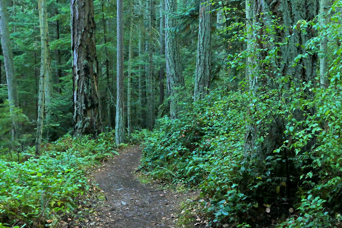 August 10, 2014. I remember the date well because my granddaughter Kataleya was born that morning. And that afternoon the poet laureate of the state of Washington, Elizabeth Austen, led a dozen of us on a hike from Pass Lake to the Ginnett overlook area, to teach us about seeing and about writing. We chatted as we hiked, and observed the trail and trees, the ferns and firs, the roots and rigors of hiking a couple of miles. At the viewpoint, she asked us all to sit down and write a poem from our heart. September 12, 2021. Thinking of that day, I hiked the route again, adding in a side trip to the Big Cedar Tree, and finishing by dropping down to Rosario and then along the loop trail back to Pass Lake. I thought about that hike seven years ago and how our focus was not on just what we saw, but what we felt, what we cared about, what it meant to us personally, and how it mattered not just now, but for all time. Today my camera was focused on the intuitions of my eyes, seeing natural beauty and artistry all around me, an interplay of light and color and texture and depth. I wondered how I could share the thoughts behind the footsteps I took, the beauty I saw, the musings of my soul as I tread upon the trail. A few days earlier, a friend had read to me a poem that she had written. My heart and mind soared with the imagery and thoughts she shared. What if we talked in poetry, we wondered. I’ll try. Here is what I experienced along the way: Evening approaching, trailhead leading me in to the cool, quiet green Trees tall, I am small they raise their arms above me hearing diff’rent songs Here they stand, today, yesterday’s gone, tomorrow’s not here, breathe, breathe, breathe I walk at their pace I walk in their shadow world I walk amid giants One has fallen, now sleeps others now grow where it lies giving life in death Roots, arms reaching out anchors to the wind, living branches underground How am I grounded? How far do I reach out for depth and life and health? 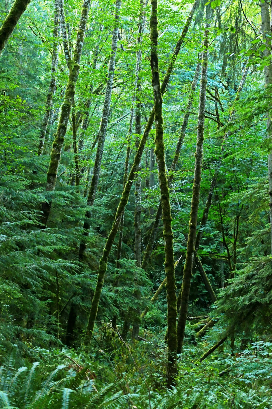 Highway sounds and then -- Naked Man Valley, silence, quiet … bird’s soft voice 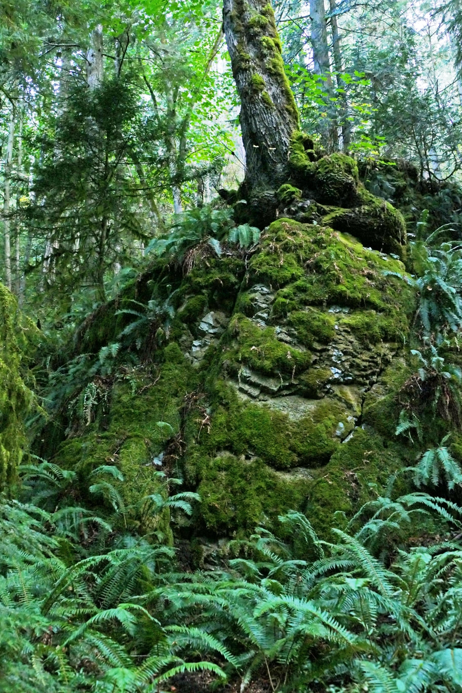 Rise up where you stand it’s given to you to be all that you are, here Trails can challenge us we challenge ourselves to move while we can, to live 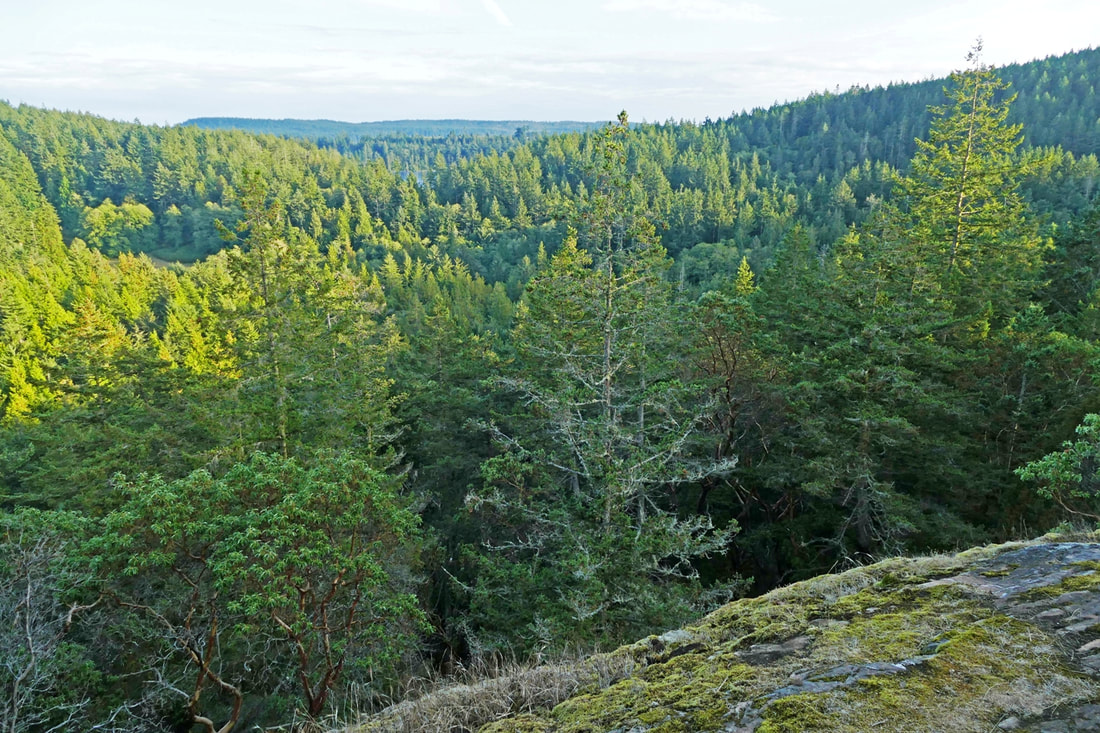 To journey is life each day’s steps lead us onward At the top, the view 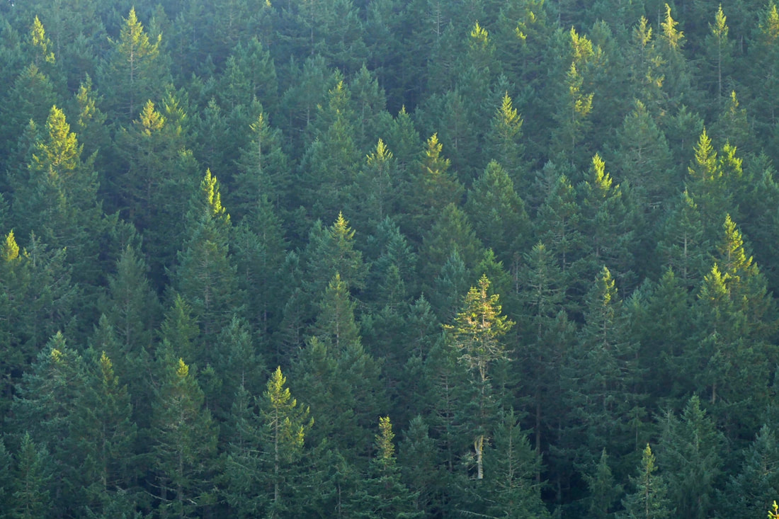 Candles in the wind gripping the light of day’s end do not go gentle 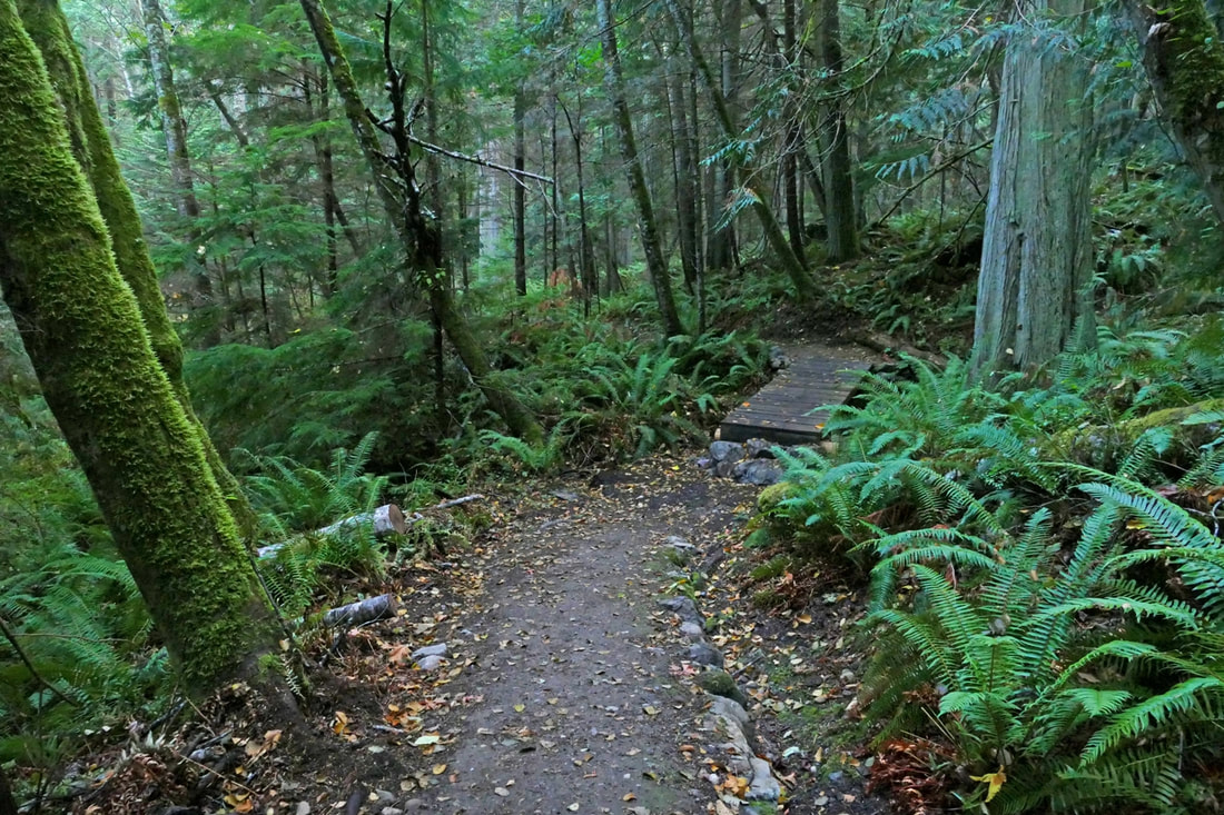 Once upon a time I danced across this streamlet a bridge cannot waltz 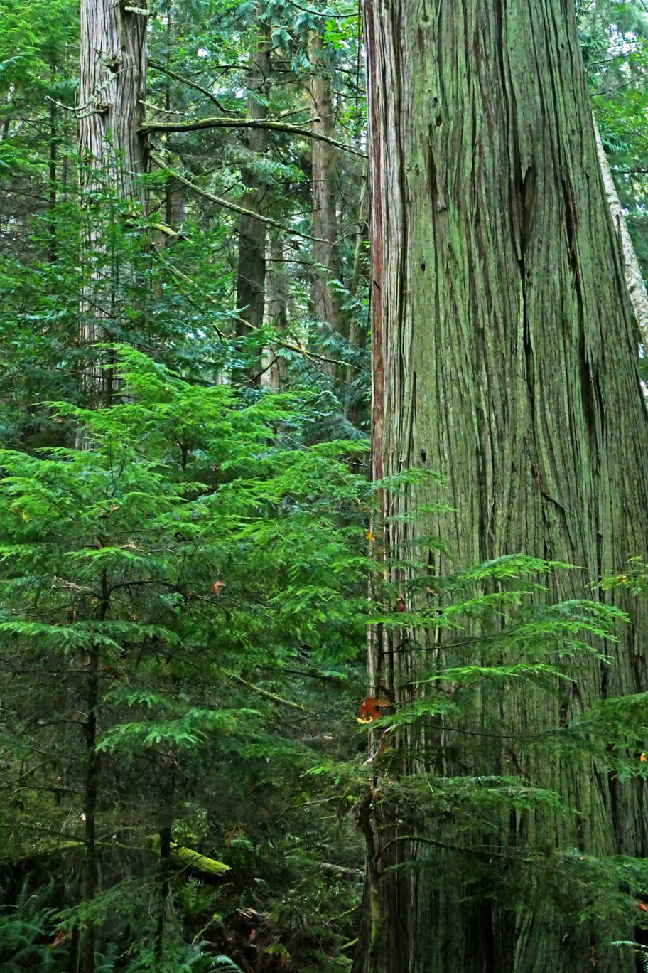 Climbing -- out of breath -- steep trail -- switchbacks -- ever up -- And then ... there it is Centuries it has stood Untold lifetimes pass beneath -- yet it stands, still here 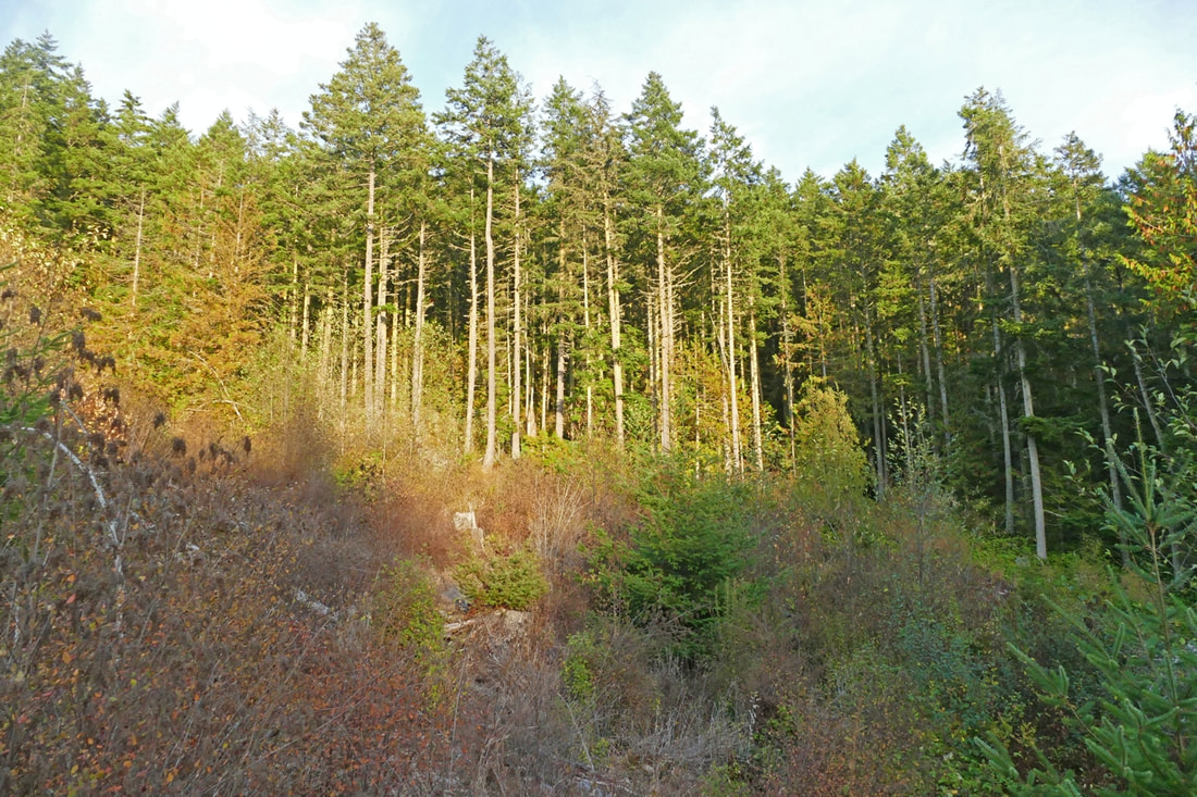 Clearcut private woods, trees gone to feed our desires. Nature feeds our souls 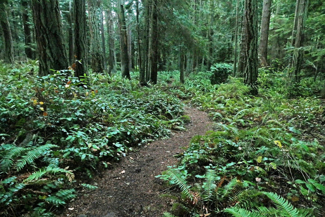 My son built this trail plans, permits, shovels and sweat The trail built my son 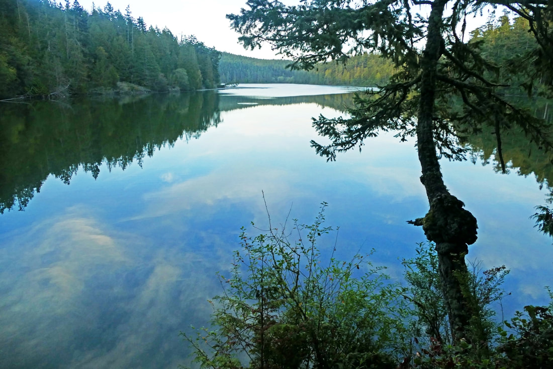 The end of the trail Reflections on the water Passing days and dreams I have hiked this trail dozens of times in the seven years since the poet walked with us. Seven years is a lot of time in the lifespan of a human. Much has changed. And seven years is just a wisp of a forest’s heartbeat along the trails we follow. And the poem I wrote back then? To my newborn granddaughter: My body carries me along this trail looking with others at fallen timbers ancient bodies with new growth springing up from underneath the old. We move on. We rise, we fall, we climb, we rest, we look ahead, we look back. You will see me as an aging tree, but still moving still climbing never stopping until I fall lying down someday as you rise above. jack ____________________________________________________________________________________________ Directions for this portion of trail: On Highway 20 just north of the Deception Pass Bridge, turn west on Rosario Road, then immediately right into the Pass Lake parking lot.
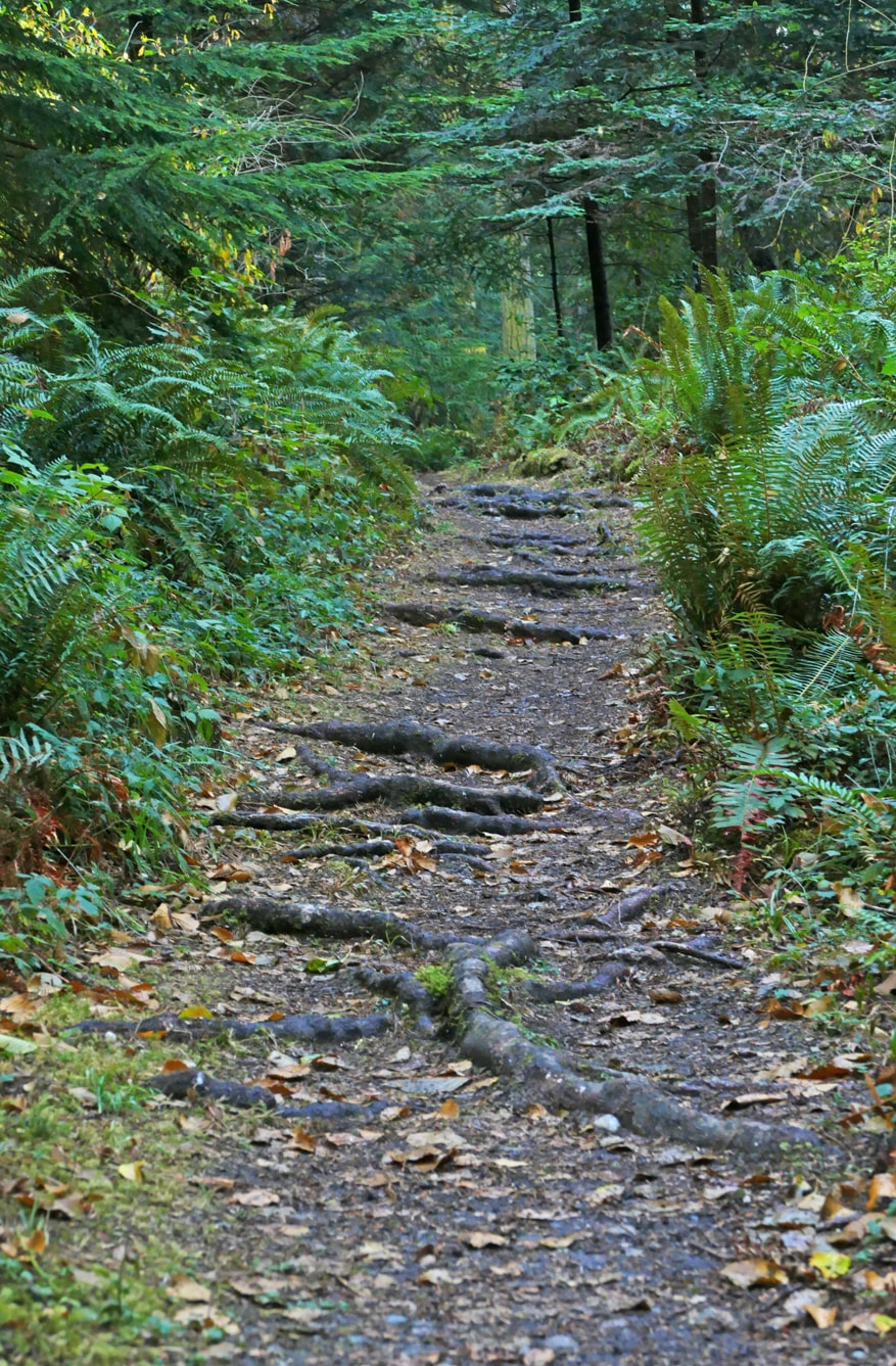
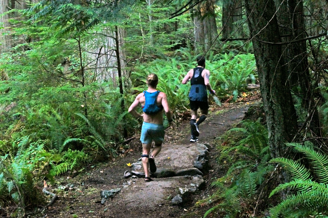
Note: Pass Lake has extremely high counts of a toxic algae. Keep yourself and all pets from the water. Accessibility: Transit services do not stop in this busy and congested area. Mobility access: This trail is hilly and uneven with numerous areas of roots and rocks. Bike access: although accessible by bike, the roadways in this area have narrow shoulders, high speed- limits, and abundant traffic. 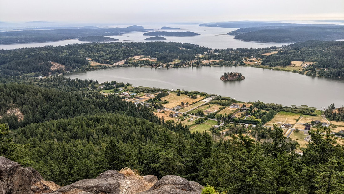 The runner is rewarded with the tape at the finish line. You are rewarded with the view at your feet. Terry and Renny Russell, On the Loose August 1. It’s early morn. Clouds hang low. A handful of raindrops speckle my windshield. I drive to Whistle Lake’s trailhead; I see just one other car. Signs nailed to trees say “High Fire Danger – No Smoking, No Fires”. It’s a tinderbox out here. My goal is to hike to the top of Mt. Erie from Whistle, to celebrate the new day and new month, and to honor a friend who had passed away just yesterday morning. I hike to the lake, muted in the overcast gray before sunrise. Doesn’t look like there will be a sunrise today. Squirrels in treetops chatter with others nearby. As I stop to listen, something falls with a loud thunk close to me -- a Doug fir cone. Then comes the noise of something else falling through the branches, and another thunk. That cone just misses me. I move on. I hike along the lake, climb up to Trail 21, follow that a short while, then turn west on Trail 207. It drops a little, then quickly begins climbing the east side of Mt. Erie. I hear a nuthatch. A Bewick sings. Then an owl asks who is cooking. Then another, a juvenile, screeches a plaintive wail of hunger. Then more cones fall through the tree branches, landing nearby like a bombardment from above. I move on again. The trail climbs steadily through the lower woods, through lush sword ferns and firs and maples. But soon I begin to notice that not all is lush. Many of the salmonberry leaves look like green potato chips, shriveled on their branches. Indian Plum leaves have turned mostly yellow. Fallen maple leaves litter the trail and forest floor. I keep climbing. Trail 207 meets Trail 216, where a decrepit sign hints at directions. The trail is level for a while, a pause before climbing the mountain in earnest. Soon I am scrambling up rock faces, stumbling up steps of tree roots, always going up and up and up. Beads of sweat dampen my shirt. I stop to drink water – lots -- to lighten my pack. I now regret carrying an extra sweatshirt in my pack. Just in case, I had reasoned. Just more sweat, I now realize. I reach the trail’s meeting with the paved road coming up the other side, then climb even steeper sections of the trail as I begin the final quarter mile of ascent. Beside me are boulders covered in the curled brown fronds of ferns, looking dead. More green fir cones fall from above. I climb a hundred feet up on a trail made of rock faces, drink more water, then enter a green valley. Now I know I’m getting close. I look for it, and a minute or two later I see it: a sign on a tree that says one simple, glorious word: summit. This peak is the highest point of land of all the hikes in our book. The final stretch is over quickly. I emerge at the Mt. Erie parking lot, then walk to the view out over Campbell Lake, over the islands in Skagit Bay, over Whidbey, over Rosario Strait, and over where the Cascades and Olympics should be except they are hidden in clouds and fog and smoke. I smell smoke. A cool breeze wicks through my shirt and chills me quickly. I put on that sweatshirt in my pack, glad I carried it now. I watch the day begin. A new day. A gift we all have, if we are alive. A day to keep alive the memory of those no longer here, and to treasure the gift of those who are. I raise my hand in memory of my friend. It’s time to go back down. And watch out for falling cones. jack Directions: From Whidbey Island go north across Deception Pass Bridge to Sharpe's Corner roundabout and turn NW toward Anacortes. From Mt Vernon take Highway 20 west and straight through Sharpe's Corner roundabout. At Commercial Ave. in Anacortes, take the roundabout south up the hill to Fidalgo Avenue where the road comes to a T. Turn left, or east, and go to the stop sign near the Catholic Church entrance. Turn left, and circle the cemetery going north, onto Hillcrest Drive, and then east, and then south which is now Whistle Lake Road. In 0.9 miles the road turns left, then right. Follow the signs. The pavement continues straight but signs will point right again down and then up a dirt road for about a quarter mile to the Whistle Lake parking area. It's sounds confusing in writing, but once you are on Whistle Lake Road, you can follow signs all the way to the lake.
Accessibility: the trail is steep, narrow and with numerous roots, rocks, and other awkward terrain. Did I mention that the trail is steep in places? Transit access: none. Bicycle access: Whistle Lake road is narrow but has a low volume of traffic. Mileage: The mileage of this route is about three miles one way. Of course it seems longer than that going up, and much shorter going back down. |
Authors
Maribeth Crandell has been a hiking guide in the Pacific NW for over 20 years. She's lived on Whidbey and Fidalgo Island for decades. As a frequent bus rider she easily makes connections between trails and transit. Archives by date
May 2024
Categories
All
|
 RSS Feed
